
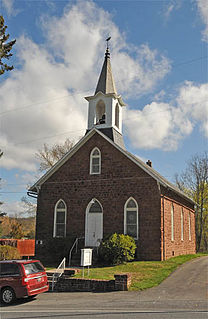
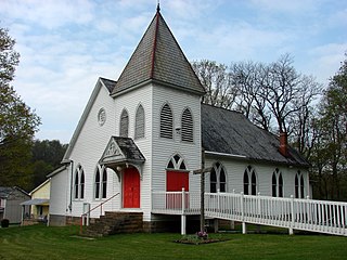
Sugarloaf Township is a township in Luzerne County, Pennsylvania, United States. The population was 4,211 at the 2010 census.
Hopeland is a small unincorporated hamlet and census-designated place (CDP) in Lancaster County in the south of the U.S. state of Pennsylvania. The hamlet's ZIP code is 17533. As of the 2010 census the population was 738.

Georgetown is an unincorporated community and census-designated place (CDP) in Bart Township, Lancaster County, Pennsylvania, United States. As of the 2010 census the population was 1,022. Georgetown has a post office for P.O. boxes that is called Bart and has the ZIP code of 17503. Otherwise, the CDP is divided into three ZIP code areas for more distant communities.
Sugarloaf is an unincorporated community residential area less than a mile south of Big Bear City and 8 miles from the eastern tip of Big Bear Lake in the San Bernardino Mountains of San Bernardino County, California. The area is primarily residential with a convenience store and a post office located at the center of the community. The residential area is set at an elevation of 7,096 feet at its center, whereas its extreme northern border is 6,998 feet above sea level and the southern tip sits at 7,218 feet above sea level. There is no municipal organization for the area, and all fire, water, and police service is provided by San Bernardino County. The ZIP code for the community is 92386, the area code 909, and the population is 1,816. Big Bear High School is located in the northern part of the community.
Reinholds is an unincorporated community and census-designated place (CDP) in West Cocalico Township, Lancaster County, Pennsylvania, United States. As of the 2010 census the population was 1,803.
Wakefield is an unincorporated community and census-designated place (CDP) within Fulton Township, Lancaster County, Pennsylvania, United States. As of the 2010 census the population was 609. It is the largest community within the "Peach Bottom" ZIP code, with the area post office on Pennsylvania Route 272 just north of town.

Slatedale is an unincorporated community and census-designated place (CDP) in Washington Township, Lehigh County, Pennsylvania, United States. It is part of the Lehigh Valley metropolitan area of the United States.

Sugarloaf is an unincorporated community and a census-designated place (CDP) located in and governed by Boulder County, Colorado, United States. The CDP is a part of the Boulder, CO Metropolitan Statistical Area. The population of the Sugarloaf CDP was 261 at the United States Census 2010. The Boulder post office serves the area.
Wagontown is an unincorporated community in West Caln Township, Chester County, Pennsylvania, United States. Wagontown is located along Pennsylvania Route 340 2.15 miles (3.46 km) north-northwest of Coatesville. Wagontown has a post office with ZIP code 19376. The Hibernia House, which is listed on the National Register of Historic Places, is located near Wagontown.

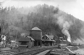
Little Nescopeck Creek is a tributary of Nescopeck Creek in Luzerne County, Pennsylvania, in the United States. It is approximately 8.5 miles (13.7 km) long and flows through Butler Township, Sugarloaf Township, and Conyngham. The watershed of the creek has an area of 14.0 square miles (36 km2). The creek is acidic and receives mine water from the Jeddo Tunnel. The main rock formation in the watershed is the Mauch Chunk Formation. However, the Pottsville Formation also appears in some areas. Soil series in the drainage basin include the Arnot Series, the Basher Series, and various other soil types.
Belsano is an unincorporated community in Cambria County, Pennsylvania, United States. The community is located at the junction of U.S. Route 422 and Pennsylvania Route 271, 8 miles (13 km) west-northwest of Ebensburg. Belsano has a post office with ZIP code 15922, which opened on February 8, 1876.
Graysville is an unincorporated community in Gray Township in Greene County, Pennsylvania, United States. The community is located along Pennsylvania Route 21 11.2 miles (18.0 km) west-northwest of Waynesburg. Graysville has a post office with ZIP code 15337.
Sycamore is an unincorporated community in Greene County, Pennsylvania, United States. The community is located along Pennsylvania Route 18 4 miles (6.4 km) west-northwest of Waynesburg. Sycamore has a post office with ZIP code 15364, which opened on April 25, 1878.
Cardale is an unincorporated community in Fayette County, Pennsylvania, United States. The community is 8.8 miles (14.2 km) west-northwest of Uniontown. Cardale has a post office with ZIP code 15420, which opened on September 5, 1924.
Fairbank is an unincorporated community in Fayette County, Pennsylvania, United States. The community is 7.7 miles (12.4 km) west-northwest of Uniontown. Fairbank has a post office with ZIP code 15435, which opened on July 30, 1906.
Kossuth is an unincorporated community in Clarion County, Pennsylvania, United States. The community is located at the intersection of U.S. Route 322 and Pennsylvania Route 338 6.4 miles (10.3 km) west-northwest of Shippenville. Kossuth has a post office with ZIP code 16331, which opened on October 16, 1849.
Lurgan is an unincorporated community in Lurgan Township in northern Franklin County, Pennsylvania, United States. The community is 6.6 miles (10.6 km) west-northwest of Shippensburg. Lurgan has a post office with ZIP code 17232.
Zullinger is an unincorporated community in Franklin County, Pennsylvania, United States. The community is located along Pennsylvania Route 16 2.9 miles (4.7 km) west-northwest of Waynesboro. Zullinger has a post office with ZIP code 17272.
Shunk is an unincorporated community in Sullivan County, Pennsylvania, United States. The community is located along Pennsylvania Route 154 8.4 miles (13.5 km) west-northwest of Forksville. Shunk has a post office with ZIP code 17768, which opened on November 5, 1845.
Falls is an unincorporated community in Wyoming County, Pennsylvania, United States. The community is located along the Susquehanna River 10.3 miles (16.6 km) west-northwest of downtown Scranton. Falls has a post office with ZIP code 18615.


