Fairview Township, Luzerne County, Pennsylvania

Last updated

Fairview Township,
Luzerne County,
Pennsylvania
The Glen Summit Chapel 2011.jpg
Glen Summit Chapel in August 2011
Map of Luzerne County, Pennsylvania Highlighting Fairview Township.PNG
Location of Fairview Township in Luzerne County, Pennsylvania
Map of Pennsylvania highlighting Luzerne County.svg
Location of Luzere County in Pennsylvania
Country United States
State Pennsylvania
County Luzerne
Area
[1]
  Total9.44 sq mi (24.46 km2)
  Land9.43 sq mi (24.44 km2)
  Water0.01 sq mi (0.02 km2)
Population
 (2020) [2]
  Total4,691 Increase2.svg
  Estimate 
(2021) [2]
4,692
  Density475.41/sq mi (183.55/km2)
Time zone UTC-5 (Eastern (EST))
  Summer (DST) UTC-4 (EDT)
ZIP Code
18707
Area code(s) 570 & 272
FIPS code 42-079-24888
Website fairviewluzerne.com

Fairview Township is a township in Luzerne County, Pennsylvania, United States. The population was 4,691 at the 2020 census. [2]

Contents

History

Founding

Fountain Lake in Fairview Township Fountain Lake Postcard 1.jpg
Fountain Lake in Fairview Township

In the late 18th century, Conrad Wickeiser was the first settler in modern-day Fairview Township. He was followed by James Wright, who built the first tavern and the first sawmill in 1820. Additional sawmills were constructed throughout the area. Logging was one of the chief industries in the area. [3]

In September 1888, the court appointed several commissioners to examine and report whether or not dividing Wright Township would be feasible. The men reported in favor of division. The court approved the report; a referendum on the question of division was held in 1889. On May 6, the court—in accordance with the affirmative vote—ordered for the division of Wright Township; the new territory was named Fairview Township.

Glen Summit Village

A postcard for the Glen Summit Hotel in Fairview Township The Glen Summit Hotel Postcard 1.jpg
A postcard for the Glen Summit Hotel in Fairview Township

One of the first settlers of Glen Summit Springs in Fairview Township was John Conety. In the early 20th century, Conety owned approximately 25 acres (10 ha) that included present-day Indian Springs and Glen Summit Springs. Conety had a log cabin on the property and kept a roadhouse for passing travelers from the Wyoming Valley to New York City or Philadelphia. [4]

After his death, the land passed to his son, Richard Conety, Senior. Conety sold the land and a house he had built on the property (in 1880) to H. H. Derr of Wilkes-Barre. Derr purchased the property for fish and game. A few years later, Derr sold the property to the Lehigh Valley Railroad. [4]

In 1882, the Lehigh Valley Railroad (along with J.E. Patterson) organized the Glen Summit Hotel and Land Company. They purchased some adjoining land to their original purchase from Derr. The land was covered in scrub oak at the time, which allowed fantastic views of the valley that stretched before the westward face of Nescopeck Mountain. Over time this view was blocked by tree growth, but the addition of trees helped to increase the beauty of the neighborhood. [4]

Ashley Planes

Ashley Planes (located in Fairview Township) was listed on the National Register of Historic Places in 1980. [5]

Geography

Bow Creek flows through Fairview Township Bow Creek looking downstream.JPG
Bow Creek flows through Fairview Township

According to the United States Census Bureau, the township has a total area of 9.4 square miles (24.4 km2), of which 9.4 square miles (24.4 km2) is land and 0.09% is water. Fairview Township is part of the Mountain Top region of Luzerne County. Most of the township's homes and businesses are located in the western half of the community. Glen Summit is a village in the township. The eastern part of the community consists mostly of thick forests. The two major roadways in the township are PA 309 and PA 437, both run north to south through the community.

Fairview has a warm-summer humid continental climate (Dfb) and average monthly temperatures in the vicinity of the junction of 309 and 437 ranges from 24.3 °F in January to 70.1 °F in July. PRISM Climate Group, Oregon State U

Demographics

Historical population
CensusPop.Note
2000 3,995
2010 4,52013.1%
2020 4,6913.8%
2021 (est.)4,692 [2] 0.0%
U.S. Decennial Census [6]

As of the census [7] of 2000, there were 3,995 people, 1,450 households, and 1,161 families residing in the township. The population density was 410.2 inhabitants per square mile (158.4/km2). There were 1,502 housing units at an average density of 154.2 per square mile (59.5/km2). The racial makeup of the township was 96.17% White, 0.83% African American, 0.05% Native American, 2.10% Asian, 0.20% from other races, and 0.65% from two or more races. Hispanic or Latino of any race were 1.05% of the population.

There were 1,450 households, out of which 40.4% had children under the age of 18 living with them, 68.2% were married couples living together, 9.0% had a female householder with no husband present, and 19.9% were non-families. 17.9% of all households were made up of individuals, and 7.9% had someone living alone who was 65 years of age or older. The average household size was 2.76 and the average family size was 3.13.

In the township, the population was spread out, with 28.8% under the age of 18, 5.6% from 18 to 24, 28.9% from 25 to 44, 23.7% from 45 to 64, and 13.0% who were 65 years of age or older. The median age was 38 years. For every 100 females, there were 92.8 males. For every 100 females age 18 and over, there were 90.7 males.

The median income for a household in the township was $55,500, and the median income for a family was $62,500. Males had a median income of $47,400 versus $26,614 for females. The per capita income for the township was $23,333. About 3.4% of families and 3.1% of the population were below the poverty line, including 4.1% of those under age 18 and 1.5% of those age 65 or over.

Related Research Articles

Grant Valley Township is a township in Beltrami County, Minnesota, United States. The population was 2,029 at the 2010 census, up from 1,450 in 2000. Grant Valley Township was named from its location in the valley of Grant Creek.

<span class="mw-page-title-main">Summit Township, Butler County, Pennsylvania</span> Township in Pennsylvania, United States

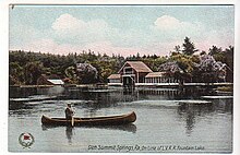
Summit Township is a township that is located in Butler County, Pennsylvania, United States. The population was 4,503 at the time of the 2020 census.

<span class="mw-page-title-main">Goshen Township, Clearfield County, Pennsylvania</span> Township in Pennsylvania, United States

Goshen Township is a township in Clearfield County, Pennsylvania, United States. The population was 393 at the 2020 census.

<span class="mw-page-title-main">Cromwell Township, Huntingdon County, Pennsylvania</span> Township in Pennsylvania, United States

Cromwell Township is a township in Huntingdon County, Pennsylvania, United States. The population was 1,475 at the 2020 census.

<span class="mw-page-title-main">Dublin Township, Huntingdon County, Pennsylvania</span> Township in Pennsylvania, United States

Dublin Township is a township in Huntingdon County, Pennsylvania, United States. The population was 1,182 at the 2020 census.

<span class="mw-page-title-main">Washington Township, Jefferson County, Pennsylvania</span> Township in Pennsylvania, United States

Washington Township is a township in Jefferson County, Pennsylvania, United States. The population was 1,892 at the 2020 census. It was named for President George Washington.

<span class="mw-page-title-main">Winslow Township, Pennsylvania</span> Township in Pennsylvania, United States

Winslow Township is a township in Jefferson County, Pennsylvania, United States. The population was 2,543 at the 2020 census. It was named for Associate Judge James Winslow.

<span class="mw-page-title-main">Black Creek Township, Pennsylvania</span> Township in Pennsylvania, United States

Black Creek Township is a township in Luzerne County, Pennsylvania, United States. The population was 1,904 as of the 2020 census.

<span class="mw-page-title-main">Fairmount Township, Pennsylvania</span> Township in Pennsylvania, United States

Fairmount Township is a township in Luzerne County, Pennsylvania, United States. The population was 1,207 at the 2020 census. Fairmount Township is home to Ricketts Glen State Park. The park receives tens of thousands of visitors each year.

<span class="mw-page-title-main">Hanover Township, Luzerne County, Pennsylvania</span> Township in Pennsylvania, United States

Hanover Township is a township in Luzerne County, Pennsylvania. As of the 2020 census, the population was 11,424, making it the most populous township in the county.

<span class="mw-page-title-main">Huntington Township, Luzerne County, Pennsylvania</span> Township in Pennsylvania, United States

Huntington Township is an American township which is in Luzerne County, Pennsylvania. The population was 2,052 at the time of the 2020 census.

<span class="mw-page-title-main">Mountain Top, Pennsylvania</span> Census-designated place in Pennsylvania, United States

Mountain Top is an unincorporated area and census-designated place (CDP) in Luzerne County, Pennsylvania, United States. As of the 2010 census, its population was 10,982.

<span class="mw-page-title-main">Newport Township, Pennsylvania</span> First Class Township in Pennsylvania, United States

Newport Township is a township in Luzerne County, Pennsylvania, United States. As of 2020, the population was 4,444. Newport is located on the outskirts of Nanticoke City.

<span class="mw-page-title-main">Rice Township, Pennsylvania</span> Township in Pennsylvania, United States

Rice Township is a township in Luzerne County, Pennsylvania, United States. The population was 3,626 at the 2020 census.

<span class="mw-page-title-main">Ross Township, Luzerne County, Pennsylvania</span> Township in Pennsylvania, United States

Ross Township is a township in Luzerne County, Pennsylvania, United States. The population was 2,719 at the 2020 census.

<span class="mw-page-title-main">Sugarloaf Township, Luzerne County, Pennsylvania</span> Township in Pennsylvania, United States

Sugarloaf Township is a township that is located in Luzerne County, Pennsylvania, United States. The population was 3,879 at the time of the 2020 census.

<span class="mw-page-title-main">Shenango Township, Mercer County, Pennsylvania</span> Township in Pennsylvania, United States

Shenango Township is a township in Mercer County, Pennsylvania, United States. The population was 3,519 at the 2020 census, down from 3,929 in 2010.

<span class="mw-page-title-main">Genesee Township, Potter County, Pennsylvania</span> Township in Pennsylvania, United States

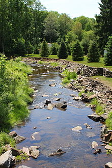
Genesee Township is a township in Potter County, Pennsylvania, United States and lies near the source of the Genesee River. The population was 729 at the 2020 census. The name Genesee derives from Indian term for "beautiful valley".

<span class="mw-page-title-main">Clinton Township, Venango County, Pennsylvania</span> Township in Pennsylvania, United States

Clinton Township is a township in Venango County, Pennsylvania, United States. The population was 951 at the 2020 census, an increase from 854 in 2010 and 758 at the 2000 census.

<span class="mw-page-title-main">Victory Township, Pennsylvania</span> Township in Pennsylvania, United States

Victory Township is a township in Venango County, Pennsylvania, United States. As of the 2020 census, the township population was 374.

References

  1. "2016 U.S. Gazetteer Files". United States Census Bureau. Retrieved August 14, 2017.
  2. 1 2 3 4 Bureau, US Census. "City and Town Population Totals: 2020—2021". Census.gov. US Census Bureau. Retrieved August 3, 2022.
  3. "FAIRVIEW TOWNSHIP". www.pagenweb.org.
  4. 1 2 3 Mountaintop Historical Society (2008). The History of Glen Summit Springs as of the year 2008.
  5. "National Register Information System". National Register of Historic Places . National Park Service. July 9, 2010.
  6. "Census of Population and Housing". Census.gov. Retrieved June 4, 2016.
  7. "U.S. Census website". United States Census Bureau . Retrieved January 31, 2008.

41°10′00″N75°51′59″W / 41.16667°N 75.86639°W / 41.16667; -75.86639