New Columbus, Pennsylvania

Last updated
New Columbus, Pennsylvania
Borough
Old Tioga Turnpike in New Columbus, Pennsylvania.JPG
Old Tioga Turnpike in New Columbus
Luzerne County Pennsylvania Incorporated and Unincorporated areas New Columbus Highlighted.svg
Location of New Columbus in Luzerne County, Pennsylvania.
USA Pennsylvania location map.svg
Red pog.svg
New Columbus
Usa edcp location map.svg
Red pog.svg
New Columbus
Coordinates: 41°10′21″N76°17′22″W / 41.17250°N 76.28944°W / 41.17250; -76.28944
Country United States
State Pennsylvania
County Luzerne
Settled1819
Incorporated1859
Government
  TypeBorough Council
Area
[1]
  Total3.10 sq mi (8.04 km2)
  Land3.10 sq mi (8.04 km2)
  Water0.00 sq mi (0.00 km2)
Population
 (2020) [2]
  Total222
  Density71.54/sq mi (27.62/km2)
Time zone UTC-5 (Eastern (EST))
  Summer (DST) UTC-4 (EDT)
Area code 570
FIPS code 42-53448

New Columbus is a borough that is located in Luzerne County, Pennsylvania, United States. The population was 219 at the time of the 2020 census. [3]

Contents

History

A small farming town that is located in western Luzerne County (just south of Ricketts Glen State Park), New Columbus was first settled in 1819. It was later incorporated as a borough in 1859.

The community has changed little since its founding; farming is still a major way of life for most of the borough.

Geography

New Columbus is located at 41°10′21″N76°17′22″W / 41.17250°N 76.28944°W / 41.17250; -76.28944 (41.1734, -76.2935). [4]

There are small clusters of houses scattered throughout the borough; most of the community consists of farmland. Downtown New Columbus, which consists of a few homes and businesses, is located at the intersection of Old Tioga Turnpike and Academy Street. According to the United States Census Bureau, the borough has a total area of 3.1 square miles (7.9 km2), all of it land.

View of New Columbus, Pennsylvania from Fishing Creek Township 2.JPG
Farmland in New Columbus
View of New Columbus, Pennsylvania from Fishing Creek Township 3.JPG
Farmland in New Columbus
Pine Creek in New Columbus, Pennsylvania.JPG
Pine Creek in New Columbus

Demographics

Historical population
CensusPop.Note
1860 240
1870 2504.2%
1880 2676.8%
1890 214−19.9%
1900 202−5.6%
1910 175−13.4%
1920 136−22.3%
1930 127−6.6%
1940 18243.3%
1950 152−16.5%
1960 144−5.3%
1970 1493.5%
1980 21443.6%
1990 2286.5%
2000 215−5.7%
2010 2275.6%
2020 219−3.5%
2021 (est.)218 [3] −0.5%
Sources: [5] [6] [7] [2]

A picture of a road sign and several houses in New Columbus.]]}} As of the census [6] of 2000, there were 215 people, 86 households, and 63 families residing in the borough. The population density was 68.1 inhabitants per square mile (26.3/km2). There were 96 housing units at an average density of 30.4 per square mile (11.7/km2).

The racial makeup of the borough was 100.00% white. Hispanic or Latino of any race were 1.40% of the population.

There were eighty-six households, out of which 31.4% had children under the age of eighteen living with them, with 60.5% living together as married couples, 9.3% documented as a female householder with no husband present, and 25.6% which were documented as non-families. Additionally, individuals 22.1% of all households were made up of individuals with 11.6% that had someone living alone who was sixty-five years of age or older.

The average household size was 2.5 and the average family size was 2.94.

Within the borough, the population was spread out, with 25.1% of residents who were under the age of eighteen, 5.1% who were aged eighteen to twenty-four, 31.2% who were aged twenty-five to forty-four, 18.6% who were aged forty-five to sixty-four, and 20.0% who were sixty-five years of age or older.

The median age of residents was thirty-six years. For every one hundred females there were eighty-seven males. For every one hundred females who were aged eighteen or older, there were roughly ninety-six males.

The median income for a household in the borough was $38,594, and the median income for a family was $39,844. Males had a median income of $31,250 compared with that of $21,071 for females. The per capita income for the borough was $15,981.

Only 2.7% of the population lived below the poverty line. None of those living in poverty were under the age of eighteen or living with families; however, 8.7% of those who were documented as impoverished were aged sixty-four or older.

As of 2017, the population of New Columbus was 222. [8]

Related Research Articles

<span class="mw-page-title-main">Sylvania, Pennsylvania</span> Borough in Pennsylvania, United States

Sylvania is a borough in Bradford County, Pennsylvania, United States. It is part of Northeastern Pennsylvania. The population was 216 at the 2020 census. Children residing in the borough are assigned to attend the Troy Area School District.

<span class="mw-page-title-main">Sugarloaf Township, Columbia County, Pennsylvania</span> Township in Pennsylvania, United States

Sugarloaf Township is a township in Columbia County, Pennsylvania. It is part of Northeastern Pennsylvania.

<span class="mw-page-title-main">Hiller, Pennsylvania</span> Census-designated place in Pennsylvania, United States

Hiller is an unincorporated community and census-designated place in Fayette County, Pennsylvania, United States. As of the 2010 census, it had a population of 1,155, down from 1,234 at the 2000 census.

<span class="mw-page-title-main">Hollenback Township, Pennsylvania</span> Township in Pennsylvania, United States

Hollenback Township is a township which is located in Luzerne County, Pennsylvania, United States. The population was 1,125 at the time of the 2020 census.

<span class="mw-page-title-main">Huntington Township, Luzerne County, Pennsylvania</span> Township in Pennsylvania, United States

Huntington Township is an American township which is in Luzerne County, Pennsylvania. The population was 2,052 at the time of the 2020 census.

<span class="mw-page-title-main">Laflin, Pennsylvania</span> Borough in Pennsylvania, United States

Laflin is a borough in the Greater Pittston area of Luzerne County, Pennsylvania, United States. The population was 1,443 at the time of the 2020 census.

<span class="mw-page-title-main">Laurel Run, Pennsylvania</span> Borough in Pennsylvania, United States

Laurel Run is a borough that is located in Luzerne County, Pennsylvania, United States. The population was 560 at the time of the 2020 census.

<span class="mw-page-title-main">Luzerne, Pennsylvania</span> Borough in Pennsylvania, United States

Luzerne is a borough located 5 miles (8 km) north of Wilkes Barre in Luzerne County, Pennsylvania, United States.

<span class="mw-page-title-main">Pringle, Pennsylvania</span> Borough in Pennsylvania, United States

Pringle is a borough in Luzerne County, Pennsylvania, United States. As of the 2020 census, the borough population was eight hundred and ninety-one.

<span class="mw-page-title-main">Sugar Notch, Pennsylvania</span> Borough in Pennsylvania, United States

Sugar Notch is a borough in Luzerne County, Pennsylvania, United States. The population was nine hundred and ninety-six at the time of the 2020 census.

<span class="mw-page-title-main">Warrior Run, Pennsylvania</span> Borough in Pennsylvania, United States

Warrior Run is a borough in Luzerne County, Pennsylvania, United States. The population was 528 at the time of the 2020 census.

<span class="mw-page-title-main">Mechanicsville, Schuylkill County, Pennsylvania</span> Borough in Pennsylvania, United States

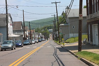
Mechanicsville is a borough in Schuylkill County, Pennsylvania, United States. Part of the Pottsville Area School District, it lies between Pottsville and Port Carbon. Pottsville Street is the community's main street.

<span class="mw-page-title-main">Middleport, Pennsylvania</span> Borough in Pennsylvania, United States

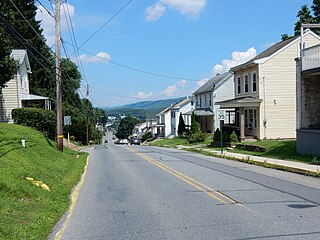
Middleport is a borough in Schuylkill County, Pennsylvania, United States. The population was 363 at the time of the 2020 census.

<span class="mw-page-title-main">Nuremberg, Pennsylvania</span> Census-designated place in Pennsylvania, United States

Nuremberg is a census-designated place (CDP) that is located in Schuylkill and Luzerne counties, Pennsylvania, United States. The population was 434 at the time of the 2010 census.

<span class="mw-page-title-main">Ringtown, Pennsylvania</span> Borough in Pennsylvania, United States

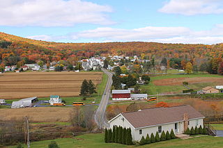
Ringtown is a borough that is located in Schuylkill County, Pennsylvania, United States. It is approximately five miles north to northwest of Shenandoah and seventeen miles west to southwest of Hazleton.

<span class="mw-page-title-main">Liberty, Tioga County, Pennsylvania</span> Borough in Pennsylvania, United States

Liberty is a small borough in Tioga County, Pennsylvania, United States. The population was 232 at the time of the 2020 census.

<span class="mw-page-title-main">Westfield, Pennsylvania</span> Borough in Pennsylvania, United States

Westfield is a borough in Tioga County, Pennsylvania, United States. The population was 1,113 at the time of the 2020 census.

<span class="mw-page-title-main">Prompton, Pennsylvania</span> Borough in Pennsylvania, United States

Prompton is a borough that is located in Wayne County, Pennsylvania, United States. The population was 250 at the time of the 2010 census.

<span class="mw-page-title-main">Laceyville, Pennsylvania</span> Borough in the United States

Laceyville is a borough that is located in Wyoming County, Pennsylvania, United States. The population was 363 at the time of the 2020 census.

<span class="mw-page-title-main">Railroad, Pennsylvania</span> Borough in Pennsylvania, United States

Railroad is a borough in York County, Pennsylvania, United States. The population was 259 at the 2020 census. It is part of the York–Hanover metropolitan area.

References

  1. "ArcGIS REST Services Directory". United States Census Bureau. Retrieved October 12, 2022.
  2. 1 2 "Census Population API". United States Census Bureau. Retrieved Oct 12, 2022.
  3. 1 2 Bureau, US Census. "City and Town Population Totals: 2020—2021". Census.gov. US Census Bureau. Retrieved August 5, 2022.
  4. "US Gazetteer files: 2010, 2000, and 1990". United States Census Bureau. 2011-02-12. Retrieved 2011-04-23.
  5. "Census of Population and Housing". U.S. Census Bureau. Retrieved 11 December 2013.
  6. 1 2 "U.S. Census website". United States Census Bureau . Retrieved 2008-01-31.
  7. "Incorporated Places and Minor Civil Divisions Datasets: Subcounty Resident Population Estimates: April 1, 2010 to July 1, 2012". Population Estimates. U.S. Census Bureau. Archived from the original on 11 June 2013. Retrieved 11 December 2013.
  8. "Population and Housing Unit Estimates" . Retrieved March 24, 2018.