Penn Lake Park, Pennsylvania

Last updated
Penn Lake Park
Borough
Penn Lake Park LuzCo PA 1.jpg
Nickname: 
Penn Lake
Luzerne County Pennsylvania Incorporated and Unincorporated areas Penn Lake Park Highlighted.svg
Location of Penn Lake Park in Luzerne County, Pennsylvania.
USA Pennsylvania location map.svg
Red pog.svg
Penn Lake Park
Usa edcp location map.svg
Red pog.svg
Penn Lake Park
Coordinates: 41°06′54″N75°46′12″W / 41.11500°N 75.77000°W / 41.11500; -75.77000
Country United States
State Pennsylvania
County Luzerne
Settled1938
Incorporated1976
Government
  TypeBorough Council
Area
[1]
  Total1.67 sq mi (4.31 km2)
  Land1.58 sq mi (4.10 km2)
  Water0.08 sq mi (0.21 km2)
Elevation
1,400 ft (400 m)
Population
 (2020) [2]
  Total360
  Density227.42/sq mi (87.83/km2)
Time zone UTC-5 (Eastern (EST))
  Summer (DST) UTC-4 (EDT)
Area code 570
FIPS code 42-59054
Website www.pennlake.org

Penn Lake Park is a borough in Luzerne County, Pennsylvania, United States. The population was 359 at the 2020 census. [3]

Contents

History

The community was founded in 1938, after ice salesman Albert Lewis used the lake to chip out his product. In 1946, Harry and Mary Goeringer bought the lake — and the 800 acres around it — from Lewis. They built a house by the lake; they later divided the rest of the land into parcels. It became a borough in 1976, when Penn Lake Park applied for a state grant because the lake's dam needed a major repair. [4]

Geography

Penn Lake Park is located at 41°06′54″N75°46′12″W / 41.115027°N 75.769922°W / 41.115027; -75.769922 . [5] According to the United States Census Bureau, the borough has a total area of 1.6 square miles (4.2 km2), of which 1.5 square miles (4.0 km2) is land and 0.08 square miles (0.2 km2), or 5.05%, is water. [6]

Penn Lake Park is located 10 miles (16 km) south of Wilkes-Barre.

Demographics

Historical population
CensusPop.Note
1980 217
1990 24211.5%
2000 26911.2%
2010 30814.5%
2020 35916.6%
2021 (est.)365 [3] 1.7%
Sources: [7] [8] [9] [2]

As of the census [8] of 2000, there were 269 people, 118 households, and 84 families residing in the borough. The population density was 137.5 inhabitants per square mile (53.1/km2). There were 222 housing units at an average density of 113.5 per square mile (43.8/km2). The racial makeup of the borough was 98.88% White, 1.12% from other races. Hispanic or Latino of any race were 0.74% of the population.

There were 118 households, out of which 23.7% had children under the age of 18 living with them, 63.6% were married couples living together, 5.1% had a female householder with no husband present, and 28.0% were non-families. 22.0% of all households were made up of individuals, and 9.3% had someone living alone who was 65 years of age or older. The average household size was 2.28 and the average family size was 2.67.

In the borough the population was spread out, with 19.0% under the age of 18, 5.6% from 18 to 24, 26.4% from 25 to 44, 31.2% from 45 to 64, and 17.8% who were 65 years of age or older. The median age was 45 years. For every 100 females there were 105.3 males. For every 100 females age 18 and over, there were 98.2 males.

The median income for a household in the borough was $45,139, and the median income for a family was $50,000. Males had a median income of $29,018 versus $26,000 for females. The per capita income for the borough was $20,437. About 5.7% of families and 4.4% of the population were below the poverty line, including none of those under the age of eighteen and 20.8% of those sixty five or over.

Related Research Articles

<span class="mw-page-title-main">Bechtelsville, Pennsylvania</span> Borough in Pennsylvania, United States

Bechtelsville is a borough in Berks County, Pennsylvania. The population was 942 at the 2010 census.

<span class="mw-page-title-main">Centre Township, Berks County, Pennsylvania</span> Township in Pennsylvania, United States

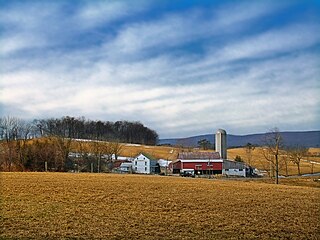
Centre Township is a township in Berks County, Pennsylvania. The population was 4,140 at the 2020 census. It is in Schuylkill Valley School District.

<span class="mw-page-title-main">Kenhorst, Pennsylvania</span> Borough in Pennsylvania, United States

Kenhorst is a borough in Berks County, Pennsylvania, United States. The population was 2,877 at the 2010 census.

<span class="mw-page-title-main">Lyons, Pennsylvania</span> Borough in Pennsylvania, United States

Lyons is a borough in Berks County, Pennsylvania, United States. The population was 478 at the 2010 census.

<span class="mw-page-title-main">Mohnton, Pennsylvania</span> Borough in Pennsylvania, United States

Mohnton is a borough in Berks County, Pennsylvania, United States. It had a population of 3,043 in the 2010 census.

<span class="mw-page-title-main">Mount Penn, Pennsylvania</span> Borough in Pennsylvania, United States

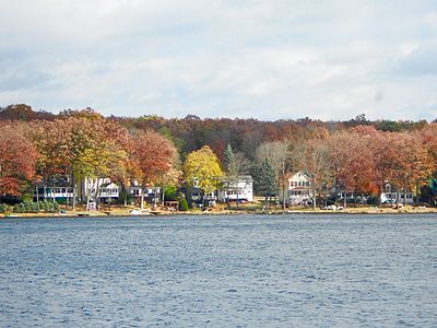
Mount Penn is a borough in Berks County, Pennsylvania, United States. The population was 3,106 at the 2010 census. The borough shares a name with a 1,120-foot-high (340 m) mountain that rises to the north and overlooks the city of Reading. The peak is sometimes recognized as the southern end of the Reading Prong group of mountains.

<span class="mw-page-title-main">Perry Township, Berks County, Pennsylvania</span> Township in Pennsylvania, United States

Perry Township is a township in Berks County, Pennsylvania, United States. The population was 2,417 at the 2010 census.

<span class="mw-page-title-main">Topton, Pennsylvania</span> Borough in Pennsylvania, United States

Topton is a borough in Berks County, Pennsylvania, United States. The population was 2,069 at the 2010 census.

<span class="mw-page-title-main">Modena, Pennsylvania</span> Borough in Pennsylvania, United States

Modena is a borough in Chester County, Pennsylvania, United States. The population was 544 at the 2020 census. It was originally called Modeville, after the local Mode family.

<span class="mw-page-title-main">Parkesburg, Pennsylvania</span> Borough in Pennsylvania, United States

Parkesburg is a borough in Chester County, Pennsylvania, United States. The population was counted as 3,866 at the 2020 census. The ZIP code is 19365.

<span class="mw-page-title-main">South Coatesville, Pennsylvania</span> Borough in Pennsylvania, United States

South Coatesville is a borough in Chester County, Pennsylvania, United States. The population was 1,604 at the 2020 census.

<span class="mw-page-title-main">Aldan, Pennsylvania</span> Borough in Pennsylvania, United States

Aldan is a borough in Delaware County, Pennsylvania, United States. The population was 4,152 at the 2010 census.

<span class="mw-page-title-main">Glenolden, Pennsylvania</span> Borough in Pennsylvania, United States

Glenolden is a borough in Delaware County, Pennsylvania, United States. The population was 7,153 at the 2010 census, down from 7,476 at the 2000 census.

<span class="mw-page-title-main">Green Lane, Pennsylvania</span> Borough in Pennsylvania, United States

Green Lane is a borough in Montgomery County, Pennsylvania. The population was 490 at the 2020 census. It is part of the Upper Perkiomen School District and Boyertown Area School District.

<span class="mw-page-title-main">Pennsburg, Pennsylvania</span> Borough in Pennsylvania, United States

Pennsburg is a borough in Montgomery County, Pennsylvania. Its population was 3,889 at the 2020 census. It is part of the Upper Perkiomen School District. It is also part of the strip of small towns that run together along Route 29: Red Hill, Pennsburg, and East Greenville. The towns are collectively referred to as Upper Perk.

<span class="mw-page-title-main">Freemansburg, Pennsylvania</span> Place in Pennsylvania, United States

Freemansburg is a borough in Northampton County, Pennsylvania. The population of Freemansburg was 2,875 as of the 2020 census. The Lehigh River, a 109-mile-long (175 km) tributary of the Delaware River, flows through Freemansburg.

<span class="mw-page-title-main">Tatamy, Pennsylvania</span> Place in Pennsylvania, United States

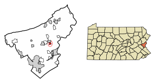
Tatamy is a borough in Northampton County, Pennsylvania. The borough's population was 1,203 as of the 2020 census. Tatamy is part of the Lehigh Valley metropolitan area, which had a population of 861,899 and was the 68th most populous metropolitan area in the U.S. as of the 2020 census.

<span class="mw-page-title-main">Walnutport, Pennsylvania</span> Place in Pennsylvania, United States

Walnutport is a borough in Northampton County, Pennsylvania. It was first incorporated in 1909. The population of Walnutport was 2,067 at the 2020 census.

<span class="mw-page-title-main">New Ringgold, Pennsylvania</span> Borough in Pennsylvania, United States

New Ringgold is a borough in Schuylkill County, Pennsylvania, United States. The population was 253 at the time of the 2020 census.

<span class="mw-page-title-main">Penn, Pennsylvania</span> Borough in Pennsylvania, United States

Penn is a borough in Westmoreland County, Pennsylvania, United States. The population was 475 at the time of the 2010 census.

References

  1. "ArcGIS REST Services Directory". United States Census Bureau. Retrieved October 12, 2022.
  2. 1 2 "Census Population API". United States Census Bureau. Retrieved Oct 12, 2022.
  3. 1 2 Bureau, US Census. "City and Town Population Totals: 2020—2021". Census.gov. US Census Bureau. Retrieved August 5, 2022.
  4. "A summer place — but so much more". 25 June 2015.
  5. "US Gazetteer files: 2010, 2000, and 1990". United States Census Bureau. 2011-02-12. Retrieved 2011-04-23.
  6. "Geographic Identifiers: 2010 Demographic Profile Data (G001): Penn Lake Park borough, Pennsylvania". United States Census Bureau . Retrieved April 12, 2012.
  7. "Census of Population and Housing". U.S. Census Bureau. Retrieved 11 December 2013.
  8. 1 2 "U.S. Census website". United States Census Bureau . Retrieved 2008-01-31.
  9. "Incorporated Places and Minor Civil Divisions Datasets: Subcounty Resident Population Estimates: April 1, 2010 to July 1, 2012". Population Estimates. U.S. Census Bureau. Archived from the original on 11 June 2013. Retrieved 11 December 2013.