Swoyersville, Pennsylvania

Last updated
Swoyersville, Pennsylvania
Borough
Swoyersville, PA municipal building, Sept. 2023.jpg
Swoyersville Borough Municipal Building
Luzerne County Pennsylvania Incorporated and Unincorporated areas Swoyersville Highlighted.svg
Location of Swoyersville in Luzerne County, Pennsylvania.
USA Pennsylvania location map.svg
Red pog.svg
Swoyersville
Usa edcp location map.svg
Red pog.svg
Swoyersville
Coordinates: 41°17′41″N75°52′36″W / 41.29472°N 75.87667°W / 41.29472; -75.87667
CountryUnited States
State Pennsylvania
County Luzerne
Incorporated1888
Government
  TypeBorough Council
  MayorChristopher Concert
Area
[1]
  Total2.16 sq mi (5.59 km2)
  Land2.16 sq mi (5.59 km2)
  Water0.00 sq mi (0.00 km2)
Elevation
[2]
560 ft (170 m)
Population
 (2020) [3]
  Total5,008 Decrease2.svg
  Estimate 
(2021) [3]
5,007
  Density2,318.98/sq mi (895.35/km2)
Time zone UTC−5 (Eastern (EST))
  Summer (DST) UTC−4 (EDT)
ZIP code
18704
Area code 570
FIPS code 42-75832
Website www.swoyersvillepa.us

Swoyersville is a borough in Luzerne County, Pennsylvania, United States. The population was 5,008 at the 2020 census. [3] Swoyersville is located within the Wyoming Valley West School District.

Contents

History

The community was originally called Swoyerville; it was incorporated as a borough in 1888. The community was named after mine owner John Henry Swoyer. In the 1950s, the town held a special vote on whether to add an "s" to the borough's name. The measure passed and the borough became Swoyersville.

Coal mining was the chief industry in and around Swoyersville for most of the 19th and 20th centuries. The mines ceased production in the 1950s (after the Knox Mine Disaster). However, work continued at the colliery on Main Street (in Swoyersville) well into the 1960s. In 1972, the town was severely flooded by the Susquehanna River as a result of Hurricane Agnes. At the time, there was great concern that many of the flooded abandoned mine tunnels — running underneath Swoyersville — would cave-in. However, the cave-ins never occurred.

Geography

A map of Luzerne County school districts. Swoyersville is part of Wyoming Valley West School District (seen in orange). Map of Luzerne County Pennsylvania School Districts.png
A map of Luzerne County school districts. Swoyersville is part of Wyoming Valley West School District (seen in orange).

Swoyersville is located at 41°17′41″N75°52′36″W / 41.294602°N 75.876684°W / 41.294602; -75.876684 . [4] According to the United States Census Bureau, the borough has a total area of 2.1 square miles (5.5 km2), all land.

Swoyersville's terrain is flat in the south, with the northern part of the borough being hilly. The majority of the borough's land is urban, with some forest in the north. [5]

A massive pile of coal ash as high as a 17-story building is in the town, surrounded by homes. The pile is enough to fill 26,000 rail cars, and the mayor Christopher Concert advocates for it to be hauled away, if state and federal funding can be secured, even though he used it for sledding in the winter as a child. [6]

Demographics

Historical population
CensusPop.Note
1900 2,264
1910 5,396138.3%
1920 6,87627.4%
1930 9,13332.8%
1940 9,2341.1%
1950 7,795−15.6%
1960 6,751−13.4%
1970 6,7860.5%
1980 5,795−14.6%
1990 5,630−2.8%
2000 5,157−8.4%
2010 5,062−1.8%
2020 5,008−1.1%
2021 (est.)5,007 [3] 0.0%
Sources: [7] [8] [9]

As of the census [8] of 2000, there were 5,157 people, 2,243 households, and 1,484 families residing in the borough. The population density was 2,386.4 inhabitants per square mile (921.4/km2). There were 2,356 housing units at an average density of 1,090.3 per square mile (421.0/km2). The racial makeup of the borough was 99.22% White, 0.10% African American, 0.06% Native American, 0.16% Asian, 0.08% from other races, and 0.39% from two or more races. Hispanic or Latino of any race were 0.16% of the population.

There were 2,243 households, out of which 24.0% had children under the age of 18 living with them, 51.5% were married couples living together, 11.1% had a female householder with no husband present, and 33.8% were non-families. 31.0% of all households were made up of individuals, and 17.5% had someone living alone who was 65 years of age or older. The average household size was 2.30 and the average family size was 2.88.

In the borough the age distribution of the population shows 18.5% under the age of 18, 6.6% from 18 to 24, 26.7% from 25 to 44, 24.7% from 45 to 64, and 23.4% who were 65 years of age or older. The median age was 44 years. For every 100 females there were 89.4 males. For every 100 females age 18 and over, there were 86.4 males.

The median income for a household in the borough was $30,434, and the median income for a family was $39,188. Males had a median income of $29,101 versus $26,304 for females. The per capita income for the borough was $16,449. About 10.4% of families and 10.8% of the population were below the poverty line, including 19.3% of those under age 18 and 6.5% of those age 65 or over.

Notable people

Related Research Articles

<span class="mw-page-title-main">Springdale, Pennsylvania</span> Borough in Pennsylvania, United States

Springdale is a borough in northeastern Allegheny County, Pennsylvania, United States, 18 miles (29 km) northeast of Pittsburgh along the Allegheny River. The population was 3,400 at the 2020 census. The borough became official in 1906, after breaking away from the township.

<span class="mw-page-title-main">West Elizabeth, Pennsylvania</span> Borough in Pennsylvania, United States

West Elizabeth is a borough in Allegheny County, Pennsylvania, United States. The population was 403 at the 2020 census.

<span class="mw-page-title-main">Saxton, Pennsylvania</span> Borough in Pennsylvania, United States

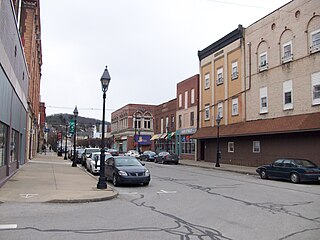
Saxton is a borough in Bedford County, Pennsylvania, United States. The population was 722 at the 2020 census.

<span class="mw-page-title-main">Lansford, Pennsylvania</span> Borough in Pennsylvania, United States

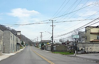
Lansford is a county-border borough (town) in Carbon County, Pennsylvania, United States. It is part of Northeastern Pennsylvania. It is located 37 miles (60 km) northwest of Allentown and 19 miles south of Hazleton in the Panther Creek Valley about 72 miles (116 km) from Philadelphia and abutting the cross-county sister-city of Coaldale in Schuylkill County.

<span class="mw-page-title-main">Summit Hill, Pennsylvania</span> Borough in Pennsylvania, United States

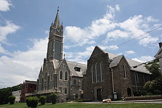
Summit Hill is a borough in Carbon County, Pennsylvania, United States. It is part of Northeastern Pennsylvania. The population was 3,034 at the 2010 census.

<span class="mw-page-title-main">Ernest, Pennsylvania</span> Borough in Pennsylvania, United States

Ernest is a borough in Indiana County, Pennsylvania, United States. The population was 422 at the 2020 census.

<span class="mw-page-title-main">Plumville, Pennsylvania</span> Borough in Pennsylvania, United States

Plumville is a borough in Indiana County, Pennsylvania, United States. The population was 257 at the 2020 census.

<span class="mw-page-title-main">Avoca, Pennsylvania</span> Borough in Pennsylvania, United States

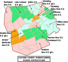
Avoca is a borough within the Greater Pittston area of Luzerne County, Pennsylvania, United States. It is located 7.5 miles (12.1 km) northeast of Wilkes Barre and 3.4 miles (5.5 km) southwest of Scranton. The population was 2,501 at the time of the 2020 census. The Wilkes-Barre/Scranton International Airport (AVP) is located near Avoca.

<span class="mw-page-title-main">Larksville, Pennsylvania</span> Borough in Pennsylvania, United States

Larksville is a borough in Luzerne County, Pennsylvania, United States. It is 2 miles (3 km) west of Wilkes Barre on the Susquehanna River. The population was 4,216 as of the 2020 census.

<span class="mw-page-title-main">Luzerne, Pennsylvania</span> Borough in Pennsylvania, United States

Luzerne is a borough located 5 miles (8 km) north of Wilkes Barre in Luzerne County, Pennsylvania, United States.

<span class="mw-page-title-main">West Pittston, Pennsylvania</span> Borough in Pennsylvania, United States

West Pittston is a borough in the Greater Pittston area of Luzerne County, Pennsylvania, United States. It is located on the Susquehanna River. In 2020, the population was 4,644.

<span class="mw-page-title-main">Cressona, Pennsylvania</span> Borough in Pennsylvania, United States

Cressona is a borough in Schuylkill County, Pennsylvania. Formed in 1857 from part of North Manheim Township, it was founded by and named for John Chapman Cresson, a Philadelphia civil engineer and manager of the Schuylkill Navigation Company, president of the Mine Hill and Schuylkill Haven Railroad, and the chief engineer of Fairmount Park in Philadelphia.

<span class="mw-page-title-main">Gilberton, Pennsylvania</span> Borough in Pennsylvania, United States

Gilberton is a borough in Schuylkill County, Pennsylvania, United States, four miles (7 km) west by south of Mahanoy City. Its population was 583 at the 2020 census, a decline from the figure of 769 tabulated in 2010. Extensive deposits of anthracite coal are in the region, and coal-mining had been practiced by many of the 4,373 people who lived there in 1900. The coal-mining industry was thriving in 1910, and 5,401 people lived in Gilberton.

<span class="mw-page-title-main">Port Trevorton, Pennsylvania</span> CDP in Pennsylvania, United States

Port Trevorton is a census-designated place (CDP) in Snyder County, Pennsylvania, United States. The population was 451 at the 2000 census.

<span class="mw-page-title-main">Summit Township, Somerset County, Pennsylvania</span> Township in Pennsylvania, United States

Summit Township is a township in Somerset County, Pennsylvania, United States. The population was 2,141 at the 2020 census. It is part of the Johnstown, Pennsylvania, Metropolitan Statistical Area.

<span class="mw-page-title-main">California, Pennsylvania</span> Borough in Pennsylvania, United States

California is a borough on the Monongahela River in Washington County, Pennsylvania, United States. The population was 5,479 as of the 2020 census. It is part of the Pittsburgh metropolitan area.

<span class="mw-page-title-main">Ellsworth, Pennsylvania</span> Borough in Pennsylvania, United States

Ellsworth is a borough in Washington County, Pennsylvania, United States. The population was 947 at the 2020 census. The coal town was founded by James Ellsworth, who bought the land in 1890s, developed the Monongahela Railway, and sold the mines to Bethlehem Steel in the 1920s.

<span class="mw-page-title-main">Marianna, Pennsylvania</span> Borough in Pennsylvania, United States

Marianna is a borough in Washington County, Pennsylvania, United States. The population was 396 at the 2020 census.

<span class="mw-page-title-main">Export, Pennsylvania</span> Borough in Pennsylvania, United States

Export is a borough in Westmoreland County, Pennsylvania, United States, surrounded entirely by the Municipality of Murrysville. The population was 893 at the 2020 census.

<span class="mw-page-title-main">Irwin, Pennsylvania</span> Borough in Pennsylvania, United States

Irwin is a borough in Westmoreland County, Pennsylvania, 22 miles (35 km) southeast of Pittsburgh. Some of the most extensive bituminous coal deposits in the commonwealth are located here. In the past, iron foundries, flour mills, car shops, facing and planing mills, electricals goods, and mirror factories provided employment to the residents. In 1900, the population numbered 2,452; it increased to 2,886 in 1910. The population was 3,973 at the 2010 census.

References

  1. "2019 U.S. Gazetteer Files". United States Census Bureau. Retrieved July 28, 2020.
  2. "Swoyersville, Pennsylvania (PA 18704) profile: Population, maps, real estate, averages, homes, statistics, relocation, travel, jobs, hospitals, schools, crime, moving, houses, news, sex offenders".
  3. 1 2 3 4 Bureau, US Census. "City and Town Population Totals: 2020—2021". Census.gov. US Census Bureau. Retrieved August 5, 2022.
  4. "US Gazetteer files: 2010, 2000, and 1990". United States Census Bureau. 2011-02-12. Retrieved 2011-04-23.
  5. "Google Maps".
  6. Bruggers, James (2021-12-12). "Coal Powered the Industrial Revolution. It Left Behind an 'Absolutely Massive' Environmental Catastrophe". Inside Climate News. Retrieved 2021-12-18.
  7. "Census of Population and Housing". U.S. Census Bureau. Retrieved 11 December 2013.
  8. 1 2 "U.S. Census website". United States Census Bureau . Retrieved 2008-01-31.
  9. "Incorporated Places and Minor Civil Divisions Datasets: Subcounty Resident Population Estimates: April 1, 2010 to July 1, 2012". Population Estimates. U.S. Census Bureau. Archived from the original on 11 June 2013. Retrieved 11 December 2013.