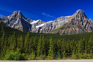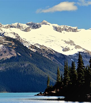
Mount Columbia is a mountain located in the Winston Churchill Range of the Rocky Mountains. It is the highest point in Alberta, Canada, and is second only to Mount Robson for height and topographical prominence in the Canadian Rockies. It is located on the border between Alberta and British Columbia on the northern edge of the Columbia Icefield. Its highest point, however, lies within Jasper National Park in Alberta.

Mount Forbes is the seventh tallest mountain in the Canadian Rockies and the tallest within the boundaries of Banff National Park. It is located in southwestern Alberta, 18 km (11 mi) southwest of the Saskatchewan River Crossing in Banff. The mountain was named by James Hector in 1859 after Edward Forbes, Hector's natural history professor at the University of Edinburgh during the mid-19th century.

The Winston Churchill Range is a mountain range in the central section of the Park Ranges of the Canadian Rockies located in Jasper National Park. The range was named after Sir Winston Churchill, former British prime minister.

Mount King Edward is a mountain located at the head of the Athabasca River valley in Jasper National Park, Canada. Mt. King Edward is situated on the Continental Divide with Mt. Columbia 51⁄2 km east. The mountain was named in 1906 by Mary Schäffer Warren after King Edward VII.

The Fairholme Range is a mountain range east of the Bow River valley in the Canadian Rockies. The range is bounded on the west side by the Trans-Canada Highway as it passes through the towns of Exshaw and Canmore, while the northern section of the range extends into Banff National Park to the southern shores of Lake Minnewanka. John Palliser named the range in 1859 after his sister Grace Fairholme, who had married William Fairholme.
Pika Peak is a mountain located between Mount Richardson and Ptarmigan Peak in Banff National Park, Alberta, Canada The mountain was named in 1928 after the pika, the small "rock rabbit" that inhabits alpine regions.

The Slate Range is a mountain range of the Canadian Rockies, located in Banff National Park, Canada. The range is named after slate, the primary composition of the mountains in the area.

Mount Richardson is the highest mountain of the Slate Range located beside Pika Peak in Banff National Park, Alberta, Canada. The mountain was named in 1859 by James Hector after Sir John Richardson who was the ship's surgeon and naturalist on John Franklin's 1819 and 1825 expeditions into the Arctic.

Ptarmigan Peak is a peak located beside Pika Peak in Banff National Park, Alberta, Canada.

Mount Brazeau is a mountain in Alberta, Canada.

Stanley Peak is a 3,155-metre (10,351 ft) mountain located in the Ball Range, at the northeastern section of Kootenay National Park, in the Canadian Rocky Mountains. The mountain was named in 1901 by its first climber, the English explorer Edward Whymper, after Frederick Stanley, 16th Earl of Derby, the sixth Governor-General of Canada. There are sources that date the naming in 1912 after Stanley H. Mitchell, Secretary-Treasurer of Alpine Club of Canada.

Pyramid Mountain is a mountain in Jasper National Park, Alberta, Canada, named for its pyramid-like shape. James Hector named the mountain in 1859 due to its appearance from the Athabasca River valley on the eastern side of the peak.

The Three Sisters are a trio of peaks near Canmore, Alberta, Canada. They are known individually as Big Sister, Middle Sister and Little Sister.

Mount Saskatchewan is a mountain located in the North Saskatchewan River valley of Banff National Park, in the Canadian Rockies of Alberta, Canada.

Mount Hector is a 3,394-metre (11,135-foot) mountain summit located in the Bow River valley of Banff National Park, in the Canadian Rockies of Alberta, Canada. The mountain was named in 1884 by George M. Dawson after James Hector, a geologist on the Palliser expedition. The mountain is located beside the Icefields Parkway, 17 km (11 mi) north of Lake Louise.

Howse Peak is the highest mountain in the Waputik Mountains, a subrange of the Canadian Rockies. It is located 5 km (3 mi) west of the Icefields Parkway, above Chephren Lake, on the continental divide between Alberta and British Columbia. At 3,295 m (10,810 ft), it is the 46th highest peak in Alberta, and the 59th highest in British Columbia.

Mount Lyell is a mountain on the Alberta–British Columbia border in western Canada. Comprising five distinct summits, Mount Lyell reaches a height of 3,498 m (11,476 ft). The mountain was named by James Hector in 1858 in recognition of Scottish geologist Sir Charles Lyell.

Mount Wilcox is a 2,884-metre (9,462-foot) mountain summit located in the Canadian Rockies of Alberta, Canada. It is located in Jasper National Park right beside the Columbia Icefield visitor centre with the Icefields Parkway traversing the western base of the mountain. Its nearest higher peak is Nigel Peak, 3.35 km (2.08 mi) to the northeast. Mount Wilcox is a moderate scramble from Wilcox Pass. Due to its location, it provides one of the best views of the Athabasca Glacier.

The Waputik Mountains are a mountain range of the Canadian Rockies, located on the Continental Divide between Banff and Yoho National Park. Covering an area of 1,069 square kilometres (413 sq mi), the range is located west of the Howse, Blaeberry and Amiskwi Rivers and east of the Bow and Mistaya Rivers and south to Kicking Horse Pass. Named in 1884 by George M. Dawson, "waputik" is the Stoney Indian word for white goat.

Mount Carr is a 2,590-metre (8,497-foot) mountain summit located in British Columbia, Canada.


