The Greater Taree City Council (GTCC) was a local government area on the Mid North Coast of New South Wales, Australia, until 12 May 2016 when it was amalgamated to form part of the Mid-Coast Council. It was originally formed in 1981 from the Manning Shire, and the Taree and Wingham Municipal Councils. The council was centred on Taree, located adjacent to the Manning River, the Pacific Highway and the North Coast railway line.
Willow Vale is a Northern Village of the Southern Highlands of New South Wales, Australia, in Wingecarribee Shire. It is located 2 km north of Mittagong and is often considered part of Braemar along with its neighbour Balaclava.

Nambucca Heads is a town on the Mid North Coast of New South Wales, Australia in the Nambucca Valley. It is located on a ridge, north of the estuary of the Nambucca River near the Pacific Highway. Its 2021 population was 6,675, including 5,226 (78.3%) Australian-born persons and 672 indigenous persons.

McLaren Vale is a town and locality in the Australian state of South Australia located about 33 kilometres (21 mi) south of the Adelaide city centre and about 9 kilometres (5.6 mi) south of the municipal seat at Noarlunga Centre.
Coopernook is a small town in mid-north New South Wales, Australia. It is located 24 kilometres north of Taree and 11 kilometres west of Harrington and is administered by Mid-Coast Council. At the 2021 census, Coopernook and the surrounding area had a population of 625 people, while the town itself had 430 inhabitants. It was formerly situated on the Pacific Highway, until 22 March 2006, when the Coopernook Bypass was opened. The old highway crossed the Lansdowne River on a narrow iron girder bridge.
Glenreagh is a small town in the Clarence Valley in the Northern Rivers region of north-eastern New South Wales, Australia. At the 2021 census, Glenreagh had a population of 562 people.

The City of Kalamunda is a local government area in the eastern metropolitan region of the Western Australian capital city of Perth about 25 kilometres (16 mi) east of Perth's central business district. The area covers 324 square kilometres (125 sq mi), much of which is state forest rising into the Darling Scarp to the east. As of 2021, the city had a population of 58,762.
North Arm is a rural town and locality in the Sunshine Coast Region, Queensland, Australia. In the 2021 census, the locality of North Arm had a population of 734 people.
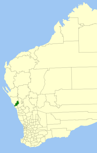
The Shire of Chapman Valley is a local government area located in the Mid West region of Western Australia, immediately northeast of the City of Geraldton and about 440 kilometres (273 mi) north of Perth, the state capital. The Shire covers an area of 3,965 square kilometres (1,531 sq mi) and its seat of government is the small town of Nabawa.
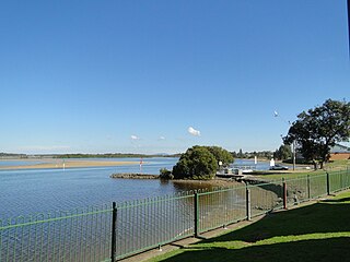
Harrington is a fishing village located on the northern entrance of the Manning River in New South Wales, Australia. It was established in 1853 and proclaimed a village on 26 September 1896. It is 15 km north-east of Taree on the Mid North Coast, and 335 kilometres (208 mi) north east of the state capital, Sydney. At the 2021 census, Harrington had a population of 3,381. It was named after the Earl of Harrington by the explorer, John Oxley.
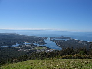
Camden Haven is a parish in the Mid North Coast region of New South Wales, Australia, approximately 30 km south of the major regional centre of Port Macquarie. The harbour is located where the Camden Haven River empties into the Tasman Sea.
Turkey Beach is a coastal town and locality in the Gladstone Region, Queensland, Australia. In the 2021 census, the locality of Turkey Beach had a population of 148 people.

The City of Greater Geraldton is a local government area in the Mid West region of Western Australia, 424 kilometres (263 mi) north of the state capital, Perth on the Indian Ocean. It covers an area of 12,625.5 square kilometres (4,874.7 sq mi), and its seat of government is the town of Geraldton.

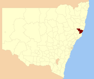
MidCoast Council is a local government area that is located in the Mid North Coast region of New South Wales, Australia. The council was formed on 12 May 2016 through a merger of the Gloucester Shire, Great Lakes and City of Greater Taree Councils.
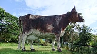
Kulangoor is a locality in the Sunshine Coast Region, Queensland, Australia. It was known as the home of The Big Cow for many years. In the 2021 census, Kulangoor had a population of 455 people.
Cannon Creek is a rural locality in the Scenic Rim Region, Queensland, Australia. In the 2021 census, Cannon Creek had a population of 75 people.
Taabinga is a rural town and locality in the South Burnett Region, Queensland, Australia.
Seventeen Mile is a rural locality in the Lockyer Valley Region, Queensland, Australia. In the 2021 census, Seventeen Mile had a population of 22 people.

Hidden Valley is a mixed-use locality in the Livingstone Shire, Queensland, Australia. In the 2021 census, Hidden Valley had a population of 879 people.
Sundown is a rural locality in the Cassowary Coast Region, Queensland, Australia. In the 2021 census, Sundown had a population of 145 people.
