List of Special Protection Areas in Scotland

Last updated

This is a list of Special Protection Areas (SPAs) in Scotland.

Site nameSite codeCountryArea (ha)CoordinatesStatus
Abernethy Forest UK9002561S5793.46 57°13′22″N03°18′10″W / 57.22278°N 3.30278°W / 57.22278; -3.30278 Classified
Achanalt Marshes UK9001701S208.25 57°36′10″N04°53′30″W / 57.60278°N 4.89167°W / 57.60278; -4.89167 Classified
Ailsa Craig UK9003091S99.94 55°15′15″N05°07′00″W / 55.25417°N 5.11667°W / 55.25417; -5.11667 Classified
Aird and Borve, Benbecula UK9001751S361 57°27′20″N07°23′30″W / 57.45556°N 7.39167°W / 57.45556; -7.39167 Classified
Anagach Wood UK9020297SPotential
Arran Moors UK9003341S10736.51 55°32′40″N05°13′30″W / 55.54444°N 5.22500°W / 55.54444; -5.22500 Classified
Assynt Lochs UK9001591S1156.43 58°10′00″N05°00′00″W / 58.16667°N 5.00000°W / 58.16667; -5.00000 Classified
Auskerry UK9002381S101.97 59°02′00″N02°34′00″W / 59.03333°N 2.56667°W / 59.03333; -2.56667 Classified
Ballochbuie UK9002781S1881.73 56°59′30″N03°19′06″W / 56.99167°N 3.31833°W / 56.99167; -3.31833 Classified
Beinn Dearg UK9001631S5567.59 57°48′00″N04°55′00″W / 57.80000°N 4.91667°W / 57.80000; -4.91667 Classified
Ben Alder UK9002551S2860.21 56°50′25″N04°29′45″W / 56.84028°N 4.49583°W / 56.84028; -4.49583 Classified
Ben Wyvis UK9001641S2174.54 57°41′00″N04°34′30″W / 57.68333°N 4.57500°W / 57.68333; -4.57500 Classified
Black Cart UK9003221S56.3 55°52′45″N04°26′20″W / 55.87917°N 4.43889°W / 55.87917; -4.43889 Classified
Bridgend Flats, Islay UK9003052S331.16 55°46′22″N06°16′05″W / 55.77278°N 6.26806°W / 55.77278; -6.26806 Classified
Buchan Ness to Collieston Coast UK9002491S208.62 57°26′20″N01°48′30″W / 57.43889°N 1.80833°W / 57.43889; -1.80833 Classified
Caenlochan UK9004011S5975.28 56°52′54″N03°17′30″W / 56.88167°N 3.29167°W / 56.88167; -3.29167 Classified
Cairngorms UK9002241S50903.74 57°04′30″N03°38′30″W / 57.07500°N 3.64167°W / 57.07500; -3.64167 Classified
Caithness Lochs UK9001151S145516.75 58°20′10″N03°56′15″W / 58.33611°N 3.93750°W / 58.33611; -3.93750 Classified
Caithness and Sutherland Peatlands UK9001171S1378.45 58°29′30″N03°20′00″W / 58.49167°N 3.33333°W / 58.49167; -3.33333 Classified
Calf of Eday UK9002431S238.03 59°14′24″N02°43′48″W / 59.24000°N 2.73000°W / 59.24000; -2.73000 Classified
Cameron Reservoir UK9004131S68.76 56°17′32″N02°51′12″W / 56.29222°N 2.85333°W / 56.29222; -2.85333 Classified
Canna and Sanday UK9001431S1341.27 57°04′00″N06°30′00″W / 57.06667°N 6.50000°W / 57.06667; -6.50000 Classified
Cape Wrath UK9001231S1019.18 58°36′00″N04°53′30″W / 58.60000°N 4.89167°W / 58.60000; -4.89167 Classified
Castle Loch, Lochmaben UK9003191S107.6 55°07′12″N03°25′50″W / 55.12000°N 3.43056°W / 55.12000; -3.43056 Classified
Cnuic agus Cladach Mhuile UK9003311S29248.97 56°26′30″N06°00′20″W / 56.44167°N 6.00556°W / 56.44167; -6.00556 Classified
Coll (corncrake)UK9003031S2321.88 56°39′16″N06°30′05″W / 56.65444°N 6.50139°W / 56.65444; -6.50139 Classified
Coll UK9003033S371.13 56°36′10″N06°37′15″W / 56.60278°N 6.62083°W / 56.60278; -6.62083 Classified
Copinsay UK9002151S125.42 58°54′00″N02°40′30″W / 58.90000°N 2.67500°W / 58.90000; -2.67500 Classified
Craigmore Wood UK9001801S654.09 57°17′00″N03°37′00″W / 57.28333°N 3.61667°W / 57.28333; -3.61667 Classified
Creag Meagaidh UK9002161S2872.64 56°57′00″N04°35′00″W / 56.95000°N 4.58333°W / 56.95000; -4.58333 Classified
Cromarty Firth UK9001623S3746.95 57°41′00″N04°12′00″W / 57.68333°N 4.20000°W / 57.68333; -4.20000 Classified
Cuillins UK9001781S29490.01 57°14′39″N06°08′45″W / 57.24417°N 6.14583°W / 57.24417; -6.14583 Classified
Darnaway and Lethen Forest UK9020292S1828.61 57°32′45″N03°41′45″W / 57.54583°N 3.69583°W / 57.54583; -3.69583 Classified
Din Moss - Hoselaw Loch UK9004291S50.59 55°34′33″N02°18′30″W / 55.57583°N 2.30833°W / 55.57583; -2.30833 Classified
Dornoch Firth and Loch Fleet UK9001622S7836.33 57°51′00″N04°02′30″W / 57.85000°N 4.04167°W / 57.85000; -4.04167 Classified
Drumochter Hills UK9002301S9445.56 56°51′54″N04°14′48″W / 56.86500°N 4.24667°W / 56.86500; -4.24667 Classified
East Caithness Cliffs UK9001182S442.62 58°16′49″N03°20′21″W / 58.28028°N 3.33917°W / 58.28028; -3.33917 Classified
East Sanday Coast UK9002331S1515.23 59°16′00″N02°34′00″W / 59.26667°N 2.56667°W / 59.26667; -2.56667 Classified
Eilean na Muice Duibhe (Duich Moss), Islay UK9003054S576.42 55°43′20″N06°15′20″W / 55.72222°N 6.25556°W / 55.72222; -6.25556 Classified
Eoligarry, Barra UK9001761S144.04 57°02′50″N07°25′48″W / 57.04722°N 7.43000°W / 57.04722; -7.43000 Classified
Fair Isle UK9002091S561.27 59°32′15″N01°37′00″W / 59.53750°N 1.61667°W / 59.53750; -1.61667 Classified
Fala Flow UK9004241S318.04 55°49′00″N02°54′20″W / 55.81667°N 2.90556°W / 55.81667; -2.90556 Classified
Fetlar UK9002031S2594.91 60°36′35″N00°51′20″W / 60.60972°N 0.85556°W / 60.60972; -0.85556 Classified
Firth of Forth UK9004411S6313.72 56°01′00″N02°53′00″W / 56.01667°N 2.88333°W / 56.01667; -2.88333 Classified
Firth of Tay and Eden Estuary UK9004121S6923.29 56°24′30″N03°05′00″W / 56.40833°N 3.08333°W / 56.40833; -3.08333 Classified
Flannan Isles UK9001021S58.87 58°17′20″N07°35′30″W / 58.28889°N 7.59167°W / 58.28889; -7.59167 Classified
Forest of Clunie UK9004381S19349.38 56°40′00″N03°35′00″W / 56.66667°N 3.58333°W / 56.66667; -3.58333 Classified
Forth Islands UK9004171S106.01 56°11′10″N02°33′20″W / 56.18611°N 2.55556°W / 56.18611; -2.55556 Classified
Foula UK9002061S1323.31 60°08′20″N02°05′00″W / 60.13889°N 2.08333°W / 60.13889; -2.08333 Classified
Fowlsheugh UK9002271S10.15 56°54′45″N02°11′45″W / 56.91250°N 2.19583°W / 56.91250; -2.19583 Classified
Gladhouse Reservoir UK9004231S186.41 55°47′10″N03°06′00″W / 55.78611°N 3.10000°W / 55.78611; -3.10000 Classified
Glas Eileanan UK9003211S1.43 56°29′48″N05°42′50″W / 56.49667°N 5.71389°W / 56.49667; -5.71389 Classified
Glen App and Galloway Moors UK9003351S8942.38 55°00′20″N04°56′30″W / 55.00556°N 4.94167°W / 55.00556; -4.94167 Classified
Glen Tanar UK9002771S4180.09 57°01′10″N02°53′30″W / 57.01944°N 2.89167°W / 57.01944; -2.89167 Classified
Greenlaw Moor UK9004281S247.59 55°44′06″N02°27′06″W / 55.73500°N 2.45167°W / 55.73500; -2.45167 Classified
Gruinart Flats, Islay UK9003051S3261.32 55°50′42″N06°19′33″W / 55.84500°N 6.32583°W / 55.84500; -6.32583 Classified
Handa UK9001241S367.49 58°23′00″N05°11′12″W / 58.38333°N 5.18667°W / 58.38333; -5.18667 Classified
Hermaness, Saxa Vord and Valla Field UK9002011S1662.92 60°49′19″N00°54′00″W / 60.82194°N 0.90000°W / 60.82194; -0.90000 Classified
Hoy UK9002141S9499.7 58°51′30″N03°19′10″W / 58.85833°N 3.31944°W / 58.85833; -3.31944 Classified
Imperial Dock Lock, Leith UK9004451S0.11 55°59′00″N03°10′15″W / 55.98333°N 3.17083°W / 55.98333; -3.17083 Potential
Inner Clyde Estuary UK9003061S1826.02 55°56′50″N04°38′00″W / 55.94722°N 4.63333°W / 55.94722; -4.63333 Classified
Inner Moray Firth UK9001624S2339.23 56°50′25″N04°21′15″W / 56.84028°N 4.35417°W / 56.84028; -4.35417 Classified
Inverpolly, Loch Urigill and nearby lochsUK9001511S1986.3 58°04′30″N05°11′00″W / 58.07500°N 5.18333°W / 58.07500; -5.18333 Classified
Kilpheder to Smerclate, South Uist UK9001083S380.63 57°02′40″N07°23′24″W / 57.04444°N 7.39000°W / 57.04444; -7.39000 Classified
Kintyre Goose Roosts UK9003071S412.37 55°31′00″N05°37′00″W / 55.51667°N 5.61667°W / 55.51667; -5.61667 Classified
Kinveachy Forest UK9002581S2849.36 57°14′15″N03°54′00″W / 57.23750°N 3.90000°W / 57.23750; -3.90000 Classified
Knapdale Lochs UK9003301S112.39 55°51′30″N05°35′00″W / 55.85833°N 5.58333°W / 55.85833; -5.58333 Classified
Ladder Hills UK9002951S4240.4 57°12′12″N03°15′00″W / 57.20333°N 3.25000°W / 57.20333; -3.25000 Potential
Laggan, Islay UK9003053S1230.02 55°43′16″N06°18′24″W / 55.72111°N 6.30667°W / 55.72111; -6.30667 Classified
Lairg and Strathbrora LochsUK9001611S286.3 58°04′45″N04°24′40″W / 58.07917°N 4.41111°W / 58.07917; -4.41111 Classified
Langholm - Newcastleton Hills UK9003271S7544.87 55°12′15″N02°53′50″W / 55.20417°N 2.89722°W / 55.20417; -2.89722 Classified
Lewis Peatlands UK9001571S58984.23 58°15′00″N06°35′00″W / 58.25000°N 6.58333°W / 58.25000; -6.58333 Classified
Loch Ashie UK9001554S162.29 57°22′44″N04°17′00″W / 57.37889°N 4.28333°W / 57.37889; -4.28333 Classified
Loch Eye UK9001621S205.14 57°47′30″N03°58′00″W / 57.79167°N 3.96667°W / 57.79167; -3.96667 Classified
Loch Flemington UK9001691S21 57°32′32″N03°59′15″W / 57.54222°N 3.98750°W / 57.54222; -3.98750 Classified
Loch Ken and River Dee marshesUK9003111S769.11 54°59′28″N04°01′00″W / 54.99111°N 4.01667°W / 54.99111; -4.01667 Classified
Loch Knockie and Nearby LochsUK9001552S395.92 57°05′45″N04°35′00″W / 57.09583°N 4.58333°W / 57.09583; -4.58333 Classified
Loch Leven UK9004111S1611.81 56°11′48″N03°22′30″W / 56.19667°N 3.37500°W / 56.19667; -3.37500 Classified
Loch Lomond UK9003021S510.49 56°03′45″N04°30′30″W / 56.06250°N 4.50833°W / 56.06250; -4.50833 Classified
Loch Maree UK9001531S3173.66 57°41′10″N05°28′15″W / 57.68611°N 5.47083°W / 57.68611; -5.47083 Classified
Loch of Inch and Torrs Warren UK9003121S2111.04 54°50′30″N04°52′30″W / 54.84167°N 4.87500°W / 54.84167; -4.87500 Classified
Loch of Kinnordy UK9004051S85.09 56°40′30″N03°02′40″W / 56.67500°N 3.04444°W / 56.67500; -3.04444 Classified
Loch of Lintrathen UK9004061S186.4 56°40′40″N03°11′00″W / 56.67778°N 3.18333°W / 56.67778; -3.18333 Classified
Loch of Skene UK9002261S120.89 57°09′30″N02°21′30″W / 57.15833°N 2.35833°W / 57.15833; -2.35833 Classified
Loch of Spiggie and Loch of Brow UK9002211S615.94 57°37′24″N01°53′00″W / 57.62333°N 1.88333°W / 57.62333; -1.88333 Classified
Loch of Strathbeg UK9001551S201.15 57°19′54″N04°16′48″W / 57.33167°N 4.28000°W / 57.33167; -4.28000 Classified
Loch Ruthven UK9001721S2290.94 56°50′00″N05°30′00″W / 56.83333°N 5.50000°W / 56.83333; -5.50000 Classified
Loch Shiel UK9002201S93.62 57°41′00″N03°16′42″W / 57.68333°N 3.27833°W / 57.68333; -3.27833 Classified
Loch Spynie UK9002751S44.6 57°14′20″N03°48′00″W / 57.23889°N 3.80000°W / 57.23889; -3.80000 Classified
Loch Vaa UK9002281S1431.28 56°56′30″N03°16′00″W / 56.94167°N 3.26667°W / 56.94167; -3.26667 Classified
Lochnagar UK9002651S141.48 59°56′00″N01°20′00″W / 59.93333°N 1.33333°W / 59.93333; -1.33333 Classified
Marwick Head UK9002121S8.7 59°06′20″N03°21′00″W / 59.10556°N 3.35000°W / 59.10556; -3.35000 Classified
Mingulay and Berneray UK9001121S911.07 56°48′18″N07°38′33″W / 56.80500°N 7.64250°W / 56.80500; -7.64250 Classified
Mointeach Scadabhaigh UK9001501S4148.44 57°36′00″N07°17′00″W / 57.60000°N 7.28333°W / 57.60000; -7.28333 Classified
Monach Isles UK9001071S595.74 57°31′30″N07°36′30″W / 57.52500°N 7.60833°W / 57.52500; -7.60833 Classified
Montrose Basin UK9004031S984.61 56°42′40″N02°30′20″W / 56.71111°N 2.50556°W / 56.71111; -2.50556 Classified
Morangie Forest UK9001791S3512.92 57°47′30″N04°07′15″W / 57.79167°N 4.12083°W / 57.79167; -4.12083 Classified
Moray and Nairn CoastUK9001625S2410.25 57°38′54″N03°43′48″W / 57.64833°N 3.73000°W / 57.64833; -3.73000 Classified
Mousa UK9002361S197.98 60°00′00″N01°10′20″W / 60.00000°N 1.17222°W / 60.00000; -1.17222 Classified
Muir of Dinnet UK9002791S157.6 57°05′00″N02°55′00″W / 57.08333°N 2.91667°W / 57.08333; -2.91667 Classified
Muirkirk and North Lowther Uplands UK9003261S26330.31 55°30′35″N04°04′35″W / 55.50972°N 4.07639°W / 55.50972; -4.07639 Classified
Ness and Barvas, Lewis UK9001741S649.2 58°29′30″N06°15′30″W / 58.49167°N 6.25833°W / 58.49167; -6.25833 Classified
North Caithness Cliffs UK9001181S557.73 58°39′00″N03°24′30″W / 58.65000°N 3.40833°W / 58.65000; -3.40833 Classified
North Colonsay and Western Cliffs UK9003171S973.96 56°06′28″N06°10′00″W / 56.10778°N 6.16667°W / 56.10778; -6.16667 Classified
North Harris Mountains UK9001572S13132.01 58°00′00″N06°57′30″W / 58.00000°N 6.95833°W / 58.00000; -6.95833 Classified
North Inverness Lochs UK9001553S123.21 57°21′42″N04°30′10″W / 57.36167°N 4.50278°W / 57.36167; -4.50278 Classified
North Rona and Sula Sgeir UK9001011S138.81 59°07′18″N05°49′30″W / 59.12167°N 5.82500°W / 59.12167; -5.82500 Classified
North Sutherland Coastal Islands UK9001211S221.11 58°33′30″N04°21′00″W / 58.55833°N 4.35000°W / 58.55833; -4.35000 Classified
North Uist Machair and Islands UK9001051S4876.35 57°32′00″N07°22′45″W / 57.53333°N 7.37917°W / 57.53333; -7.37917 Classified
Noss UK9002081S343.82 60°08′40″N01°01′00″W / 60.14444°N 1.01667°W / 60.14444; -1.01667 Classified
Novar UK9020293S1054.65 57°41′30″N04°20′10″W / 57.69167°N 4.33611°W / 57.69167; -4.33611 Classified
Orkney Mainland Moors UK9002311S4444.35 59°05′00″N03°08′00″W / 59.08333°N 3.13333°W / 59.08333; -3.13333 Classified
Otterswick and Graveland UK9002941S2241.41 60°33′35″N01°06′30″W / 60.55972°N 1.10833°W / 60.55972; -1.10833 Classified
Papa Stour UK9002051S569.03 60°20′10″N01°42′00″W / 60.33611°N 1.70000°W / 60.33611; -1.70000 Classified
Papa Westray (North Hill and Holm of Papa)UK9002111S245.71 59°22′40″N02°52′45″W / 59.37778°N 2.87917°W / 59.37778; -2.87917 Classified
Pentland Firth Islands UK9001131S170.51 58°44′30″N03°03′30″W / 58.74167°N 3.05833°W / 58.74167; -3.05833 Classified
Priest Island (Summer Isles)UK9001261S131.68 57°57′40″N05°30′30″W / 57.96111°N 5.50833°W / 57.96111; -5.50833 Classified
Ramna Stacks and Gruney UK9002021S11.59 60°39′10″N01°18′10″W / 60.65278°N 1.30278°W / 60.65278; -1.30278 Classified
Rannoch Lochs UK9004021S1170.19 56°40′00″N04°37′00″W / 56.66667°N 4.61667°W / 56.66667; -4.61667 Classified
Renfrewshire Heights UK9020295SPotential
Rinns of Islay UK9003057S9407.46 55°46′55″N06°21′00″W / 55.78194°N 6.35000°W / 55.78194; -6.35000 Classified
River Spey - Insh Marshes UK9002231S1158.87 57°05′23″N03°59′48″W / 57.08972°N 3.99667°W / 57.08972; -3.99667 Classified
Ronas Hill - North Roe and Tingon UK9002041S5470.2 60°33′00″N01°25′00″W / 60.55000°N 1.41667°W / 60.55000; -1.41667 Classified
Rousay UK9002371S633.41 59°10′50″N03°06′00″W / 59.18056°N 3.10000°W / 59.18056; -3.10000 Classified
Rùm UK9001341S10942.38 57°00′00″N06°20′00″W / 57.00000°N 6.33333°W / 57.00000; -6.33333 Classified
Shiant Isles UK9001041S212.33 57°54′00″N06°22′00″W / 57.90000°N 6.36667°W / 57.90000; -6.36667 Classified
Sléibhtean agus Cladach Thiriodh (Tiree Wetlands and Coast)UK9003032S1938.59 56°30′00″N06°52′00″W / 56.50000°N 6.86667°W / 56.50000; -6.86667 Classified
South Tayside Goose Roosts UK9004401S331.01 56°15′54″N03°50′00″W / 56.26500°N 3.83333°W / 56.26500; -3.83333 Classified
South Uist Machair and Lochs UK9001082S5017.23 57°18′50″N07°20′00″W / 57.31389°N 7.33333°W / 57.31389; -7.33333 Classified
St Abb's Head to Fast Castle UK9004271S250.88 55°55′00″N02°10′00″W / 55.91667°N 2.16667°W / 55.91667; -2.16667 Classified
St Kilda UK9001031S865.51 57°49′00″N08°35′00″W / 57.81667°N 8.58333°W / 57.81667; -8.58333 Classified
Sule Skerry and Sule Stack UK9002181S18.9 59°05′05″N04°24′15″W / 59.08472°N 4.40417°W / 59.08472; -4.40417 Classified
Sumburgh Head UK9002511S39.04 59°51′55″N01°16′05″W / 59.86528°N 1.26806°W / 59.86528; -1.26806 Classified
Switha UK9002891S57.39 58°47′08″N03°06′00″W / 58.78556°N 3.10000°W / 58.78556; -3.10000 Classified
Tips of Corsemaul and Tom Mór UK9002811S83.71 57°26′32″N03°00′35″W / 57.44222°N 3.00972°W / 57.44222; -3.00972 Classified
Tiree (corncrake)UK9003034S544.08 56°28′20″N06°55′00″W / 56.47222°N 6.91667°W / 56.47222; -6.91667 Classified
Treshnish Isles UK9003041S240.67 56°29′30″N06°25′10″W / 56.49167°N 6.41944°W / 56.49167; -6.41944 Classified
Troup, Pennan and Lion`s Heads UK9002471S172.11 57°41′00″N02°15′05″W / 57.68333°N 2.25139°W / 57.68333; -2.25139 Classified
Upper Solway Flats and Marshes UK9005012ES43636.73 54°54′20″N03°25′27″W / 54.90556°N 3.42417°W / 54.90556; -3.42417 Classified
West Westray UK9002101S350.62 59°17′40″N03°00′45″W / 59.29444°N 3.01250°W / 59.29444; -3.01250 Classified
Wester Ross Lochs UK9001711S1980.26 57°45′00″N05°27′00″W / 57.75000°N 5.45000°W / 57.75000; -5.45000 Classified
Westwater UK9004251S49.77 55°45′30″N03°24′30″W / 55.75833°N 3.40833°W / 55.75833; -3.40833 Classified
Ythan Estuary, Sands of Forvie and Meikle Loch UK9002221S1016.24 57°20′30″N01°57′30″W / 57.34167°N 1.95833°W / 57.34167; -1.95833 Classified

Reference

Related Research Articles

Site of Special Scientific Interest Conservation designation denoting a protected area in the United Kingdom

A Site of Special Scientific Interest (SSSI) in Great Britain or an Area of Special Scientific Interest (ASSI) in the Isle of Man and Northern Ireland is a conservation designation denoting a protected area in the United Kingdom and Isle of Man. SSSI/ASSIs are the basic building block of site-based nature conservation legislation and most other legal nature/geological conservation designations in the United Kingdom are based upon them, including national nature reserves, Ramsar sites, Special Protection Areas, and Special Areas of Conservation. The acronym "SSSI" is often pronounced "triple-S I".

A Special Protection Area (SPA) is a designation under the European Union Directive on the Conservation of Wild Birds. Under the Directive, Member States of the European Union (EU) have a duty to safeguard the habitats of migratory birds and certain particularly threatened birds. Together with Special Areas of Conservation (SACs), the SPAs form a network of protected sites across the EU, called Natura 2000. Each SPA has an EU code – for example the North Norfolk Coast SPA has the code UK9009031.

A Special Area of Conservation (SAC) is defined in the European Union's Habitats Directive (92/43/EEC), also known as the Directive on the Conservation of Natural Habitats and of Wild Fauna and Flora. They are to protect the 220 habitats and approximately 1,000 species listed in annex I and II of the directive which are considered to be of European interest following criteria given in the directive. They must be chosen from the Sites of Community Importance by the member states and designated SAC by an act assuring the conservation measures of the natural habitat.

Scheduled monument Legally protected archaeological site or historic building in the United Kingdom

In the United Kingdom, a scheduled monument is a nationally important archaeological site or historic building, given protection against unauthorised change.

Protected areas of the United Kingdom Designated area for protection in the United Kingdom

Protected areas of the United Kingdom are areas in the United Kingdom which need and /or receive protection because of their environmental, historical or cultural value to the nation. Methods and aims of protection vary depending on the nature and importance of the resource. Protection operates at local, regional, national and international levels, and may be backed by legislation and international treaty, or less formally by planning policy.

This page gives an overview of the complex structure of environmental and cultural conservation in the United Kingdom.

NatureScot, which was formerly known as Scottish Natural Heritage, is the public body responsible for Scotland's natural heritage, especially its natural, genetic and scenic diversity. It advises the Scottish Government and acts as a government agent in the delivery of conservation designations, i.e. national nature reserves, local nature reserves, national parks, Sites of Special Scientific Interest (SSSIs), Special Areas of Conservation, Special Protection Areas and the national scenic areas. The protected areas in Scotland account for 20% of the total area, SSSIs alone 13%. NatureScot receives annual funding from the Government in the form of Grant in Aid to deliver Government priorities for the natural heritage.

The Northern Ireland Environment Agency (NIEA) is an executive agency within the Department of Agriculture, Environment and Rural Affairs (DAERA). It is responsible for conservation of Northern Ireland's environment and natural heritage.

River Tweed River in the Scottish Borders and northern England

The River Tweed, or Tweed Water, is a river 97 miles (156 km) long that flows east across the Border region in Scotland and northern England. Tweed cloth derives its name from its association with the River Tweed. The Tweed is one of the great salmon rivers of Britain and the only river in England where an Environment Agency rod licence is not required for angling. The river generates a large income for the local borders region, attracting anglers from all around the world.

Listed building Protected historic structure in the United Kingdom

A listed building, or listed structure, is one that has been placed on one of the four statutory lists maintained by Historic England in England, Historic Environment Scotland in Scotland, Cadw in Wales and the Northern Ireland Environment Agency in Northern Ireland.

Auskerry

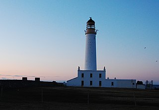
Auskerry is a small island in eastern Orkney, Scotland. It lies in the North Sea south of Stronsay and has a lighthouse, completed in 1866.

Local nature reserve (LNR) is a designation for nature reserves in Great Britain. The designation has its origin in the recommendations of the Wild Life Conservation Special Committee which established the framework for nature conservation in the United Kingdom and suggested a national suite of protected areas comprising national nature reserves, conservation areas, national parks, geological monuments, local nature reserves and local educational nature reserves.

Rinns of Islay Peninsula in Scotland

The Rinns of Islay is an area on the west of the island of Islay in the Inner Hebrides of Scotland.

Ramna Stacks Group of islands in Shetland Islands, Scotland, UK

The Ramna Stacks are a group of skerries in the Shetland islands. They are north of the northern tip of Mainland, and along with nearby Gruney they are a special protection area on account of their birdlife.

Protected areas of Scotland Designated area for protection in Scotland

Many parts of Scotland are protected in accordance with a number of national and international designations because of their environmental, historical or cultural value. Protected areas can be divided according to the type of resource which each seeks to protect. NatureScot has various roles in the delivery of many environmental designations in Scotland, i.e. those aimed at protecting flora and fauna, scenic qualities and geological features. Historic Environment Scotland is responsible for designations that protect sites of historic and cultural importance. Some international designations, such as World Heritage Sites, can cover both categories of site.

Morar, Moidart and Ardnamurchan National Scenic Area

Morar, Moidart and Ardnamurchan is a national scenic area (NSA) covering the coastal scenery of three peninsulas in the western Highlands of Scotland: Ardnamurchan, Moidart and Morar. It is one of 40 such areas in Scotland, which are defined so as to identify areas of exceptional scenery and to ensure its protection from inappropriate development by restricting certain forms of development. The Morar, Moidart and Ardnamurchan NSA covers 36,956 ha in total, consisting of 17,220 ha of land with a further 19,736 ha being marine.

Upper Tweeddale National Scenic Area

The Upper Tweeddale National Scenic Area lies in the Borders region of Scotland. It is one of 40 national scenic areas (NSA) in Scotland, which are defined so as to identify areas of exceptional scenery and to ensure their protection from inappropriate development. The designated area covers 12,770 ha of countryside surrounding the upper reaches of the River Tweed between Broughton and Peebles.

Conservation in Scotland

This article gives an overview of the structure of environmental and cultural conservation in Scotland, a constituent country of the United Kingdom.