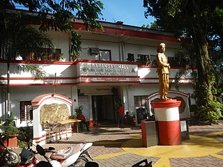
Muntinlupa, officially the City of Muntinlupa, is a 1st class highly urbanized city in the National Capital Region of the Philippines. According to the 2020 census, it has a population of 543,445 people.

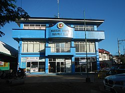
Marikina, officially the City of Marikina, is a 1st class highly urbanized city in the National Capital Region of the Philippines. According to the 2020 census, it has a population of 456,159 people.

Antipolo, officially the City of Antipolo, is a 1st class component city and capital of the province of Rizal, Philippines. According to the 2020 census, it has a population of 887,399 people. It is the most populous city in the Calabarzon region, and the seventh most-populous city in the Philippines. It is also the most populated city under the component city status.

Dasmariñas, officially the City of Dasmariñas, is a 1st class component city in the province of Cavite, Philippines. With a land area of 90.1 square kilometers (34.8 sq mi) and a population of 703,141 people according to the 2020 census, it is the largest city both in terms of area and population in Cavite and the wealthiest Local Government Unit in terms of city in the province.

San Mateo, officially the Municipality of San Mateo, is a 1st class urban municipality in the province of Rizal, Philippines. According to the 2020 census, it has a population of 273,306.

Puerto Princesa, officially the City of Puerto Princesa, is a 1st class highly urbanized city in the Mimaropa region of the Philippines. According to the 2020 census, it has a population of 307,079 people.

Bel-Air refers to both a private subdivision, a gated community and a barangay in Makati Philippines. To the north the village itself is bound by Kalayaan Avenue, Anza, Orion, Mercedes and Amapola Streets. Estrella Street on the northeast, Epifanio de los Santos Avenue on the southeast, Jupiter Street on the southwest and Nicanor Garcia Street on the northwest. It encompasses a total land area of 171.2 hectares and is shaped roughly like a tobacco pipe.

Bagong Silangan is a barangay located in the 2nd district of Quezon City, Philippines. Nearby barangays are Commonwealth, Batasan Hills and Payatas. Separated by a river in the east, the barangay leads to the Municipality of San Mateo in the province of Rizal.

Barangka is an administrative division of Marikina, Metro Manila, the Philippines. It is an urban barangay part of the 1st district of Marikina and is one of the oldest barangays in Marikina.

BF Homes Parañaque, officially Barangay BF Homes, is a gated community and administrative division in southern Metro Manila, the Philippines. It is one of the sixteen barangays that make up Parañaque and is the city's largest barangay and southernmost village. As a subdivision, the local term for gated community, its territory includes portions of neighboring cities, Las Piñas and Muntinlupa. It was formerly known as Las Piñas-Parañaque BF Homes and was developed by Banco Filipino owner Tomas Aguirre in 1968. The development was part of the BF Homes project, alongside its sister branches in Quezon City, Caloocan, and Naga, and became fully operational by early 1970. Philippine media refer to it as "the biggest subdivision in Asia". The larger portion of the development in Parañaque was carved out of the village of San Dionisio to form its own barangay in 1978.

The Makati Central Business District is a financial and central business district in the Philippines located in the heart of Makati in Metro Manila. It is politically known as "Central Cluster" in the West District of Makati. It is different from the Makati civic center known as "Makati Poblacion" which is situated at the northeast portion of the district. It is bounded by EDSA, Amorsolo Street, Ayala Avenue, Gil Puyat Avenue, Osmeña Highway, Zobel Roxas Street, Ocampo Street, Metropolitan Avenue, Nicanor Garcia Street, Kalayaan Avenue, Makati Avenue, Anza Street, Polaris Street, Orion Street, Mercedes Street, Amapola Street and Estrella Street. The whole district occupies barangays of San Antonio, San Lorenzo, Bel-Air, and Urdaneta.

The following is an alphabetical list of articles related to the Philippine capital region of Metro Manila.

Bagong Pag-asa, also known as the Magsaysay District, is an administrative division in eastern Metro Manila. It is an urban barangay of Quezon City with low-density housing and is known for its shopping malls, transport hubs and office buildings.

Sucat is an administrative division in southern Metro Manila, the Philippines. It is an urban barangay in Muntinlupa City with many high-rise condominiums and commercial establishments in the area. The area is also well known for the Sucat exit of the South Luzon Expressway and Metro Manila Skyway.

Bayanan is a barangay in the Muntinlupa, Philippines. It has a total land area of 0.784 km2 (0.303 sq mi), making it the city's second smallest barangay in terms of land area. As of 2020, it has a population of 39,150.

Santo Niño is an administrative division in southern Metro Manila, the Philippines. It is a barangay in the city of Parañaque immediately surrounding Ninoy Aquino International Airport on its west and south sides. A large portion of the village extends into the property of the airport grounds to include Terminal 1 as well as the western half of Runway 06/24. The village has a total land area of 245.97 hectares of which about 55% is occupied by the airport complex. Its population is concentrated in the areas along the Estero de Tripa de Gallina.

San Martin de Porres is an administrative division in southern Metro Manila, the Philippines. It is an elongated barangay located in the northeast corner of Parañaque adjoining the areas of Bicutan in Taguig and northern Muntinlupa. It is unique in that it is connected to the rest of Parañaque by only two bridges, one of which is a footbridge. Its western border follows the South Luzon Expressway, thus separating it from Merville, Sun Valley, Don Bosco and Marcelo Green. It neighbors Western Bicutan to the north, particularly the redevelopment area of the former Food Terminal Inc. (FTI) known as Arca South. To the east, it adjoins Taguig's barangays of Upper Bicutan, Central Bicutan, North Daang Hari and Tanyag. It neighbors South Daang Hari and Sucat, Muntinlupa to the south.


