
Weld County is a county located in the U.S. state of Colorado. As of the 2020 census, the population was 328,981. The county seat is Greeley.

Larimer County is a county located in the U.S. state of Colorado. As of the 2020 census, the population was 359,066. The county seat and most populous city is Fort Collins. The county was named for William Larimer, Jr., the founder of Denver.

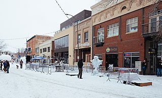
The Town of Berthoud is a Statutory Town located in Larimer and Weld counties, Colorado, United States. The town population was 10,332 at the 2020 United States Census with 10,071 residing in Larimer County and 261 residing in Weld County. Berthoud is situated north of the Little Thompson River, 21 miles (34 km) south of Fort Collins and 43 miles (69 km) north of Denver in the Front Range Urban Corridor.

Campion is an unincorporated community located in southeastern Larimer County, Colorado, United States. A former census-designated place (CDP), the population was 1,832 at the United States Census 2000.
The City of Loveland is the home rule municipality that is the second most populous municipality in Larimer County, Colorado, United States. Loveland is situated 46 miles (74 km) north of the Colorado State Capitol in Denver and is the 14th most populous city in Colorado. As of the 2020 census the population of Loveland was 76,378. The city forms part of the Fort Collins-Loveland Metropolitan Statistical Area and the Front Range Urban Corridor. The city's public schools are part of the Thompson R2-J School District.

Windsor is a home rule municipality in Larimer and Weld counties in the U.S. state of Colorado. According to the 2020 census, the population of the town was 32,716. Windsor is located in the Northern Colorado region.

Johnstown is a home rule municipality in Weld and Larimer counties in the U.S. state of Colorado. The population was 17,303 at the 2020 United States Census.

The Town of LaSalle is a Statutory Town in Weld County, Colorado, United States. The town population was 2,359 at the 2020 United States Census.

Milliken is a statutory town in Weld County, Colorado, United States. The town population was 8,386 at the 2020 United States Census.

Severance is a Statutory Town in Weld County, Colorado, United States. The population was 7683 at the 2020 census. The town is located on the Colorado Eastern Plains, northwest of Greeley, a crossroads of county roads.

The United States Office of Management and Budget has defined the 12-county Denver–Aurora, CO Combined Statistical Area comprising the Denver–Aurora–Lakewood, CO Metropolitan Statistical Area, the Boulder, CO Metropolitan Statistical Area, and the Greeley, CO Metropolitan Statistical Area. The United States Census Bureau estimates that the population was 3,214,218 as of July 1, 2012, an increase of +3.99% since the 2010 United States Census, and ranking as the 16th most populous metropolitan combined statistical area and the 17th most populous primary statistical area of the United States. The population estimate for 2020 was 3,652,385.

The Fort Collins – Loveland Metropolitan Statistical Area is a United States Office of Management and Budget (OMB) defined Metropolitan Statistical Area (MSA) located in the Fort Collins and Loveland area in the North Central region of the U.S. state of Colorado. The Fort Collins–Loveland MSA is defined as Larimer County, Colorado. The Census Bureau estimates that the population was 362,533 in 2021. The Fort Collins–Loveland MSA is the 150th most populous MSA in the United States.

The North Central Colorado Urban Area comprises the four contiguous metropolitan statistical areas in the north central region of the State of Colorado: the Denver–Aurora Metropolitan Statistical Area, the Boulder Metropolitan Statistical Area, the Fort Collins-Loveland Metropolitan Statistical Area, and the Greeley Metropolitan Statistical Area. With the exception of southeastern Elbert County, southeastern Park County, and tiny portions of southern Douglas County, the entire North Central Colorado Urban Area is drained by the South Platte River and its tributaries. The North Central Colorado Urban Area is the central, and the most populous, of the three primary subregions of the Front Range Urban Corridor.

Colorado's transportation consists of a network of highway, surface street, rail, and air options. While the public transportation system in Denver is much more complex and developed than other parts of the state, tourism and growth have led to extensive needs statewide.

State Highway 257 (SH 257) is an 18.478-mile (29.737 km) state highway in the Front Range in Weld County, Colorado, United States, that connects Colorado State Highway 60 (SH 60) in Milliken with Colorado State Highway 14 (SH 14) on the northestern corner of Severance.
The Northern Colorado Economic Development Corporation (NCEDC) served as a 501(c)(6) nonprofit corporation dedicated to attracting and supporting primary employers in Larimer County, Colorado. The not-for-profit corporation was dissolved in November of 2015. Over the course of its history, NCEDC was successful in attracting and serving a broad range of primary employers in Larimer County, Colorado. A primary employer is a company which derives 50 percent or more of its revenue from products or services sold and consumed outside of the county..

The Front Range Urban Corridor is an oblong region of urban population located along the eastern face of the Southern Rocky Mountains, encompassing 18 counties in the US states of Colorado and Wyoming. The corridor derives its name from the Front Range, the mountain range that defines the western boundary of the corridor which serves as a gateway to the Rocky Mountains. The region comprises the northern portion of the Southern Rocky Mountain Front geographic area, which in turn comprises the southern portion of the Rocky Mountain Front geographic area of Canada and the United States. The Front Range Urban Corridor had a population of 5,055,344 at the 2020 Census, an increase of +16.65% since the 2010 Census.

Colorado's 23rd Senate district is one of 35 districts in the Colorado Senate. It has been represented by Republican Barbara Kirkmeyer since 2021.
Ryan Armagost is a state representative from Berthoud, Colorado. A Republican, Armagost represents Colorado House of Representatives District 64, which includes parts of Larimer and Weld counties in Colorado and includes the communities of Greeley, Johnstown, Berthoud, Millikin and Mead.
