
Kedah, also known by its honorific Darul Aman and historically as Queda, is a state of Malaysia, located in the northwestern part of Peninsular Malaysia. The state covers a total area of over 9,000 km2, and it consists of the mainland and the Langkawi islands. The mainland has a relatively flat terrain, which is used to grow rice, while Langkawi is an archipelago, most of which are uninhabited islands.
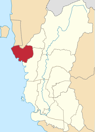
The Kerian District is an administrative district in Perak, Malaysia. It covers the northwestern corner of Perak, bordering the states of Penang and Kedah to the north; the main town of Parit Buntar is located a mere 37 km (23 mi) southeast of George Town, Penang's capital city. The district is well known for Bukit Merah, an popular tourist destination.

The Kinta District is a district in Perak, Malaysia. It contains the state capital Ipoh. Kinta is the most populated district in Perak and also the seventh most populated district in Malaysia. Kinta houses Ipoh, Perak's largest city and state capital while Batu Gajah is a seat in Kinta district.

The Batang Padang District is a district in Perak, Malaysia. This district is administered by a local council, namely, the Tapah District Council, based in Tapah. The major towns of Batang Padang are Bidor, Tapah and Sungkai.

Hulu Perak District is a district in Perak, Malaysia. As the largest district in Perak, there are border to the east of the district is the state of Kelantan, to the west is Kedah, to the south is the district of Kuala Kangsar while to the south-west is the district of Larut, Matang and Selama. Hulu Perak also shares a border with Betong District of Thailand. The seat of the district is Gerik, which is also the largest town of the district.
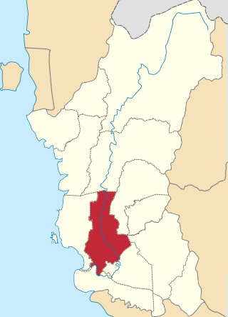
Perak Tengah District is a district in Perak, Malaysia. It is administered by the Perak Tengah District Council, which is based at the town of Seri Iskandar. Parit is however the largest settlement in the area. The district is well known for its historical sites in the Pasir Salak.

The Pendang District is a town, a district and a parliamentary constituency in Kedah, Malaysia. The district is primarily covered with paddy fields with agriculture being its main economic activity. Pendang town is about 20 km from state capital Alor Setar.
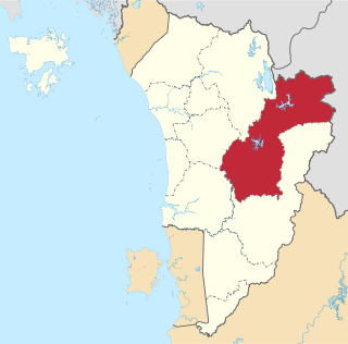
Sik District is a district in Kedah, Malaysia. It is largest district in Kedah.
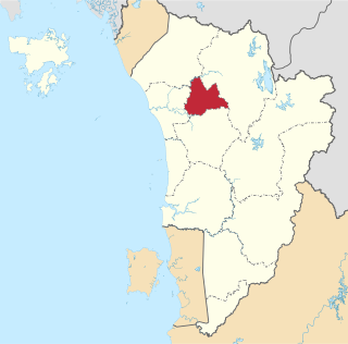
The Pokok Sena District is a district and parliamentary constituency in Kedah, Malaysia. It is the 12th district of Kedah which was formerly a subdistrict of Kota Setar, about 20 km east of Alor Setar. The declaration of the 24,000ha district with a population of 50,000 was made by the Sultan of Kedah, Tuanku Abdul Halim Mu'adzam Shah in conjunction with his 81st birthday celebrations in January 2009. The district is divided into 6 sub-districts: Gajah Mati, Jabi, Tualang, Lesong, Bukit Lada, Derang and consists of 122 villages and 21 residential areas. The Pokok Sena district lies within the boundaries of the Alor Setar City Council local government area authority.

Tanah Merah District is a district (jajahan) in the state of Kelantan in northeast Malaysia. The urban area of Tanah Merah is situated along the Kelantan River. It is bordered by Pasir Mas District in the north, Machang District to the East, Kuala Krai District to the South East, Jeli District to the South West and Thailand in the West.

The Kota Setar District is a district in Kedah, Malaysia where the state capital Alor Star is situated.

The Kuala Muda District is a district in Kedah, Malaysia. Sungai Petani is the administrative center of the district. Kuala Muda district is in close proximity to the border of Kedah and Penang. Apart from Sungai Petani, other major towns in the district include Tikam Batu, Padang Tembusu, Sungai Lalang, Bedong, Bukit Selambau, Sidam, Gurun, Semeling, Merbok, Kota Kuala Muda and Tanjung Dawai. The Mount Jerai is shared with the neighbouring district of Yan while the Muda River is shares the bordering state of Penang. The iconic Jambatan Merdeka connect both Tikam Batu with Bumbung Lima in Penang. Kuala Muda is the second largest and most populous district in Kedah, and it is also the site of some of the earliest civilization site in the country.
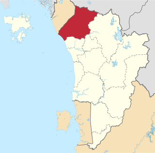
The Kubang Pasu District is a district in northern Kedah, Malaysia. It contains the border town of Bukit Kayu Hitam as well as the educational hub of Changlun, while Jitra is the largest town and administrative centre of the district. The district council had been upgraded into municipal council on 22 October 2018, becoming the fifth city or municipal in the state.

The Larut, Matang and Selama District is a district of Perak, Malaysia. Taiping is the capital town of this district. Larut, Matang and Selama used to be three small different districts and they merged into one larger district later. Larut, Matang and Selama houses Taiping, Perak's second largest city and former state capital. Other towns in the region include Changkat Jering, Terong, Matang, Kuala Sepetang and Selama. The region borders the state of Kedah on the north, the Kerian District on the northwest, the Hulu Perak and Kuala Kangsar District on the east, and the Manjung District on the south.

Durian Burung is a small border town in Mukim Batang Tunggang Kiri, Padang Terap District, Kedah, Malaysia. Across the border is Ban Prakop of Songkhla, Thailand.
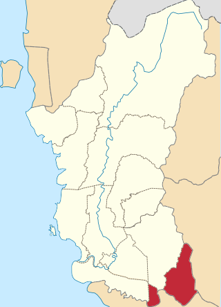
The Muallim District is the eleventh district of the state of Perak, Malaysia, situated at the southeastern tip of the state, bordering the state of Selangor. It was proclaimed by the current Sultan of Perak, Sultan Nazrin Muizzuddin Shah on 11 January 2016 at the Tanjung Malim District Council Building. The district was previously part of the neighbouring Batang Padang district.

Padang Terap is a federal constituency in Padang Terap District, Kedah, Malaysia, that has been represented in the Dewan Rakyat since 1974.

Port Dickson District is a district in Negeri Sembilan, Malaysia. It is the only coastal district in Negeri Sembilan. The district borders Sepang District, Selangor to the north, the Strait of Malacca to the west, Seremban District to the northeast, Rembau District to the east, and Alor Gajah District, Malacca to the south. It also surrounds Tanjung Tuan, an exclave of Malacca under the jurisdiction of Alor Gajah District, to its southwest.

The Rembau District is a district that is located in the state of Negeri Sembilan, Malaysia. The district is a stronghold of the matrilineal system known as adat perpatih, a customary practice inherited from the Minangkabaus, of Sumatra. The district borders Seremban District to the north, Port Dickson District to the west, Tampin District to the east, Kuala Pilah District to the northeast and Alor Gajah District, Malacca to the southwest.
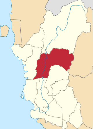
The Kuala Kangsar District is a district in Perak, Malaysia. Kuala Kangsar shares its borders with Larut, Matang and Selama at the west, Hulu Perak at the north, Gua Musang of Kelantan at the east, Kinta at the south, Perak Tengah and Manjung at the southwest. The seat of this district is the town of Kuala Kangsar.


