Kuala Selangor District

Last updated

Kuala Selangor District
Daerah Kuala Selangor
Other transcription(s)
   Jawi دايره کوالا سلاڠور
   Chinese 瓜拉雪兰莪县(Simplified)
瓜拉雪蘭莪縣(Traditional)
Guālā Xuělán'é xiàn(Hanyu Pinyin)
   Tamil கோலா சிலாங்கூர் மாவட்டம்
Kōlā Cilāṅkūr māvaṭṭam(Transliteration)
The Official Flag of Kuala Selangor Municipal Council.png
The Seal of Kuala Selangor Municipal Council.png
Daerah Kuala Selangor Highlighted in the State of Selangor, Malaysia.svg
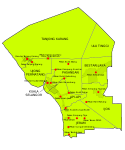
Location of Kuala Selangor District in Selangor
Kuala Selangor District
Malaysia location map with districts.svg
Red pog.svg
Kuala Selangor District
Location of Kuala Selangor District in Malaysia
Coordinates: 3°24′N101°20′E / 3.400°N 101.333°E / 3.400; 101.333
Country Flag of Malaysia.svg  Malaysia
State Flag of Selangor.svg  Selangor
Granted
Municipal Status
7 August 2021
Seat Kuala Selangor
Government
  Type Municipal council
  BodyKuala Selangor Municipal Council
  District officerShamsul Shahril Badliza Noor [1]
   Sultan's RepresentativeYaacob Ismail [2]
  PresidentMohamad Hanafe Bin Basri [3]
Area
[4]
  Total1,194.52 km2 (461.21 sq mi)
Population
 (2021) [5]
  Total273,728
  Density230/km2 (590/sq mi)
Time zone UTC+8 (MST)
  Summer (DST) UTC+8 (Not observed)
Postcode
45xxx
Calling code +6-03
Vehicle registration plates B

The Kuala Selangor District is a district in Selangor, Malaysia. It has a total landmass of 1,194.52 square kilometres (461 sq mi) separated by Selangor River into two division, Tanjung Karang and Kuala Selangor. The district boundary is shared with Sabak Bernam at the north, Hulu Selangor and Gombak at the west, Petaling at the southwest and Klang at the south.

Contents

Geography

The geography of Kuala Selangor is characterised by a flat land in Tanjung Karang and Jeram. Bordered in Kapar in South and some hills at Southeast. The district's name was from a town that named when Selangor River meets the sea.

Administrative divisions

Map of Kuala Selangor District, Selangor.svg

Kuala Selangor District is divided into 9 mukims, which are: [4]

Demographics

Historical population
YearPop.±%
1991 123,052    
2000 161,168+31.0%
2010 205,257+27.4%
2020 281,753+37.3%
Source: [6]

Federal Parliament and State Assembly Seats

Kuala Selangor, Selangor Parliament and State Assembly Electoral Districts Kuala Selangor, Federal Parliament and State Assembly Seats.svg
Kuala Selangor, Selangor Parliament and State Assembly Electoral Districts

List of Kuala Selangor district representatives in the Federal Parliament (Dewan Rakyat)

ParliamentSeat NameMember of ParliamentParty
P95 Tanjong Karang Zulkafperi HanapiPerikatan Nasional (BERSATU)
P96 Kuala Selangor Dzulkefly Ahmad Pakatan Harapan (AMANAH)
P107 Sungai Buloh Ramanan Ramakrishnan Pakatan Harapan (PKR)

List of Kuala Selangor district representatives in the State Legislative Assembly (Dewan Undangan Negeri)

ParliamentStateSeat NameState AssemblymanParty
P95N8 Sungai Burong Mohammad Zamri Mohamad ZainuddinPerikatan Nasional (PAS)
P95N9 Permatang Nurul Syazwani NohPerikatan Nasional (BERSATU)
P96N10 Bukit Melawati Noorazley YahyaPerikatan National (BERSATU)
P96N11 Ijok Jefri MejanPerikatan Nasional (PAS)
P96N12 Jeram Harrison HassanPerikatann Nasional (BERSATU)
P107N38 Paya Jaras Abdul Halim TamuriPerikatan Nasional (PAS)

The Kuala Selangor District Council is seeking for the area to become declared as a municipality. [7]

Transportation

Road construction

Currently there is an expressway named Kuala Lumpur–Kuala Selangor Expressway E25 (LATAR) linked Ijok, Kuala Selangor and Templer Park, Rawang. It is also connected with Guthrie Corridor Expressway (GCE) to Shah Alam and North–South Expressway Central Link to northern Peninsular Malaysia. Another expressway which is under construction named West Coast Expressway (WCE) in Tanjung Karang only have small amount of them which only provided in the township of Tanjung Karang and some sub-roads in some villages. The town is usually accessed via Klang–Teluk Intan Road FT5 (coastal route), Kuala Selangor–Kepong Road FT54 (to Kuala Lumpur) and Kuala Selangor–Bestari Jaya Road B33 (to Bestari Jaya & Rawang).

Public Transport

There are 6 bus lines by Selangor Omnibus, Wawasan Sutera and rapidKL bus currently serving the Kuala Selangor District which is:

Two free bus services provided by MDKS (Kuala Selangor District Council) are available:

Taxi services and Grab Car also available in the Kuala Selangor town.

The Local Planning Masterplan for the year 2015 released by MDKS envision the addition of a Light Rail Transit facility (linking Bestari Jaya, Puncak Alam and Shah Alam) in the future.

See also

Related Research Articles

<span class="mw-page-title-main">Shah Alam</span> City and state capital in Selangor, Malaysia

Shah Alam is a city and the state capital of Selangor, Malaysia and situated within the Petaling District and a small portion of the neighbouring Klang District. Shah Alam replaced Kuala Lumpur as the capital city of the state of Selangor in 1978 due to Kuala Lumpur's incorporation into a Federal Territory in 1974. Shah Alam was the first planned city in Malaysia after independence from Britain in 1957.

<span class="mw-page-title-main">Selangor</span> State of Malaysia

Selangor, also known by its Arabic honorific Darul Ehsan, or "Abode of Sincerity", is one of the 13 states of Malaysia. It is on the west coast of Peninsular Malaysia and is bordered by Perak to the north, Pahang to the east, Negeri Sembilan to the south, and the Strait of Malacca to the west. Selangor surrounds the federal territories of Kuala Lumpur and Putrajaya, both of which were previously part of it. Selangor has diverse tropical rainforests and an equatorial climate. The state's mountain ranges belong to the Titiwangsa Mountains, which is part of the Tenasserim Hills that covers southern Myanmar, southern Thailand and Peninsular Malaysia, with Mount Semangkok as the highest point in the state.

<span class="mw-page-title-main">Sepang District</span> District of Malaysia in Selangor

The Sepang District is a district located in the southern part of the state of Selangor in Malaysia. Sepang District covers an area of around 600 square kilometres, and had a population of 190,889 in the 2010 Census.

<span class="mw-page-title-main">Petaling District</span> District of Malaysia in Selangor

The Petaling District is a district located in the heart of Selangor in Malaysia. Petaling is not to be confused with the city of Petaling Jaya located in it, nor the mukim of Petaling under Petaling Jaya City. The district office is located in Subang.

<span class="mw-page-title-main">Klang Valley</span> Urban conglomeration in Malaysia

The Klang Valley is an urban conglomeration in Malaysia that is centered in the federal territories of Kuala Lumpur and Putrajaya, and includes its adjoining cities and towns in the state of Selangor. It is conterminous with Greater Kuala Lumpur, although there are variations between the two.

<span class="mw-page-title-main">Hulu Langat District</span> District of Malaysia in Selangor

Hulu Langat District is a district of Malaysia located in the southeastern corner of Selangor, between Kuala Lumpur and Negeri Sembilan. It is bordered by the state of Pahang to the east and north, Gombak district to the north-west, Federal Territory of Kuala Lumpur and Petaling district to the west, Sepang district to the south-west, and state of Negeri Sembilan to the south.

<span class="mw-page-title-main">Kuala Selangor</span> Town in Selangor, Malaysia

Kuala Selangor is a town in northwestern Selangor, Malaysia. It is the largest town and administrative centre of the coterminous Kuala Selangor District.

<span class="mw-page-title-main">Hulu Selangor District</span> Administrative district in Selangor, Malaysia

Hulu Selangor is a district in Selangor, Malaysia. It contains the towns of Serendah, Batang Kali and Kuala Kubu Bharu. Its principal town is Kuala Kubu Bharu. The district is located in the northeastern part of Selangor and borders the state of Perak to the north, Pahang to the east, Sabak Bernam district to the northwest, Kuala Selangor district to its southwest and Gombak district to the south. Selangor River sources from this area, hence giving the district's name.

<span class="mw-page-title-main">Rawang, Selangor</span> Town in Selangor, Malaysia

Rawang is a town and a mukim in Gombak District, Selangor, Malaysia, about 23 km northwest of city centre Kuala Lumpur.

<span class="mw-page-title-main">Gombak District</span> District of Malaysia in Selangor

The Gombak District is an administrative district located in the state of Selangor, Malaysia. The district was created on February 1, 1974, the same day when Kuala Lumpur was declared a Federal Territory. Until 1997, Rawang was the district capital; the capital has been moved to Bandar Baru Selayang. Gombak borders Kuala Lumpur to the southeast and the Genting Highlands to the east. Both Gombak and Kuala Lumpur, along with some other districts in Selangor, are situated within the Klang Valley. Other localities in Gombak district include Batu Arang, Kuang, Rawang, Kundang, Gombak Town, Selayang, Batu Caves and Hulu Kelang.

<span class="mw-page-title-main">Sabak Bernam District</span> District of Malaysia in Selangor

The Sabak Bernam District is a district and a parliamentary constituency in north-western Selangor, Malaysia. It covers an area of 997 square kilometres, and had a population of 103,153 at the 2010 Census. It is situated at the northwestern corner of Selangor. It is bordered by the state of Perak to the north, the district of Hulu Selangor to the east, the district of Kuala Selangor to the south, and the Straits of Malacca to the west. Bernam River forms its border with Perak. Towns in Sabak Bernam include Sabak, Sungai Besar and Sekinchan. This area is also famous for its residents of Javanese descent.

<span class="mw-page-title-main">Kuala Langat District</span> District of Malaysia in Selangor

The Kuala Langat District is a district of Selangor, Malaysia. It is situated in the southwestern part of Selangor. It covers an area of 858 square kilometres, and had a population of 307,787 at the 2020 Census. It is bordered by the districts of Klang and Petaling to the north and Sepang to the east. The Strait of Malacca forms its western border.

<span class="mw-page-title-main">Puncak Alam</span> Township in Selangor, Malaysia

Puncak Alam is a city in Kuala Selangor district, Malaysia. It is located within 20 kilometers to the northwest from the city of Shah Alam, the capital of the state of Selangor.

Transport in Greater Kuala Lumpur includes a road network, a railway network, airports, and other modes of public transport. Greater Kuala Lumpur is conterminous with the Klang Valley, an urban conglomeration consisting of the city of Kuala Lumpur, as well as surrounding towns and cities in the state of Selangor. The Klang Valley has the country's largest airport, the Kuala Lumpur International Airport (KLIA), as well as the country's largest intermodal transport hub and railway station, Kuala Lumpur Sentral.

<span class="mw-page-title-main">Kuala Lumpur–Kuala Selangor Expressway</span> Expressway in Malaysia

The Kuala Lumpur–Kuala Selangor ExpresswayKuala Lumpur–Kuala Selangor Expressway, KLS(formerly Ijok–Templer Park Highway, LATAR) or sometimes called LATAR Expressway, is an expressway in Selangor, Malaysia. It is part of the Kuala Lumpur Outer Ring Road. The 32 km (20 mi) expressway connects Ijok near Kuala Selangor to Templer's Park near Rawang and not Kuala Lumpur as its name suggests – consequently, motorists will need to travel another 20 km to Kuala Lumpur via Kuala Lumpur–Rawang Highway. Kuala Lumpur–Kuala Selangor Expressway is the fourth east–west-oriented expressway in the Klang Valley after the Federal Highway, the New Klang Valley Expressway (NKVE) and the Shah Alam Expressway.

<span class="mw-page-title-main">Greater Kuala Lumpur</span> Metropolitan area in Malaysia

Greater Kuala Lumpur is the geographical term that determines the boundaries of metropolitan Kuala Lumpur in Malaysia. Though similar to the term "Klang Valley", there remains a variation between the two. It is similar to Greater London and Greater Toronto. The metropolitan area covers 5,194.72 square km of land.

<span class="mw-page-title-main">Klang District</span> District of Malaysia in Selangor

The Klang District is a district in Selangor, Malaysia. It is located in the western part of Selangor. It borders the Kuala Selangor District to the north, Petaling to the east, Kuala Langat district to the south and Malacca Straits to the west. The district was further divided into two mukims which is Klang and Kapar that covers 626.78 square km of land with 53.75 km of coastline.

The following is an alphabetical list of articles related to Selangor.

<span class="mw-page-title-main">Smart Selangor Bus</span> Bus service in Selangor

Smart Selangor Bus is a free bus service funded by the Selangor state government.

References

  1. "Portal Rasmi PDT Kuala Selangor Senarai Pegawai PDTKS". www2.selangor.gov.my. Archived from the original on 17 July 2019. Retrieved 25 December 2017.
  2. "Portal Rasmi PDT Kuala Selangor Orang Besar Daerah". www2.selangor.gov.my. Archived from the original on 17 July 2019. Retrieved 25 December 2017.
  3. "Portal Rasmi Majlis Perbandaran Kuala Selangor". www.mpks.gov.my/ms. Retrieved 4 February 2024.
  4. 1 2 "JPS Komuniti Kuala Selangor" (PDF). Archived from the original (PDF) on 10 October 2017. Retrieved 25 December 2017.
  5. "Population Distribution and Basic Demographic Characteristics, 2010" (PDF). Department of Statistics, Malaysia. Archived from the original (PDF) on 22 May 2014. Retrieved 19 April 2012.
  6. "Key Findings of Population and Housing Census of Malaysia 2020" (pdf) (in Malay and English). Department of Statistics, Malaysia. ISBN   978-967-2000-85-3.
  7. Ch'ng, Brenda (6 August 2020). "Documentation issues delay Kuala Selangor's elevation to municipality". The Star. Retrieved 30 May 2021.