North Seberang Perai District

Last updated
North Seberang Perai District
Daerah Seberang Perai Utara
Other transcription(s)
   Malay Daerah Seberang Perai Utara(Rumi)
دايره سبرڠ ڤراي اوتارا(Jawi)
   Chinese 威北县(Simplified)
威北縣(Traditional)
   Tamil வட செபாராங் பிறை மாவட்டம்
Vaṭa Ceparāṅ Piṟai Māvaṭṭam(Transliteration)
Kampung Maklom 2.jpg
Aerial view of Kampung Maklom
North Seberang Perai2.png
Location of North Seberang Perai District in Penang
North Seberang Perai District
Malaysia location map.svg
Red pog.svg
North Seberang Perai District
Location of North Seberang Perai District in Malaysia
Coordinates: 5°28′N100°26′E / 5.467°N 100.433°E / 5.467; 100.433
Country Flag of Malaysia 23px.svg  Malaysia
State Flag of Penang (Malaysia).svg  Penang
Seat Kepala Batas
Largest city Butterworth
Local area government(s) Seberang Perai City Council
Government
  District officerMarlia Belia [1]
Area
[2]
  Total267 km2 (103 sq mi)
Population
 (2020) [3]
  Total339,095
  Density1,300/km2 (3,300/sq mi)
Time zone UTC+8 (MST)
  Summer (DST) UTC+8 (Not observed)
Postcode
12000-13800
Calling code +6-043
Vehicle registration plates P

The North Seberang Perai District (Malay : Daerah Seberang Perai Utara; abbreviated: "SPU") is an administrative district on the mainland part of Penang State, Malaysia. It covers an area of 267 square kilometres, and had a population of 286,323 at the 2010 Census. [3] The district is bordered by Muda River in the north which separates Kuala Muda district in Kedah, Kedah state border in the east which separates Kulim district, Perai River in the south which separates Central Seberang Perai and North Channel which separates Penang Island. The district capital is Kepala Batas, and the largest town is Butterworth. Other localities that are located in North Seberang Perai include Penaga, Pinang Tunggal, Bertam, Tasek Gelugor, Teluk Air Tawar and Mak Mandin. It is one of the three administrative districts in the Seberang Perai region, the mainland portion of Penang State. Paddy is largely cultivated in North Seberang Perai as most parts of it is covered by paddy fields. [4]

Contents

Administrative divisions

Map of North Seberang Perai District, Penang.svg

SPU District is divided into 16 mukims and also consist of 2 towns which are Butterworth and Kepala Batas. [5] [6]

Demographics

Historical population
YearPop.±%
1991 224,647    
2000 243,938+8.6%
2010 288,692+18.3%
2020 339,095+17.5%
Source: [7]

The following is based on Department of Statistics Malaysia 2020 census. [3]

Ethnic groups in North Seberang Perai, 2020 census
Ethnicity PopulationPercentage
Bumiputera 203,69860.07%
Chinese 95,55428.18%
Indian 22,5976.66%
Others9680.29%
Non-Malaysian citizens16,2784.80%
Total339,095100%

Federal Parliament and State Assembly Seats


List of North Seberang Perai district representatives in the Federal Parliament (Dewan Rakyat)

ParliamentSeat NameMember of ParliamentParty
P41 Kepala Batas Siti Mastura MuhammadPerikatan Nasional (PAS)
P42 Tasek Gelugor Wan Saiful Wan Jan Perikatan Nasional (PPBM)
P43 Bagan Lim Guan Eng Pakatan Harapan (DAP)


List of North Seberang Perai district representatives in the State Legislative Assembly of Penang

ParliamentStateSeat NameState AssemblymanParty
P41N1PenagaMohd Yusni bin Mat PiahPerikatan Nasional (PAS)
P41N2BertamReezal Merican Naina MericanBarisan Nasional (UMNO)
P41N3Pinang TunggalBukhori GhazaliPerikatan Nasional (PAS)
P42N4Permatang BeranganMohd Sobri SallehPerikatan Nasional (PAS)
P42N5Sungai DuaMuhammad Fauzi YusoffPerikatan Nasional (PAS)
P42N6Telok Air TawarAzmi AlangPerikatan Nasional (BERSATU)
P43N7Sungai PuyuPhee Syn TzePakatan Harapan (DAP)
P43N8Bagan JermalChee Yeeh KeenPakatan Harapan (DAP)
P43N9Bagan DalamKumaran A/L KrishnanPakatan Harapan (DAP)

See also

Related Research Articles

<span class="mw-page-title-main">Penang</span> State in Malaysia

Penang is a Malaysian state located on the northwest coast of Peninsular Malaysia along the Strait of Malacca. It has two parts: Penang Island, where the capital city, George Town, is located, and Seberang Perai on the Malay Peninsula. These two halves are physically connected by the Penang Bridge and the Second Penang Bridge. The state shares borders with Kedah to the north and east, and Perak to the south.

<span class="mw-page-title-main">Butterworth, Seberang Perai</span> Town in Malaysia

Butterworth is the city centre of Seberang Perai in the Malaysian state of Penang. It lies about 3 km (1.9 mi) east of George Town, the capital city of Penang, across the Penang Strait. As of 2020, Butterworth had a total population of 80,378 residents.

<span class="mw-page-title-main">Seberang Perai</span> City in the Malaysian state of Penang

Seberang Perai is a city in the Malaysian state of Penang. Located on the Malay Peninsula and separated from Penang Island by the Penang Strait, it shares borders with Kedah to the north and east, and Perak to the south. The city spans an area of 748 km2 (289 sq mi) and had a population of 946,092 as of 2020, making it the third largest city in Malaysia.

<span class="mw-page-title-main">Bukit Mertajam</span> Suburb of Seberang Perai and district capital in Penang, Malaysia

Bukit Mertajam is a suburb of Seberang Perai in the Malaysian state of Penang. It also serves as the seat of the Central Seberang Perai District. As of 2020, Bukit Mertajam had a population of 12,079.

<span class="mw-page-title-main">Perai</span> Suburb of Seberang Perai in Penang, Malaysia

Perai is a suburb of Seberang Perai in the Malaysian state of Penang. It lies at the southern bank of the Perai River and borders Butterworth to the north.

<span class="mw-page-title-main">Seberang Jaya</span> Suburb of Seberang Perai in Penang, Malaysia

Seberang Jaya is a suburb of Seberang Perai in the Malaysian state of Penang. Located at the southern bank of the Perai River and east of Perai proper, the area was developed in the 1970s. Since then, Seberang Jaya has evolved into a booming area, with various commercial and retail developments.

<span class="mw-page-title-main">Batu Kawan</span> Suburb of Seberang Perai in Penang, Malaysia

Batu Kawan is an island and suburb of Seberang Perai in the Malaysian state of Penang. It is geographically separated from the rest of Seberang Perai by the Jawi and Tengah rivers. As of 2020, Batu Kawan contained a population of 11,409.

<span class="mw-page-title-main">Muda River</span> River in Kedah, Malaysia

The Muda River is the longest river in Kedah, Malaysia.

<span class="mw-page-title-main">Kuala Muda District</span> District in Kedah, Malaysia

The Kuala Muda District is a district in Kedah, Malaysia. Sungai Petani is the administrative center of the district. Kuala Muda district is in close proximity to the border of Kedah and Penang. Apart from Sungai Petani, other major towns in the district include Tikam Batu, Padang Tembusu, Sungai Lalang, Bedong, Bukit Selambau, Sidam, Gurun, Semeling, Merbok, Kota Kuala Muda and Tanjung Dawai. The Mount Jerai is shared with the neighbouring district of Yan while the Muda River is shares the bordering state of Penang. The iconic Jambatan Merdeka connect both Tikam Batu with Bumbung Lima in Penang. Kuala Muda is the second largest and most populous district in Kedah, and it is also the site of some of the earliest civilization site in the country.

<span class="mw-page-title-main">Penang Strait</span> Strait in Malaysia

The Penang Strait is an 11 kilometre-wide strait that separates Penang Island from mainland Malay Peninsula. Penang Island is to the west of the channel, while Seberang Perai, the mainland half of the State of Penang, is to the east. The northern and southern ends of the channel join the Strait of Malacca, one of the world's busiest maritime routes.

<span class="mw-page-title-main">Central Seberang Perai District</span> District in Penang, Malaysia

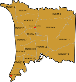
The Central Seberang Perai District is a district in the state of Penang, Malaysia. It covers an area of 238 square kilometres, and had a population of 371,975 at the 2010 Census. The district is bordered by Perai River which separates North Seberang Perai in the north, Junjong River which separates South Seberang Perai in the south, Kedah state border in the east and South Channel which separates Penang Island. Juru River also flows through the district. The capital of this district is Bukit Mertajam. Other localities in Central Seberang Perai include Permatang Pauh, Penanti, Bukit Tengah, Bukit Minyak, Juru, Alma, Machang Bubok and Permatang Tinggi. The entertainment, eatery and automobile venue of Autocity is also located in this district. Heavy industrial areas cover most parts of Central Seberang Perai.

<span class="mw-page-title-main">South Seberang Perai District</span> District in Penang, Malaysia

The South Seberang Perai District is a district in Penang, Malaysia. It covers an area of 242 square kilometres, and had a population of 184,007 at the 2020 Census. The district is bordered by Junjong River that separates Central Seberang Perai in the north, Kedah state border in the east, Perak state border in the south and the South Channel that separates Penang Island. Rivers that flow through South Seberang Perai are Junjong River, Jawi River and Kerian River. The capital of this district is Sungai Jawi and the largest town is Nibong Tebal. Other towns such as Batu Kawan, Bukit Tambun, Simpang Ampat, Sungai Bakap and Valdor are also located in this district. South Seberang Perai is thriving with the fishing industry and agriculture. Oil palm plantations covers most parts of the area.

<span class="mw-page-title-main">Seberang Perai City Council</span> Local government of the municipality of Seberang Perai in Penang

The Seberang Perai City Council is the city council which administers Seberang Perai, the mainland half of the Malaysian state of Penang. This agency is under the purview of the Penang state government.

Tasek Gelugor is a suburb of Seberang Perai in the Malaysian state of Penang. Within its vicinity it is the town closest to the North–South Expressway. The expressway sign for the Ipoh-George Town link can be seen in this town.

Kepala Batas is a suburb of Seberang Perai and the seat of the Northern Seberang Perai District in the Malaysian state of Penang. It lies about 10 km northeast of Butterworth and 15km southwest of Sungai Petani.

<span class="mw-page-title-main">Teluk Air Tawar</span> Suburb of Seberang Perai in Penang, Malaysia

Teluk Air Tawar is a suburb of Seberang Perai in the Malaysian state of Penang. Teluk Air Tawar means "Clear water bay" in the Malay language. This seaside town has a scenic view of George Town across the sea.

<span class="mw-page-title-main">Greater Penang Conurbation</span> Metropolitan area in Malaysia

The Greater Penang Conurbation, also known as the George Town Conurbation, is the built-up urban or metropolitan area within and around the Malaysian state of Penang. Encompassing all of Penang, and parts of the neighbouring states of Kedah and Perak, the conurbation was home to over 2.84 million people as of 2020, the second largest in the country after the Klang Valley.

<span class="mw-page-title-main">Kepala Batas (federal constituency)</span> Federal constituency of Penang, Malaysia

Kepala Batas is a federal constituency in North Seberang Perai District, Penang, Malaysia, that has been represented in the Dewan Rakyat since 1974.

References

  1. Webmaster, SPU. "Senarai Pegawai Daerah PDTSPU". spu.penang.gov.my.
  2. "2017 Q2 statistics" (PDF). Penang Institute. Archived from the original (PDF) on 2017-12-01. Retrieved 2017-11-30.
  3. 1 2 3 "Population Distribution and Basic Demographic Characteristics, 2010" (PDF). Department of Statistics, Malaysia. Archived from the original (PDF) on 22 May 2014. Retrieved 19 April 2012.
  4. "Latarbelakang".
  5. "Pengenalan". spu.penang.gov.my.
  6. "UPI – Unique Parcel Identifier". myliis3.mygeoportal.gov.my. Archived from the original on 2017-12-27. Retrieved 2017-11-30.
  7. "Key Findings of Population and Housing Census of Malaysia 2020" (pdf) (in Malay and English). Department of Statistics, Malaysia. ISBN   978-967-2000-85-3.