
Jabalpur, formerly Jubbulpore, is a city situated on the banks of Narmada River in the state of Madhya Pradesh, India. It is the 3rd-largest urban agglomeration of the state and the 38th-largest of the country. Jabalpur is the administrative headquarters of the Jabalpur district and the Jabalpur division. It is the judicial capital of Madhya Pradesh with Madhya Pradesh High Court being located in the city. It is generally accepted that the game of snooker originated in Jabalpur. Jabalpur is also the railway headquarters of the West Central Railway. Jabalpur Cantonment is one of the largest cantonments in India and houses the army headquarters of five states. The city is known for the marble rocks on the river Narmada at Bhedaghat. It is also known as 'Sanskardhani' meaning 'The Cultural Capital' highlighting the city's rich cultural and historical heritage. The city of Jabalpur was among the first 7 smart cities selected for the Smart Cities Mission.
Chhindwara is a city in India and a Municipal Corporation in Chhindwara district in the Indian state of Madhya Pradesh. The city is the administrative headquarters of Chhindwara District. Chhindwara is reachable by rail or road from adjacent cities Betul, Jabalpur and Nagpur. The nearest airport is in Nagpur (130 km); however there is a small airport located in the city which is not serviceable for passenger planes.

Itarsi is a city and municipality in Narmadapuram in Madhya Pradesh, India. Itarsi is a key hub for agricultural goods and is the biggest railway junction in Madhya Pradesh. Rail services from all 4 major metropolitan cities of India namely Mumbai to Kolkata and Delhi to Chennai pass through Itarsi. Itarsi has large number of agro-based industries and warehouses. Itarsi got its name by "eeta(eent)", and "rassi",. Bricks and ropes had been made earlier in itarsi. It has an Ordnance Factory. The Bori Wildlife Sanctuary and Tawa Dam are nearby.

Chhindwara district is one of the major districts of Madhya Pradesh state of India, and Chhindwara town is the district headquarters. Chhindwara was the largest district in Madhya Pradesh with an area of 10,293 square km before the bifurcation of Pandhurna district. The district is part of Jabalpur division.

Seoni is a city and a municipality in Seoni district in the Indian state of Madhya Pradesh. This tribal household dominated district was formed in the year 1956.
It is the tehsil headquarters of Narsinghpur district in Jabalpur division of Madhya Pradesh state. The district panchayat headquarters of the Panchayat and Rural Development Department of the state of Madhya Pradesh are located in Gotegaon. There are 90 panchayats under this
Damua is a census town in Chhindwara district in the state of Madhya Pradesh, India.
Multai is a town and a Nagar Palika in Betul district in the Indian state of Madhya Pradesh. Multai is one of the southern cities of Madhya Pradesh, occupying almost half of the Satpura plateau. Considering the small villages around, it occupies a large area in width of the Satpura range between the valley of the Narmada on the north and the barer plains on the south. Forests lie to the west of the city between the districts of East Nimar and Amaraoti. It lies on the Northern bank of the Tapti and the place is also known for being the origin of the Tapti river.
Nainpur is a town and Municipal City in the Mandla district, of the Indian state of Madhya Pradesh.
Narkhed is a town and a municipal council in Nagpur district in the Indian state of Maharashtra. It is about 87 km north-west of Nagpur. It is the administrative headquarters of Narkhed taluka, one of the 14 talukas of this district. It is located in the "orange belt" and is a major center for orange-trading.

Pandhurna is the administrative headquarter of the Pandhurna District in Madhya Pradesh, India. Pandhurna city is an important city from the business point of view. The famous Gotmar Fair is organized every year on the banks of Jam River. Pandhurna is also famous for its orange fields. Pandhurna also has a multinational company called drytech situated at Nagpur road.
Raghogarh-Ruthiyai or Raghogarh-Vijaypur is a town and municipality in Guna district in the Indian state of Madhya Pradesh.

Sausar (Saunsar) is a Municipal Council in the central India in the state of Madhya Pradesh. Sausar lies in Vidharbha region, Nagpur is the center for all the economic activities in this region which is just 72 km from Sausar. More than 90 per cent of farmers produce oranges. Cotton is grown in large quantities in the local area.
Waraseoni is a tehsil and Nagar Palika Parishad (municipality) in Balaghat district in the Indian state of Madhya Pradesh. It is situated 16 km (10 mi) from the district headquarters. Waraseoni is second most populous town in Balaghat District after Balaghat.
Barkuhi is a small township in Chhindwara District in the Indian state of Madhya Pradesh.
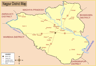
Narkhed taluka is one of the 14 taluka of Nagpur district in state of Maharashtra, India.
Kali Bari Chhindwara is a temple dedicated to Goddess Kali and the center of Bengali culture in Chhindwara, India. Established in 1995, the deity in the temple is Maa Kali.

Jam is a river in central India originating in the Betul District of Madhya Pradesh.It flows through several villages and towns during its short run, ultimately draining itself off in Kanhan River. This confluence is located at the border with Maharashtra. An ambitious water project in the form of a dam has been proposed by Maharashtra in anticipation of the growing water needs of metro Nagpur. However the project has been shelved for now due to lack of co-operation from the state government in Madhya Pradesh.A gotmar fair is also organized every year on its bank.
The Maihar district is one of the 55 districts in Madhya Pradesh, India. Maihar city is the administrative headquarter of the Maihar district.Formerly part of Satna district. the Maihar district was formed on 5 October 2023.
Piplanarayanwar is a Nagar Panchayat city in district of Chhindwara in Madhya Pradesh. Jam River flows near the Town. 480109 is the pin code of Piplanarayanwar.
