Piscatawaytown, New Jersey

Last updated

Piscatawaytown, New Jersey
2018-05-20 15 40 12 View north along Middlesex County Route 529 (Plainfield Avenue) just north of Middlesex County Route 514 (Woodbridge Avenue) in Edison Township, Middlesex County, New Jersey.jpg
County Route 529 (Plainfield Avenue) in Piscatawaytown, facing north
Location map of Middlesex County, New Jersey.svg
Red pog.svg
Piscatawaytown, New Jersey
Location of Piscatawaytown in Middlesex County. Inset: Location of county within the state of New Jersey.
USA New Jersey location map.svg
Red pog.svg
Piscatawaytown, New Jersey
Piscatawaytown, New Jersey (New Jersey)
Usa edcp location map.svg
Red pog.svg
Piscatawaytown, New Jersey
Piscatawaytown, New Jersey (the United States)
Coordinates: 40°30′06″N74°23′45″W / 40.50167°N 74.39583°W / 40.50167; -74.39583
Country Flag of the United States.svg  United States
State Flag of New Jersey.svg  New Jersey
County Middlesex
Township Edison
Elevation
[1]
115 ft (35 m)
GNIS feature ID880876 [1]

Piscatawaytown is the oldest neighborhood in Edison in Middlesex County, New Jersey. It was established in the 1660s as the original village in what was then within Piscataway. Piscatawaytown is centered around St. James Church, the Piscatawaytown Burial Ground and the Piscatawaytown Common, near the intersection of Plainfield and Woodbridge Avenues. [2] [3] [4] [5]

Contents

Establishment and naming

The Raritan were bands of the Lenape people living around the Raritan River and its bay, in what is now central New Jersey and Staten Island, New York.

Piscataway was settled New Englanders in the 17th century. In 1666, the first proprietary Governor of the Province of New Jersey, Philip Carteret, granted 12 new settlers from Massachusetts a 100 square mile allotment of land that was later founded as the townships of Piscataway and Woodbridge. [6] Soon thereafter dditional settlers from the Piscataqua River, the state boundary of New Hampshire and Maine moved to region, bringing the name. [7] [8] [9] Other settlements included Quibbletown and Raritan Landing.

Municipal boundaries

On March 17, 1870, portions of adjacent Piscataway and Woodbridge were used to form Raritan Township. [10] [11] Raritan Township was renamed Edison in the 1950s.

Historic area

St. James Episcopal Church St. James Episcopal Church Piscatawaytown.png
St. James Episcopal Church

The Proprietors of the Province of East New Jersey granted a tract of land for a burial ground and a town common on March 5, 1695. The settlement comprised a town hall, militia training ground, stockade, jail, church, burial ground and houses. [3] Saint James Church was established in 1704 and the original structure built in 1724. The existing building is from 1836. [12]

Considerable military activity and battles known as the Forage War took place during the Revolutionary War in the Piscatawaytown area in 1776 and 1777. The Post Road (a post road, now Woodbridge Avenue) was a main land artery for British communications and movement of supplies and troops. The British army used St. James Church as a barracks and a hospital from December 1776 to June 1777.

A June 1835 tornado caused damage to many of the gravestones as well as Saint James Church. [13] [14] [15] [16]

Burial ground

The Piscatawaytown Burial Ground is one of the oldest recorded cemeteries in Middlesex County and maintained by the township. [13] [14] [16] [17]

There had been burials at the location before the granting of tract, with one readable gravestone dating from 1693. [18] [4] [5] The oldest readable gravestone is that of the Hoopar brothers, aged 10 and 12, who died of mushroom poisoning. [19] [20] The brothers were buried in 1693. [19] [20]

There are many veterans from various wars buried in the grounds. [14] [21] This includes British soldiers who had died in the Revolutionary War and were buried in a common grave in 1777 . The highest ranking veteran buried in the grounds is Brevet Major General Thomas Swords, a veteran of the Mexican War and Civil War, buried in 1886. [14] [21] [20] [22]

A ground-penetrating radar scan of the burial ground conducted in 2021 identified 98 graves in the southwest corner of the grounds which has been designated as the colored burial ground. [13] [15] Only 11 of those individuals have been identified. [13] [15] In total, there have been 1,815 burials identified as of 2015, with 1,494 of those burials having gravestones. [13]

See also

Related Research Articles

<span class="mw-page-title-main">Middlesex County, New Jersey</span> County in New Jersey, United States

Middlesex County is located in central New Jersey, United States, extending inland from the Raritan Valley region to the northern portion of the Jersey Shore. As of the 2020 United States census, the county was the state's third-most populous county with a population of 863,162, its highest decennial count ever and an increase of 53,304 (+6.6%) from the 2010 census count of 809,858, which in turn reflected an increase of 4,725 (0.9%) from the 750,162 counted in the 2000 census. Middlesex is part of the New York metropolitan area. Many communities within the county serve as commuter towns to and from New York City and other points north.

<span class="mw-page-title-main">Edison, New Jersey</span> Township in Middlesex County, New Jersey, United States

Edison is a township located in Middlesex County, in the U.S. state of New Jersey. Situated in Central New Jersey within the core of the state's Raritan Valley region, Edison is a commercial hub and is a bedroom community of New York City within the New York metropolitan area. As of the 2020 United States census, the township was the state's sixth-most-populous municipality, with a population of 107,588, an increase of 7,621 (+7.6%) from the 2010 census count of 99,967, which in turn reflected an increase of 2,280 (+2.3%) from the 97,687 counted in the 2000 census.

<span class="mw-page-title-main">Metuchen, New Jersey</span> Borough in Middlesex County, New Jersey, United States

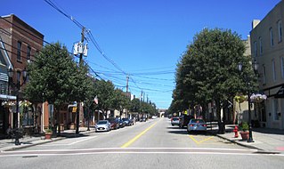
Metuchen is a suburban borough in Middlesex County in the U.S. state of New Jersey. The borough is a commuter town of New York City, located in the heart of the Raritan Valley region within the New York Metropolitan area. The borough, along with Edison, is a regional commercial hub for Central New Jersey. The borough is 6 miles (9.7 km) northeast of New Brunswick, 17 miles (27 km) southwest of Newark, 20 miles (32 km) southwest of Jersey City, and 22 miles (35 km) southwest of Manhattan. As of the 2020 United States census, the borough's population was 15,049, an increase of 1,475 (+10.9%) from the 2010 census count of 13,574, which in turn reflected an increase of 734 (+5.7%) from the 12,840 counted in the 2000 census.

<span class="mw-page-title-main">Piscataway, New Jersey</span> Township in Middlesex County, New Jersey, United States

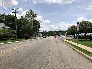
Piscataway is a township in Middlesex County, in the U.S. state of New Jersey. It is a suburb of the New York metropolitan area, in the Raritan Valley. As of the 2020 United States census, the township's population was 60,804, an increase of 4,760 (+8.5%) from the 2010 census count of 56,044, which in turn reflected an increase of 5,562 (+11.0%) from 50,482 at the 2000 census.

<span class="mw-page-title-main">Sayreville, New Jersey</span> Borough in Middlesex County, New Jersey, United States

Sayreville is a borough in Middlesex County, in the U.S. state of New Jersey. Sayreville is within the heart of the Raritan Valley region, located on the south banks of the Raritan River, and also located on the Raritan Bay. As of the 2020 United States census, the borough's population was 45,345, an increase of 2,641 (+6.2%) from the 2010 census count of 42,704, which in turn reflected an increase of 2,327 (+5.8%) from the 40,377 counted in the 2000 census.

<span class="mw-page-title-main">South Amboy, New Jersey</span> City in Middlesex County, New Jersey, United States

South Amboy is a suburban city in Middlesex County, in the U.S. state of New Jersey, located on Raritan Bay. As of the 2020 United States census, the city's population was 9,411, an increase of 780 (+9.0%) from the 2010 census count of 8,631, which in turn reflected an increase of 718 (+9.1%) from the 7,913 counted in the 2000 census.

<span class="mw-page-title-main">Woodbridge Township, New Jersey</span> Township in Middlesex County, New Jersey, United States

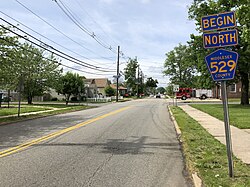
Woodbridge Township is a township in Middlesex County, in the U.S. state of New Jersey. The township is both a regional hub for Central New Jersey and a major bedroom suburb of New York City in the New York metropolitan area located within the core of the Raritan Valley region. The township hosts the intersection of the New Jersey Turnpike and the Garden State Parkway, the two busiest highways in the state, and also serves as the headquarters for the New Jersey Turnpike Authority.

<span class="mw-page-title-main">Raritan River</span> Major river in the U.S. state of New Jersey

Raritan River is a major river of New Jersey. Its watershed drains much of the mountainous area of the central part of the state, emptying into the Raritan Bay on the Atlantic Ocean.

<span class="mw-page-title-main">Central Jersey</span> Place in New Jersey, United States

Central Jersey is the central region of the U.S. state of New Jersey. The designation of Central New Jersey is a distinct administrative toponym.

<span class="mw-page-title-main">Roosevelt Park (Edison, New Jersey)</span>

Roosevelt Park is a 217-acre park located in central east Edison, New Jersey, at Parsonage Road and U.S. Route 1, just west of Menlo Park Mall. Established in 1933 in what was then Raritan Township, the park is considered the oldest park in the Middlesex County Park System. It is owned and operated by the county government.

New Jersey's 6th congressional district is represented by Democrat Frank Pallone, who has served the district in Congress since 1993. The district includes the northern and eastern portions of Middlesex County and the coastal areas of Monmouth County, including towns along the Raritan Bay.

<span class="mw-page-title-main">Stelton Baptist Church, Edison</span> Historic site in Middlesex County, New Jersey, US

The Stelton Baptist Church is in the Stelton section of Edison, Middlesex County, New Jersey. It is the second oldest Baptist Church in New Jersey and the tenth oldest in the United States.

<span class="mw-page-title-main">Edison station</span>

Edison is a commuter railroad station in the Stelton section of Edison Township, Middlesex County, New Jersey, United States. Located at the intersection of Plainfield Avenue and Central Avenue, the station is served by New Jersey Transit's Northeast Corridor Line. Amtrak trains cross through but bypass the station. Edison station contains two side platforms, both high-level for handicap accessibility under the Americans with Disabilities Act of 1990 (accessible). The next station north, towards New York Penn Station is Metuchen while the next station south, with service towards Jersey Avenue station in New Brunswick and Trenton Transit Center is New Brunswick.

<span class="mw-page-title-main">Bonhamtown, New Jersey</span> Populated place in Middlesex County, New Jersey, US

Bonhamtown is a section of Edison Township in Middlesex County, New Jersey, United States.

The Middlesex Greenway is a 3.5 miles (5.6 km) rail trail in New Jersey Metuchen, Edison and Woodbridge. It is part of the Middlesex County Park System. It makes up a portion of the East Coast Greenway.

<span class="mw-page-title-main">New Durham, Middlesex County, New Jersey</span> Unincorporated community in New Jersey, United States

New Durham was an unincorporated community and now a neighborhood located within Edison in Middlesex County, New Jersey, United States, south of Dismal Swamp.

Little India, Edison/Iselin, also known as Oak Tree Road, is a predominantly South Asian shopping, business, and dining district centered on a road, designated County Route 604, situated in Middlesex County, in Central New Jersey, and set amidst a suburban residential region home to many South Asian families. One food and entertainment critic has named the "atmospheric" Little India as one of the "50 Best Reasons to Live in New Jersey."

The Big Central Football Conference is a football-only athletic league of high schools in Central New Jersey. The 60-team league was formed in 2020.

References

  1. 1 2 "Stelton". Geographic Names Information System . United States Geological Survey, United States Department of the Interior.
  2. "NJDOT Graphic Information System Maps Middlesex" (PDF). New Jersey Department of Transportation. Retrieved March 2, 2020.
  3. 1 2 Middlesex County Office of Culture and Heritage. "History Revealed In Piscatawaytown and Edison", TAP into Piscataway, September 9, 2015. Accessed December 22, 2019. "The remnants of the Piscataway village and town commons can still be seen in modern Edison Township. Settled in the late 1600s by New Englanders, this historic site once consisted of a town hall, militia training ground, stockade, jail, church, burial ground and houses."
  4. 1 2 "Revolutionary War Sites in Edison, New Jersey". revolutionarywarnewjersey.com. Retrieved November 27, 2021.
  5. 1 2 Survey, Historic American Buildings. "St. James Episcopal Church, Piscataway, Middlesex County, NJ". www.loc.gov.
  6. Governors of New Jersey Archived November 12, 2013, at the Wayback Machine , New Jersey State Library. Accessed August 7, 2014.
  7. "History of Middlesex County, New Jersey, 1664-1920". New York, Chicago, Lewis historical publishing company. 1921.
  8. A guide to Edison (PDF). The Center for Community Renewal. 2001.
  9. Gordon, Thomas Francis (1834). "A Gazetteer of the State of New Jersey: Comprehending a General View of Its Physical and Moral Condition, Together with a Topographical and Statistical Account of Its Counties, Towns, Villages, Canals, Rail Roads, &c., Accompanied by a Map".
  10. Wall, John P. (1921). History of Middlesex County, New Jersey.
  11. Snyder, John P. The Story of New Jersey's Civil Boundaries: 1606–1968, Bureau of Geology and Topography, Trenton, New Jersey, 1969. p. 170 re Edison Township, p. 173 re Raritan Township.
  12. "St. James Episcopal Church Piscataway" (PDF). Historic American Buildings Survey. 1936. Retrieved September 25, 2022.
  13. 1 2 3 4 5 Change, Kathy (March 3, 2022). "Survey reveals almost 100 burials in the 'colored burial ground' at historic Piscatawaytown Burial Ground in Edison; 11 have been identified". centraljersey.com. Retrieved November 16, 2022.
  14. 1 2 3 4 "Piscatawaytown Burial Ground – Edison, NJ". Crossroads of the American Revolution. Retrieved November 16, 2022.
  15. 1 2 3 "Piscatawaytown burials ground GPR project report" (PDF). Edison Greenways Group. October 2021. Retrieved November 15, 2022.
  16. 1 2 "Piscatawaytown Burial Grounds - Middlesex County, New Jersey". www.interment.net. Retrieved November 16, 2022.
  17. Stochel, Walter R. (2004). "Piscatawaytown burial ground tour map 2004" (PDF). Metuchen - Edison Historical Society. Retrieved November 15, 2022.
  18. "Piscatawaytown Burial Ground" (PDF).
  19. 1 2 NJ, Weird. "Weird NJ: A sad tale from shrooms to tomb". Courier-Post. Retrieved November 16, 2022.
  20. 1 2 3 Stochel, W. R. (2004). Piscatawaytown burial ground tour map 2004. Metuchen- Edison Historical Society.
  21. 1 2 Stochel, Walter R. (2004). Piscatawaytown Burial Ground fact sheet 2004. Metuchen- Edison Historical Society.
  22. Stochel, Walter. (2010, March). General Thomas Swords 1806-1886. Metuchen - Edison Historical Society.