
The Docklands Light Railway (DLR) is an automated light metro system serving the redeveloped Docklands area of London, England and provides a direct connection between London's two major financial districts, Canary Wharf and the City of London. First opened on 31 August 1987, the DLR has been extended multiple times, giving a total route length of 38 km (24 mi). Lines now reach north to Stratford, south to Lewisham, west to Tower Gateway and Bank in the City of London financial district, and east to Beckton, London City Airport and Woolwich Arsenal. Further extensions are being considered.

The London Borough of Barking and Dagenham is a London borough in East London. It lies around 9 miles (14.4 km) east of Central London. It is an Outer London borough and the south is within the London Riverside section of the Thames Gateway; an area designated as a national priority for urban regeneration. At the 2011 census it had a population of 187,000, the majority of which are within the Becontree estate. The borough's three main towns are Barking, Chadwell Heath and Dagenham. The local authorities are the Barking and Dagenham London Borough Councils. Barking and Dagenham was one of six London boroughs to host the 2012 Summer Olympics.
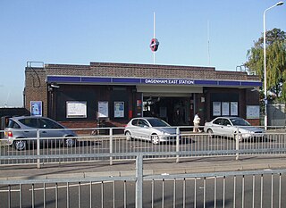
Dagenham East is a London Underground station located on the eastern side of the town of Dagenham in the London Borough of Barking and Dagenham, east London. It is on the District line between Dagenham Heathway to the west and Elm Park to the east. It is 6.4 kilometres (4.0 mi) along the line from the eastern terminus at Upminster and 27.8 kilometres (17.3 mi) to Earl's Court in central London where the line divides into numerous branches. The station has moderate usage for a suburban station, with approximately 3 million exits/entrances per year.
The Gospel Oak to Barking line is a railway line in London. It is 13 miles 58 chains (22.1 km) in length and carries both through goods trains and London Overground passenger trains, connecting Gospel Oak in north London and Barking Riverside in east London. The line is part of Network Rail Strategic Route 6, and is classified as a London and South East Commuter line.

Barking is an interchange station serving the town of Barking, east London. It is served by London Underground, London Overground and National Rail main line services. It is located on Station Parade, in the town centre.

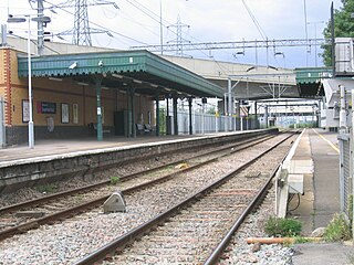
Upminster is an interchange station serving the town of Upminster in the London Borough of Havering, Greater London. It is on the London, Tilbury and Southend line (LTSR), 15 miles 20 chains (24.5 km) down the line from London Fenchurch Street; it is the eastern terminus of the District line on the London Underground; and it is the eastern terminus of the Romford to Upminster Line on the London Overground network. Upminster is the easternmost station on the London Underground network as well as the easternmost National Rail station in London.

The London, Tilbury and Southend line, also known as Essex Thameside, is a commuter railway line on the British railway system. It connects Fenchurch Street station, in central London, with destinations in east London and Essex, including Barking, Upminster, Basildon, Grays, Tilbury, Southend and Shoeburyness.
Dagenham Dock railway station is on the London, Tilbury and Southend line, serving the industrial areas, including the Ford assembly plant, around Dagenham in the London Borough of Barking and Dagenham, east London. It is 10 miles 45 chains (17.0 km) down the line from London Fenchurch Street and it is situated between Barking to the west and Rainham to the east. Its three-letter station code is DDK and it is in Travelcard zone 5.

Becontree is a London Underground station located to the south of Becontree in the London Borough of Barking and Dagenham, east London. It is on the District line between Upney to the west and Dagenham Heathway to the east. It is 9.1 kilometres (5.7 mi) along the line from the eastern terminus at Upminster and 25.1 kilometres (15.6 mi) to Earl's Court in central London where the line divides into numerous branches. It is in Travelcard Zone 5.

Abbey Wood is a National Rail station in Abbey Wood in southeast London, England. It is between Plumstead and Belvedere stations on the North Kent Line. It is 11 miles 43 chains (18.6 km) measured from London Charing Cross, with services to central London routed via Greenwich or Lewisham, and Elizabeth line services to Paddington via Canary Wharf and Liverpool Street. The station is managed by Transport for London with passenger services provided by Southeastern, Thameslink and the Elizabeth line. It is the closest railway station to the suburb of Thamesmead, which is connected to the station by local buses. The station platforms are located in the Royal Borough of Greenwich with the station entrance in the London Borough of Bexley.
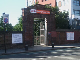
Woodgrange Park railway station is a railway station on Romford Road in Manor Park in the London Borough of Newham, east London. It is served by London Overground, and is on the Gospel Oak to Barking line, 12 miles 1 chain (19.3 km) down the line from Gospel Oak; it lies in Travelcard Zones 3 and 4. It has only limited station buildings and facilities.

East London Transit (ELT) is a part-segregated bus rapid transit, operated as part of the London Buses network. The East London Transit opened in phases between 2010 and 2013. The scheme for this system was developed by Transport for London to meet the existing and anticipated demand for public transport in East London caused by the Thames Gateway redevelopment, and has been planned to allow for a possible future upgrade to tram operation.

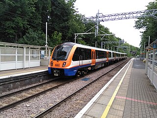
London Overground is a suburban rail network serving London and its environs. Established in 2007 to take over Silverlink Metro routes, it now serves a large part of Greater London as well as the home county of Hertfordshire, with 113 stations on nine different routes.

Barking Riverside is a mixed-use development in the area of Barking, east London, England, within the London Borough of Barking and Dagenham. It is being built on land formerly occupied by Barking Power Station, adjacent to the River Thames, and is 10.5 miles (16.9km) east of Charing Cross. The 440 acre brownfield site has planning permission for 10,800 homes.
The Docklands Light Railway extension to Dagenham Dock was a proposed extension of the Docklands Light Railway to Dagenham Dock in East London, to serve the Barking Riverside development and the wider Thames Gateway area.
Public transport in the London Borough of Havering, in east London, England, is a mix of National Rail, London Underground, London Overground and Crossrail and London Buses services. Rail services are primarily radial to central London with bus services providing most of the orbital connections. The public transport authority is Transport for London and the local authority is Havering London Borough Council.
Beam Park is a planned railway station to serve the new community of Beam Park. Plans for the station have been in development since at least 2002. Beam Park is a large housing development that extends from the London Borough of Havering, where the new station is proposed to be sited, into the London Borough of Barking and Dagenham. The construction costs of the station have been met by developers in the area and the Greater London Authority. As of January 2023 the Department for Transport has not authorised the introduction of passenger services at the station.

Barking Riverside is a railway station in the London Borough of Barking and Dagenham, East London. The station serves the Barking Riverside regeneration area, and was built as part of an £327m extension of the Gospel Oak to Barking Line to the area. It opened on 18 July 2022. It is served by London Overground, and provides interchange with the Thames Clippers boat service from Barking Riverside Pier.
The Docklands Light Railway extension to Thamesmead is a proposed Docklands Light Railway (DLR) extension to serve the Beckton Riverside and Thamesmead redevelopment areas of East London.
R25 was a proposed railway orbital around the Zone 3 area of London, England. First proposed in the Mayor of London's £1.3 trillion London Infrastructure 2050 plan, the line would have used some existing Network Rail and London Overground lines, linked by stretches of new railway.

