Washington Park is a community area on the South Side of Chicago which includes the 372 acre (1.5 km2) park of the same name, stretching east-west from Cottage Grove Avenue to the Dan Ryan Expressway, and north-south from 51st Street to 63rd. It is home to the DuSable Museum of African American History. The park was the proposed site of the Olympic Stadium and the Olympic Aquatics Center in Chicago's bid to host the 2016 Summer Olympics.

Kew Gardens is a neighborhood in the central area of the New York City borough of Queens. Kew Gardens is bounded to the north by the Union Turnpike and the Jackie Robinson Parkway, to the east by the Van Wyck Expressway and 131st Street, to the south by Hillside Avenue, and to the west by Park Lane, Abingdon Road, and 118th Street. Forest Park is to the west and the neighborhood of Forest Hills to the north-west, Flushing Meadows–Corona Park north, Richmond Hill south, Briarwood southeast, and Kew Gardens Hills east.

Oregon Hill is a historic working-class neighborhood in Richmond, Virginia. Oregon Hill overlooks the James River and Belle Isle, and provides access to Hollywood Cemetery. Due to the neighborhood's proximity to the Monroe Park Campus of Virginia Commonwealth University, the neighborhood is sometimes referred to as a student quarter because of its high college student population.
The Greater Richmond, Virginia area has many neighborhoods and districts.

Richmond Hill is a commercial and residential neighborhood located in the southeastern section of the New York City borough of Queens. The area borders Kew Gardens and Forest Park to the north, Jamaica and South Jamaica to the east, South Ozone Park to the south, and Woodhaven and Ozone Park to the west. The neighborhood is split between Queens Community Board 9 and 10.

Deer Park is a neighborhood four miles southeast of downtown Louisville, Kentucky, USA. Most of the neighborhood was developed from 1890 through the 1920s as a streetcar suburb, with all but six of its 24 subdivisions being developed by 1917, and the last laid out by 1935, although some development west of Norris Place continued after World War II.

Grove Park is a northwest Atlanta, inside-the-perimeter neighborhood bounded by:

Kensington is a neighborhood in Philadelphia that belongs to Lower Northeast. As with all neighborhoods in the city, the lack of any official designation means the boundaries of the area vary between sources over time and are disputed among locals. Kensington, as most long-term residents view it, refers generally to the area consisting of Kensington, East Kensington, West Kensington, and Harrowgate. The adjacent Fairhill and Norris Square neighborhoods are more separate but may be included in Kensington; Fishtown and South (Olde) Kensington were historically included. The most conservative boundaries of the neighborhood, shown in the map below, are Front Street and 5th Street to the west, the Amtrak train tracks to the North, Trenton Avenue, the Trenton Avenue train tracks, and Frankford Avenue to the east, and Cecil B. Moore Avenue to the south.
Conrad Frederick Sauer was an American pharmacist from Richmond, Virginia, who founded the C.F. Sauer Company on October 13, 1887, his 21st birthday. He was also a real estate developer, and developed the Sauer's Gardens neighborhood near his factory.
The Iron Triangle, sometimes known as Central Richmond, is a neighborhood in Richmond, California. It is a largely residential area but includes the downtown Richmond business district along Macdonald Avenue. Commercial areas on Cutting Boulevard and near Interstate 580 are also in the neighborhood if the more extensive of two possible definitions of its area is used.

The Upper Eastside is a neighborhood in Miami, Florida. It is north of Edgewater, east of Little Haiti, south of the village of Miami Shores, and sits on Biscayne Bay. In geographical order from south to north and east to west, it contains the subdivisions of Magnolia Park, Bay Point, Morningside, Bayside, Belle Meade, Shorecrest, and Palm Grove. The MiMo District along Biscayne Boulevard in the area is host to many art galleries, shops and restaurants.

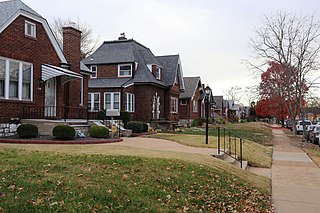
Lindenwood Park is a neighborhood of St. Louis, Missouri, United States. The Lindenwood Neighborhood is defined by Arsenal Street and I-44 to the north, Watson and Chippewa Street to the south, Hampton Avenue on the east and the city limits to the west.

Southwest Garden is a neighborhood of St. Louis, Missouri, located south of The Hill and Forest Park Southeast, west of the Missouri Botanical Garden and Tower Grove Park, east of Lindenwood Park and Clifton Heights, and north of North Hampton.
Princeton Heights is a neighborhood of St. Louis, Missouri. The neighborhood boundaries are defined as Hampton Boulevard on the west, Eichelberger on the north, Christy Boulevard on the east, and Gravois on the south.

The Medbury's–Grove Lawn Subdivisions Historic District is a residential historic district located in Highland Park, Michigan. It runs along three east–west streets: Eason Street, Moss Street, and Puritan Street, from Hamilton Avenue on the west to Woodward Avenue on the east. The district was listed on the National Register of Historic Places in 1988.

The Martin Drive neighborhood of Milwaukee is a residential district on the west side of the city. It is named for the local 19th-century politician Morgan Lewis Martin. Housing development started in the 1920s around two breweries. The area has benefited from local improvement programs and community activities since the 1990s.

Slotermeer is a neighborhood of Amsterdam, Netherlands, in the Dutch province of North Holland. The name of Slotermeer comes from the Slootermeer Lake that used to be in this area
South River City is a community located in Austin, Texas. Also frequently called Travis Heights, the neighborhood is located south of the city's urban core, just below Lake Lady Bird in South Austin. The area encompasses a portion of ZIP code 78704.
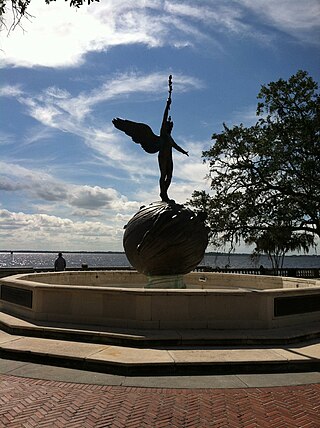
Riverside and Avondale are two adjacent and closely associated neighborhoods, alternatively considered one continuous neighborhood, of Jacksonville, Florida. The area is primarily residential, but includes some commercial districts, including Five Points, the King Street District, and the Shoppes of Avondale.

Broadacres is a subdivision in Houston, Texas, United States, within the Boulevard Oaks community. It is located north of Bissonnet Street, south of U.S. Route 59, west of the Houston Museum District, and east of other subdivisions of Boulevard Oaks. The neighborhood is known for its large lots, historic preservationism, broad tree canopies, wide streets with medians, and affluence.
