Church Hill, also known as the St. John's Church Historic District, is an Old and Historic District in Richmond, Virginia. This district encompasses the original land plat of the city of Richmond. Church Hill is the eastern terminus of Broad Street, a major east-west thoroughfare in the Richmond metropolitan area. The name Church Hill is often used to describe both the specific historic district and the larger general area in the East End encompassing other neighborhoods such as Union Hill, Chimborazo, Fairmount, Peter Paul, Woodville, etc.

The Fan is a district of Richmond, Virginia, so named because of the "fan" shape of the array of streets that extend west from Belvidere Street, on the eastern edge of Monroe Park, westward to Arthur Ashe Boulevard. However, the streets rapidly resemble a grid after they go through what is now Virginia Commonwealth University. The Fan is one of the easterly points of the city's West End section, and is bordered to the north by Broad Street and to the south by VA 195, although the Fan District Association considers the southern border to be the properties abutting the south side of Main Street. The western side is sometimes called the Upper Fan and the eastern side the Lower Fan, though confusingly the Uptown district is located near VCU in the Lower Fan. Many cafes and locally owned restaurants are located here, as well as historic Monument Avenue, a boulevard formerly featuring statuary of the Civil War's Confederate president and generals. The only current statue is a more modern one of tennis icon Arthur Ashe. Development of the Fan district was strongly influenced by the City Beautiful movement of the late 19th century.

Oregon Hill is a historic working-class neighborhood in Richmond, Virginia. Oregon Hill overlooks the James River and Belle Isle, and provides access to Hollywood Cemetery. Due to the neighborhood's proximity to the Monroe Park Campus of Virginia Commonwealth University, the neighborhood is sometimes referred to as a student quarter because of its high college student population.

Ginter Park is a suburban neighborhood of Richmond, Virginia built on land owned and developed by Lewis Ginter. The neighborhood's first well known resident was newspaperman Joseph Bryan, who lived in Laburnum, first built in 1883 and later rebuilt. In 1895, many acres of land north of Richmond were purchased by Ginter in order to develop into neighborhoods. Ginter Park and other neighborhoods were developed from this initial land purchase. In Ginter Park are Union Presbyterian Seminary and as well as Pollard Park.

Broad Street is a 15-mile-long (24 km) road located in the independent city of Richmond, Virginia, and adjacent Henrico County. Broad Street is significant to Richmond due to the many commercial establishments that have been built along it throughout Richmond's history. From downtown through miles into the suburbs, the street is largely dedicated to retailing and offices, including regional and neighborhood shopping centers and malls.

The White House of the Confederacy is a historic house located in the Court End neighborhood of Richmond, Virginia. Built in 1818, it was the main executive residence of the sole President of the Confederate States of America, Jefferson Davis, from August 1861 until April 1865. It was viewed as the Confederate States counterpart to the White House in Washington, D.C. It currently sits on the campus of Virginia Commonwealth University.

The Maggie L. Walker National Historic Site is a United States National Historic Landmark and a National Historic Site located at 110½ E. Leigh Street on "Quality Row" in the Jackson Ward neighborhood of Richmond, Virginia. The site was designated a U.S. National Historic Landmark in 1975. The National Historic Site was established in 1978 to tell the story of the life and work of Maggie L. Walker (1867-1934), the first woman to serve as president of a bank in the United States. It was built by George W. Boyd, father of physician, Sarah Garland Boyd Jones. The historic site protects the restored and originally furnished home of Walker. Tours of the home are offered by National Park Service rangers.

Jackson Ward, previously known as Central Wards, is a historically African-American district in Richmond, Virginia, with a long tradition of African-American businesses. It is located less than a mile from the Virginia State Capitol, sitting to the west of Court End and north of Broad Street. It was listed as a National Historic Landmark District in 1978. "Jackson Ward" was originally the name of the area's political district within the city, or ward, from 1871 to 1905, yet has remained in use long after losing its original meaning.
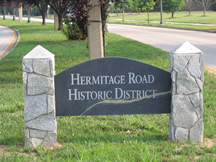
Hermitage Road Historic District (HRHD) is a Northside neighborhood in the independent city of Richmond, Virginia. The district is a Richmond Old and Historic District, as well as being listed on the Virginia Landmarks Register and the National Register of Historic Places.

Originally a trolley car suburb in the years just before the dawn of the 20th century, the Fairmount neighborhood in Church Hill, Richmond, Virginia, is located just north of Union Hill. Much of the neighborhood was developed from the 1890s to the 1920s, and its buildings largely reflect Queen Anne, Italianate, and 1920s bungalow architecture. What is likely the oldest remaining residence, a frame house, probably dates from before 1870. A notable property in the Fairmount neighborhood is the Fairmount School. Annexed from Henrico County in 1906, Fairmount was first incorporated as an independent town on March 10, 1902.

Shockoe Slip is a district in the downtown area of Richmond, Virginia. The name "slip" referred to a narrow passageway leading from Main Street to where goods were loaded and unloaded from the former James River and Kanawha Canal. The rough boundaries of Shockoe Slip include 14th Street, Main Street, Canal Street and 12th Street.

Charles Morrison Robinson, most commonly known as Charles M. Robinson, was an American architect. He worked in Altoona and Pittsburgh, Pennsylvania from 1889 to 1906 and in Richmond, Virginia from 1906 until the time of his death in 1932. He is most remembered as a prolific designer of educational buildings in Virginia, including public schools in Richmond and throughout Virginia, and university buildings for James Madison University, College of William and Mary, Radford University, Virginia State University, University of Mary Washington, and the University of Richmond. He was also the public school architect of the Richmond Public Schools from 1910 to 1929. Many of his works have been listed on the National Register of Historic Places.

Chimborazo Park is a park and historic land site in Richmond, Virginia, United States. Created in 1874, the park was the site of Chimborazo Hospital, one of the world's largest military hospitals.
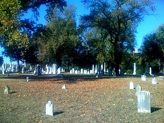
The Shockoe Hill Cemetery is a historic cemetery located on Shockoe Hill in Richmond, Virginia.

The Museum District, alternately known as West of the Boulevard, is a neighborhood in the city of Richmond, Virginia. It is anchored by the contiguous six-block tract of museums along the west side of Boulevard, including the Virginia Museum of Fine Arts and the Virginia Museum of History & Culture, hence the name.

The Church Hill North Historic District is a historic district in Richmond, Virginia, that was listed on the National Register of Historic Places in 1997. An expansion of the district was listed in 2000. This added 37 acres (15 ha) to the original 70 acres (28 ha)

The Chestnut Hill–Plateau Historic District is a historic area in the Highland Park neighborhood of Richmond, Virginia. It is also known as 'Highland Park Southern Tip' on city neighborhood maps.
The Scott's Addition Historic District is a national historic district located in Richmond, Virginia.
The Shockoe Hill African Burying Ground was established by the city of Richmond, Virginia, for the interment of free people of color, and the enslaved. The heart of this now invisible burying ground is located at 1305 N 5th St.

The Shockoe Hill Burying Ground Historic District, located in the city of Richmond, Virginia, is a significant example of a municipal almshouse-public hospital-cemetery complex of the sort that arose in the period of the New Republic following disestablishment of the Anglican Church. The District illustrates changing social and racial relationships in Richmond through the New Republic, Antebellum, Civil War, Reconstruction, and Jim Crow/Lost Cause eras of the nineteenth and twentieth centuries. The Shockoe Hill Burying Ground Historic District occupies 43 acres (17 ha) of land bounded to the south by E. Bates Street, to the north by the northern limit of the Virginia Passenger Rail Authority right-of-way at the southern margin of the Bacon's Quarter Branch valley, to the west by 2nd Street, and to the east by the historic edge of the City property at the former location of Shockoe Creek. The District encompasses most of a 28.5-acre (11.5 ha) tract acquired by the city of Richmond in 1799 to fulfill several municipal functions, along with later additions to this original tract.


