Related Research Articles

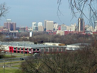
Downtown Richmond is the central business district of Richmond, Virginia, United States. It is generally defined as being bound by Belvidere Street to the west, I-95 to the north and east, and the James River to the south. The Fan district borders it to the west, Highland Park to the north, Church Hill to the east, and Manchester to the south.

Shockoe Hill is one of several hills on which much of the oldest portion of the City of Richmond, Virginia, U.S., was built. It extends from the downtown area, including where the state capitol complex sits, north almost a mile to a point where the hill falls off sharply to the winding path of Shockoe Creek. Interstate 95 now bisects the hill, separating the highly urbanized downtown portion from the more residential northern portion.
Fulton Hill is a neighborhood located in the East End of Richmond, Virginia. The name is used for the area stretching from Gillies Creek to the Richmond city limits. The Greater Fulton Hill Civic Association includes Fulton Bottom, part of Montrose Heights and part of Rocketts. Fulton Hill is south of Church Hill and Shockoe Bottom, north of Varina, east of the James River, and west of Sandston. The zip code is 23231.

Shockoe Bottom historically known as Shockoe Valley, is an area in Richmond, Virginia, just east of downtown, along the James River. Located between Shockoe Hill and Church Hill, Shockoe Bottom contains much of the land included in Colonel William Mayo's 1737 plan of Richmond, making it one of the city's oldest neighborhoods.
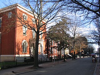
Court End is a neighborhood in Richmond, Virginia, that sits to the north of the Capitol Square and East Broad Street. It developed in the Federal era, after Virginia's capital moved from Williamsburg.

Oakwood Cemetery is a large, city-owned burial ground in the East End of Richmond, Virginia. It holds over 48,000 graves, including many soldiers from the Civil War.

Lumpkin's Jail, also known as "the Devil's half acre", was a holding facility, or slave jail, located in Richmond, Virginia, just three blocks from the state capitol building. More than five dozen firms traded in enslaved human beings within blocks of Richmond's Wall Street between 14th and 18th Streets between the 1830s and the end of the American Civil War. Its final and most notorious owner, Robert Lumpkin, bought and sold slaves throughout the South for well over twenty years, and Lumpkin's Jail became Richmond's largest slave-holding facility.

Barton Heights is a streetcar suburb neighborhood and former town in the Northside area of Richmond, Virginia. The area was primarily developed between 1890 and the 1920s.
Creighton Court is a neighborhood in Richmond, Virginia's East End region. Creighton Court sits on the border between the City of Richmond and eastern Henrico County. The neighborhood is situated directly north of the Oakwood Cemetery and alongside the interchange of Virginia Route 33 and Interstate 64. North 29th Street and Creighton Road serve as the main arteries of the community.
The Biotech and MCV District is the community that surrounds the MCV Campus of Virginia Commonwealth University in Downtown Richmond, Virginia.

The Chamberlayne Industrial Center, sometimes simply known as Chamberlayne is a heavy industry district within the boundaries of Richmond, Virginia's North Side region. The neighborhood contains a mixture of residential, commercial industrial-zoned areas, but most of the residential and commercial buildings are in the eastern corner of the neighborhood. The neighborhood is named after Chamberlayne Avenue which serves as the spine for the neighborhood.
Gilpin is a small neighborhood located in Richmond, Virginia and within the boundaries of the North Side of the city limits. Originally part and parcel of the historically Black neighborhood of Jackson Ward, the northern section of that neighborhood was heavily redeveloped with the provision of public housing from the mid-20th century onwards, with the major development taking the name "Gilpin Court". During the same period, a massive expansion of highway building around and through central Richmond saw the Gilpin Court and the rest of the neighborhood essentially cut off from the rest of Jackson Ward.
Jahnke is a neighborhood in Richmond, Virginia located in the Southside region of the city. The neighborhood lies within the city limits. The zip code for the neighborhood is 23225. Jahnke is named after Jahnke Road which is the main road through the neighborhood. The heart of Jahnke is at the intersection of Jahnke Road and German School Road.

Mosby Court is a Housing Project also a neighborhood. The neighborhood is named Mosby while the Housing Project is named Mosby Court. Mosby Court is located in the East End quadrant of Richmond, Virginia Adjacent to the Richmond City Jail, Mosby Court is primarily served by Coalter Street, which accesses the community North 18th Street. Directly south of the neighborhood is Martin Luther King Jr. Middle School.

Carillon is a neighborhood in the West End of Richmond that is situated in between Virginia State Routes 146 and 161. Adjacent to Maymont and Byrd Park, the middle-class neighborhood is home to the Dogwood Dell Amphitheater. Pump House Drive and Rugby Road are the arteries of the southern tier of the community, while Douglasdale Avenue and South Belmont Drive form the spin of the northern portions of Carillon.
Old Town Manchester is a neighborhood in Richmond, Virginia's Southside quadrant. The neighborhood is where downtown Manchester, Richmond, Virginia, United States, was situated before the city merged with Richmond. The area is heavily industrialized, but has gone through a series of gentrification for the last 10 years. Several lofts and art galleries have opened in the area.
Lockgreen is an upper-class gated community located in Richmond, Virginia's West End. The neighborhood lies within Wilton and is served by Lockgreen Circle. Lockgreen was built as an extension to Windsor Farms's Old Locke subdivision. The zip code for the subdivision is 23226.
Randolph is a historically black middle class neighborhood located within the West End of Richmond, Virginia. The neighborhood is named in honor of Virginia E. Randolph, a former African-American educator in Henrico County, Virginia during the 19th century. The neighborhood is bounded by the Downtown Expressway to the north, Harrison Street to the east, Colorado Avenue to the south, and South Meadow street to the west. Some famous landmarks and places of interest in the neighborhood include Petronius Park, the Randolph Community Center, and just adjacent to the neighborhood, the Hollywood Cemetery.
The Shockoe Bottom African Burial Ground, or known historically as the "Burial Ground for Negroes", is the older of two municipal burial grounds established for the interment of free people of color and the enslaved in the city of Richmond, Virginia. It is located at 1554 E Broad St., across from the site of Lumpkin's Jail, in Shockoe Bottom. The area now known as Shockoe Bottom, was historically known as Shockoe Valley. Richmond's second African Burial Ground, called the "Shockoe Hill African Burying Ground" is the larger of the two burial grounds, and is located a mile and a half away at 1305 N 5th St, on Shockoe Hill.

The Shockoe Hill Burying Ground Historic District, located in the city of Richmond, Virginia, is a significant example of a municipal almshouse-public hospital-cemetery complex of the sort that arose in the period of the New Republic following disestablishment of the Anglican Church. The District illustrates changing social and racial relationships in Richmond through the New Republic, Antebellum, Civil War, Reconstruction, and Jim Crow/Lost Cause eras of the nineteenth and twentieth centuries. The Shockoe Hill Burying Ground Historic District occupies 43 acres (17 ha) of land bounded to the south by E. Bates Street, to the north by the northern limit of the Virginia Passenger Rail Authority right-of-way at the southern margin of the Bacon's Quarter Branch valley, to the west by 2nd Street, and to the east by the historic edge of the City property at the former location of Shockoe Creek. The District encompasses most of a 28.5-acre (11.5 ha) tract acquired by the city of Richmond in 1799 to fulfill several municipal functions, along with later additions to this original tract.