Wiggins, Colorado

Last updated

Wiggins, Colorado
Town of Wiggins
Wiggins, Colorado Municipal Building.JPG
The Wiggins Municipal Building
Morgan County Colorado Incorporated and Unincorporated areas Wiggins Highlighted 0884770.svg
Location in Morgan County, Colorado
USA Colorado location map.svg
Red pog.svg
Wiggins
Usa edcp location map.svg
Red pog.svg
Wiggins
Coordinates: 40°13′49″N104°4′24″W / 40.23028°N 104.07333°W / 40.23028; -104.07333
Country Flag of the United States (23px).png  United States
State Flag of Colorado.svg  Colorado
County [1] Morgan County
Established1882
Incorporated October 11, 1974 [2]
Named for Oliver P. Wiggins
Government
  Type Statutory town [1]
Area
[3]
  Total1.33 sq mi (3.44 km2)
  Land1.32 sq mi (3.43 km2)
  Water0.00 sq mi (0.01 km2)
Elevation
[4]
4,554 ft (1,388 m)
Population
 (2020) [5]
  Total1,401
  Density1,059.0/sq mi (408.9/km2)
Time zone UTC-7 (Mountain (MST))
  Summer (DST) UTC-6 (MDT)
ZIP code [6]
80654
Area code 970
FIPS code 08-84770
GNIS feature ID 0204698 [4]
Website townofwiggins.colorado.gov

Wiggins is a statutory town in Morgan County, Colorado, United States. The population was 1,401 as of the 2020 census, [5] up from 893 at the 2010 census.

Contents

The community was established in 1882 as the Burlington Railroad depot of "Corona". Around 1900, Corona was renamed in honor of Oliver P. Wiggins, [7] who had served as a guide and scout for Captain John C. Frémont on some of his explorations through northern Colorado in the 1840s and who had accompanied Kit Carson for 12 years on his expeditions.

Geography

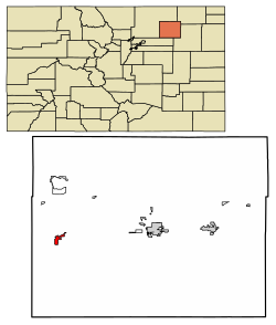
Wiggins is in western Morgan County on the south side of Interstate 76, which leads east 15 miles (24 km) to Fort Morgan, the county seat, and southwest 64 miles (103 km) to Denver. U.S. Route 34 splits off from I-76 just north of the town, leading northwest 38 miles (61 km) to Greeley.

According to the United States Census Bureau, the town of Wiggins has a total area of 1.3 square miles (3.4 km2), of which 0.004 square miles (0.010 km2), or 0.30%, are water. [3]

Demographics

Historical population
CensusPop.Note
1980 531
1990 499−6.0%
2000 83867.9%
2010 8936.6%
2020 1,40156.9%
U.S. Decennial Census [8]

As of the census [9] of 2000, there were 838 people, 265 households, and 210 families residing in the town. The population density was 938.4 inhabitants per square mile (362.3/km2). There were 279 housing units at an average density of 312.4 per square mile (120.6/km2). The racial makeup of the town was 82.10% White, 1.19% African American, 2.27% Native American, 12.89% from other races, and 1.55% from two or more races. Hispanic or Latino of any race were 25.06% of the population.

There were 265 households, out of which 46.8% had children under the age of 18 living with them, 62.6% were married couples living together, 10.9% had a female householder with no husband present, and 20.4% were non-families. 17.0% of all households were made up of individuals, and 7.2% had someone living alone who was 65 years of age or older. The average household size was 3.16 and the average family size was 3.52.

The age of the town's population is spread out, with 37.0% under the age of 18, 7.8% from 18 to 24, 28.0% from 25 to 44, 19.6% from 45 to 64, and 7.6% who were 65 years of age or older. The median age was 30 years. For every 100 females, there were 100.5 males. For every 100 females age 18 and over, there were 98.5 males.

The median income for a household in the town was $33,438, and the median income for a family was $34,219. Males had a median income of $26,296 versus $20,833 for females. The per capita income for the town was $11,827. About 15.0% of families and 14.8% of the population were below the poverty line, including 16.1% of those under age 18 and none of those age 65 or over.

Education

Wiggins is home to the Wiggins RE-50J school district. The district includes Wiggins Elementary School, Wiggins Middle School and Wiggins High School.

See also

Related Research Articles

<span class="mw-page-title-main">Morgan County, Colorado</span> County in Colorado, United States

Morgan County is a county located in the U.S. state of Colorado. As of the 2020 census, the population was 29,111. The county seat is Fort Morgan. The county was named after old Fort Morgan, which in turn was named in honor of Colonel Christopher A. Morgan.

<span class="mw-page-title-main">Campo, Colorado</span> Town in Colorado, United States

Campo is a Statutory Town located in Baca County, Colorado, United States. The town population was 103 at the 2020 United States Census. The town is situated on the High Plains, straddling U.S. Route 287/385.

<span class="mw-page-title-main">Cheyenne Wells, Colorado</span> Town in Colorado, United States

Cheyenne Wells is the Statutory Town that is the county seat and the most populous municipality of Cheyenne County, Colorado, United States. The town population was 758 at the 2020 United States Census.

<span class="mw-page-title-main">Bayfield, Colorado</span> Town in Colorado, United States

Bayfield is a Statutory Town located in La Plata County, Colorado, United States. The town population was 2,838 at the 2020 United States Census, a +21.65% increase since the 2010 United States Census. Bayfield is part of the Durango, CO Micropolitan Statistical Area.

<span class="mw-page-title-main">Kim, Colorado</span> Town in Colorado, United States

Kim is a Statutory Town in Las Animas County, Colorado, United States. The population was 63 at the time of the 2020 United States Census.

<span class="mw-page-title-main">Palisade, Colorado</span> Town in Mesa County, Colorado, United States

Palisade is a statutory town in Mesa County, Colorado, United States. It is part of the Grand Junction Metropolitan Statistical Area. The population was 2,565 at the 2020 census, down from 2,692 in 2010.

<span class="mw-page-title-main">Hillrose, Colorado</span> Town in Colorado, United States

The Town of Hillrose is a statutory town located in Morgan County, Colorado, United States. The town population was 312 at the 2020 United States Census, an 18.18% increase since the 2010 United States Census.

<span class="mw-page-title-main">Log Lane Village, Colorado</span> Town in Colorado, United States

Log Lane Village is a statutory town in Morgan County, Colorado, United States. The population was 913 at the 2020 census.

<span class="mw-page-title-main">Manzanola, Colorado</span> Town in Otero County, Colorado, United States

Manzanola is a Statutory Town in Otero County, Colorado, United States. The town population was 341 at the 2020 United States Census.

<span class="mw-page-title-main">Swink, Colorado</span> Town in Otero County, Colorado, United States

Swink is a Statutory Town in Otero County, Colorado, United States. The population was 604 at the 2020 census.

<span class="mw-page-title-main">Wiley, Colorado</span> Town in Prowers County, Colorado, United States

Wiley is a Statutory Town in Prowers County, Colorado, United States. The population was 437 at the 2020 Census.

<span class="mw-page-title-main">Center, Colorado</span> Town in Saguache and Rio Grande counties in Colorado, United States

The Town of Center is a Statutory Town located in Saguache and Rio Grande counties in Colorado, United States. The town's population was 1,929 at the 2020 United States Census with 1,885 residing in Saguache County and 44 residing in Rio Grande County.

<span class="mw-page-title-main">Moffat, Colorado</span> Town in Saguache County, Colorado, United States

The Town of Moffat is a statutory town in Saguache County, Colorado, United States. The town population was 108 at the 2020 United States Census.

<span class="mw-page-title-main">Akron, Colorado</span> Town in Colorado, United States

Akron is the Statutory Town that is the county seat and the most populous municipality of Washington County, Colorado, United States. The town population was 1,757 at the 2020 United States Census.

<span class="mw-page-title-main">Dacono, Colorado</span> City in Colorado, United States

Dacono is a home rule municipality located in southwestern Weld County, Colorado, United States. The city population was 6,297 at the 2020 United States Census, an increase of +51.66% since the 2010 United States Census. Dacono is a part of the Greeley, CO Metropolitan Statistical Area and the Front Range Urban Corridor.

<span class="mw-page-title-main">Mead, Colorado</span> Town in Colorado, United States

The Town of Mead is a Statutory Town in Weld County, Colorado, United States. The town population was 4,781 at the 2020 United States Census.

<span class="mw-page-title-main">Platteville, Colorado</span> Town in Colorado, United States

Platteville is a Statutory Town in Weld County, Colorado, United States. The population was 2,955 at the 2020 census. It is adjacent to Fort Vasquez on U.S. Highway 85.

<span class="mw-page-title-main">Eckley, Colorado</span> Town in Colorado, United States

Eckley is a statutory town located in Yuma County, Colorado, United States. The town population was 232 at the 2020 United States Census.

<span class="mw-page-title-main">Merrillville, Indiana</span> Town in Indiana, United States

Merrillville is a town in Ross Township, Lake County, Indiana, United States. The population was 35,246 at the 2010 census. Merrillville is in east-central Lake County, in the Chicago metropolitan area. On January 1, 2015, Merrillville became the most populated town in Indiana, as Fishers in Hamilton County was converted from a town to a city. The town serves as a major shopping hub for Northwest Indiana.

<span class="mw-page-title-main">Corona, South Dakota</span> Town in South Dakota, United States

Corona is a town in Roberts County, South Dakota, United States. The population was 69 at the 2020 census.

References

  1. 1 2 "Active Colorado Municipalities". State of Colorado, Department of Local Affairs. Retrieved September 1, 2007.
  2. "Colorado Municipal Incorporations". State of Colorado, Department of Personnel & Administration, Colorado State Archives. December 1, 2004. Retrieved September 2, 2007.
  3. 1 2 "2022 U.S. Gazetteer Files: Colorado". United States Census Bureau. Retrieved December 2, 2022.
  4. 1 2 U.S. Geological Survey Geographic Names Information System: Wiggins, Colorado
  5. 1 2 "P1. Race – Wiggins town, Colorado: 2020 DEC Redistricting Data (PL 94-171)". U.S. Census Bureau. Retrieved December 2, 2022.
  6. "ZIP Code Lookup" (JavaScript/HTML). United States Postal Service . Retrieved January 8, 2008.
  7. Dawson, John Frank. Place names in Colorado: why 700 communities were so named, 150 of Spanish or Indian origin. Denver, CO: The J. Frank Dawson Publishing Co. p. 52.
  8. "Census of Population and Housing". Census.gov. Retrieved June 4, 2015.
  9. "U.S. Census website". United States Census Bureau . Retrieved January 31, 2008.