Idylwood, Houston

Last updated
Idylwood IdylwoodSignHoustonTX.JPG
Idylwood

Idylwood is a historic neighborhood in the southeastern part of the I-610 loop in Houston, Texas. Idylwood, as of 2021, is the most expensive neighborhood in the East End. As of that year its houses were priced between $295,000 and $679,900. It currently has approximately 340 homes. Bill England, a redeveloper in the East End area, stated in 2004 that Idylwood appealed to buyers who are priced out of houses located in the cities of Bellaire and West University Place. [1]

Contents

History

Idylwood was developed in the 1930s. Richard Connelly of the Houston Press said "like most of these underrated [Houston neighborhoods]," Idylwood "watched helplessly as development trended elsewhere" as more prominent development appeared west of Downtown Houston instead of southeast of Downtown Houston. [2]

From 1998 to 2003, houses in Idylwood appreciated 10% per year. [1]

In 2010 the Houston Press ranked Idylwood one of the "Five Most Underrated Neighborhoods In Houston." [2]

Cityscape

Idlywood is inside the 610 Loop and southeast of Downtown Houston. The neighborhood is bounded by the Brays Bayou, the Wortham Golf Course, and the Villa de Matel, a Roman Catholic convent and basilica. Forest Park Lawndale, a cemetery, lies on the other side of the Brays Bayou. [3] The neighborhood features some of the few rolling hills located within the City of Houston. [4] As of 2004, at a certain point of time, six to nine houses are on sale, and sales conclude quickly. [1] In 2009 Richard Connelly of the Houston Press said that the classic-style houses in Idylwood were "affordable." [2]

Anjali Athavaley of the Houston Chronicle said that flooding is not a significant problem for Idylwood residents. In 2001 Tropical Storm Allison affected some houses located in proximity to North MacGregor Way. [1] The houses primarily consist of cottage bungalows. Idlywood is in proximity to the Texas Medical Center, the Houston Museum District, Hermann Park, the University of Houston, and Rice University. [3]

Government and infrastructure

Idylwood is in Houston City Council District I. [5]

The Harris Health System (formerly Harris County Hospital District) designated the Ripley Health Center for the ZIP code 77023. [6] In 2000 Ripley was replaced by the Gulfgate Health Center. [7] The designated public hospital is Ben Taub General Hospital in the Texas Medical Center. [6]

Education

Idylwood is within the Houston Independent School District.

Idylwood is zoned to J.P. Henderson Elementary School, [8] Navarro Middle School (formerly Jackson Middle School), [9] and Austin High School. [10]

Parks and recreation

R. F. Bob Spurlock Park .SpurlockParkHouston.JPG
R. F. Bob Spurlock Park

Spurlock Park, operated by the City of Houston, [11] is located within Idylwood. [12]

Related Research Articles

Westbury, Houston

Westbury is a neighborhood in the Brays Oaks district of Southwest Houston, Texas, United States. It is located east of Bob White Road, north of U.S. Highway 90 Alternate, and west of South Post Oak Road, adjacent to the Fondren Southwest and Meyerland neighborhoods, just west of the southwest corner of the 610 Loop.

Harrisburg is a community that is now located within the city of Houston, Texas, United States.

Meyerland, Houston Community in Houston, Texas

Meyerland is a 6,000-acre (9 sq mi) community in southwest Houston, Texas, outside of the 610 Loop and inside Beltway 8. The neighborhood is named after the Meyer family, who bought and owned 6,000 acres (24 km²) of land in southwest Houston.

Garden Villas, Houston

Garden Villas is a subdivision in Houston, Texas, United States.

Old Braeswood, Houston

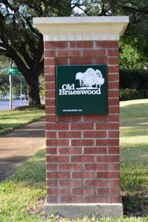
Old Braeswood is a neighborhood of single family homes in Houston, Texas, United States. It is generally bounded by South Main, North Braeswood, Kirby Drive, and Holcombe. The Texas Medical Center, Rice University, Rice Village, and the NRG Center complex are all within a one-mile radius. Nearby neighborhoods include Southgate, West University Place and Braeswood Place.

Garden Oaks, Houston Place in Texas, United States

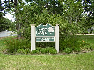
Garden Oaks is a neighborhood in Houston, Texas (USA). The neighborhood, located north of Houston Heights, was established in 1937 by Edward L. Crain.

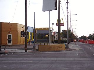
Eastwood is a historic neighborhood in the East End area of Houston, Texas, United States. Eastwood maintains Houston’s largest intact collection of Craftsman, Arts & Crafts, Foursquare and Mission style architecture.

Pecan Park is a neighborhood in Houston, Texas.

Willow Meadows, Houston

Willow Meadows is a subdivision in Houston, Texas, United States.

Willowbend, Houston

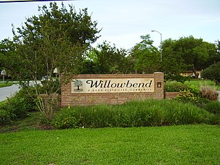
Willowbend is a neighborhood in Houston, Texas.

Independence Heights is a community in Houston, Texas, bordered by 40th Street east of N. Main and 40th Street west of N. Main to the north, Yale Street to the west, the 610 Loop to the south, and Airline Drive to the east. The Super Neighborhood boundary created by the City of Houston is bordered by Tidwell to the north, Shepherd Drive to the west, the 610 Loop to the south, and Interstate 45 to the east.

First Ward, Houston

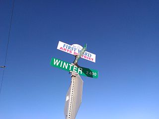
The First Ward of Houston, which is located inside the 610 Loop, is one of the city's historic wards. It was originally the center of the business district for the city, and was strategically located at the intersection of Buffalo Bayou and White Oak Bayou, near an area now known as Allen's Landing. It was one of the original four wards in Houston when it was created in 1840. It was defined as all area within the city limits of Houston north of Congress Street and west of Main Street.

Clinton Park, Houston

Clinton Park is a neighborhood located in Houston, Texas. Clinton Park is located outside the 610 Loop in eastern Houston. Clinton Park is predominantly African-American. Carolyn Campbell of KHOU-TV described Clinton Park, close to the Port of Houston, as "small" and "isolated."

Magnolia Park, Houston

Magnolia Park is an area of the East End, Houston, Texas, located near the Houston Ship Channel. One of the oldest Hispanic neighborhoods in the City of Houston, Magnolia Park was formerly incorporated as the City of Magnolia Park in eastern Harris County.

Glenbrook Valley, Houston

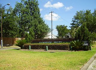
Glenbrook Valley is a subdivision located in Houston, Texas, United States.

Lindale Park, Houston Neighborhood in Houston, Texas

Lindale Park is a neighborhood in Houston, Texas.

East End, Houston

East End Houston, managed by the East End District (EED), is a district in eastern Houston, Texas, United States, located between the eastern edge of downtown to the Port of Houston and South to Hobby Airport. The District is home to Houston's early history and industry and is the site of Harrisburg, the seat of government for the Republic of Texas in 1836. East End Houston consists of many different ethnic groups, including Hispanic, Asian, White, and African American. Latinos make up more than half of the 100,512 residents, The area includes two of Houston's oldest Hispanic neighborhoods, Magnolia Park and Second Ward.

Riverside Terrace is a neighborhood in Houston, Texas, United States. It is along Texas State Highway 288 and north of the Texas Medical Center and located near Texas Southern University and University of Houston. There about 20 sections of Riverside Terrace that span across North and South MacGregor. The community, formerly an affluent Jewish neighborhood, became an affluent community for African Americans in the 1950s and '60s. It is still predominantly African American neighborhood with different income levels. It has been undergoing a gradual change in demographics and aesthetics due to gentrification efforts since the early 2000s.

Port Houston is a neighborhood located on the East Side of Houston, Texas, United States.

Knollwood Village, Houston

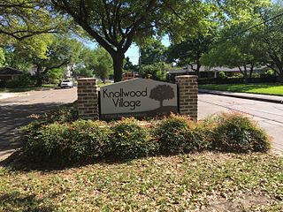
Knollwood Village is a subdivision in Houston, Texas. It is managed by the Knollwood Village Civic Club (KVCC), which governs Knollwood Village sections 1-10 and Braes Terrace II.

References

  1. 1 2 3 4 Athavaley, Anjali. "INSIDE THE LOOP Finding happiness as an Inner Looper." Houston Chronicle . July 10, 2004. Retrieved on January 7, 2011.
  2. 1 2 3 Connelly, Richard. "The Five Most Underrated Neighborhoods In Houston." Houston Press . Friday August 13, 2010. Retrieved on November 3, 2012.
  3. 1 2 "About Idylwood." Idlywood Civic Club. Retrieved on January 7, 2011. "Encroaching commerce is kept at bay on three sides of the neighborhood, thanks to the Villa de Matel, Wortham Golf Course, and Brays Bayou."
  4. Gray, Lisa. "East End becomes artist's muse." Houston Chronicle . October 29, 2009. Retrieved on January 7, 2011.
  5. City of Houston, Council District Maps, District I Archived 2013-09-18 at the Wayback Machine ." City of Houston. Retrieved on November 5, 2011.
  6. 1 2 "Clinic/Emergency/Registration Center Directory By ZIP Code". Harris County Hospital District. 2001-11-19. Archived from the original on 2001-11-19. Retrieved 2021-04-08. - See ZIP code 77023. See this map for relevant ZIP code.
  7. "Gulfgate Health Center" (Archive). Harris County Hospital District. Accessed October 17, 2008.
  8. "J.P. Henderson Elementary Attendance Zone." Houston Independent School District. December 19, 2016.
  9. "Navarro Middle Attendance Zone." Houston Independent School District. Retrieved on December 19, 2016.
  10. "Austin High School Attendance Zone." Houston Independent School District. Retrieved on December 19, 2016.
  11. "Our Parks O-Z." City of Houston. Retrieved on January 7, 2011.
  12. "Spurlock Park." Idylwood Civic Club. Retrieved on January 7, 2011.

Coordinates: 29°43′16″N95°18′36″W / 29.721°N 95.310°W / 29.721; -95.310