Related Research Articles

Jacinto City is a city in Harris County, Texas, United States, east of the intersection of Interstate 10 and the East Loop of Interstate 610. Jacinto City is part of the Houston–Sugar Land–Baytown metropolitan area and is bordered by the cities of Houston and Galena Park. The population was 9,613 at the 2020 census.
Harrisburg is a community that is now located within the city of Houston, Texas, United States.
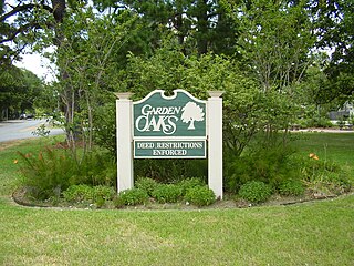
Garden Oaks is a neighborhood in Houston, Texas (USA). The neighborhood, located north of Houston Heights, was established in 1937 by Edward L. Crain.

Briargrove is a neighborhood in Houston, Texas, United States, near Uptown Houston.
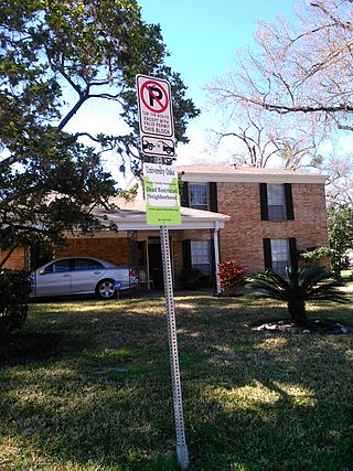
University Oaks is a subdivision in southeast Houston with approximately 240 homes located adjacent to the University of Houston. It is bounded by Wheeler Avenue to the north, South MacGregor Way to the south, Calhoun Road to the east, and Cullen Boulevard to the west.

Jones Futures Academy, previously Jesse H. Jones High School, is a public high school in South Park, Houston, Texas, United States. It has Dual Credit Magnet Program with emphasis in Health Sciences and Petroleum Engineering. Students who maintain the course of the entire program would graduate high school in May/June of their Sr. year and will have the ability to receive an associate degree in August following their graduation in one of their offered degree programs. Jones, which serves grades 9 through 12, is a part of the Houston Independent School District. Jones was named after Jesse Holman Jones.
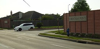
Corinthian Pointe is a large planned affordable subdivision located in Houston, Texas, in the United States. It is a part of the larger master planned community Pointe 2.3.4, and is within the 5 Corners District.

Ebbert L. Furr High School is a secondary school located in Houston, Texas, United States. Furr, which serves grades 9 through 12, is a part of the Houston Independent School District.

Clinton Park is a neighborhood located in Houston, Texas. Clinton Park is located outside the 610 Loop in eastern Houston. Clinton Park is predominantly African-American. Carolyn Campbell of KHOU-TV described Clinton Park, close to the Port of Houston, as "small" and "isolated."

Magnolia Park is an area of the East End, Houston, Texas, located near the Houston Ship Channel. One of the oldest Hispanic neighborhoods in the City of Houston, Magnolia Park was formerly incorporated as the City of Magnolia Park in eastern Harris County.
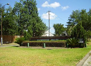
Glenbrook Valley is a subdivision located in Houston, Texas, United States.
James D. Ryan Middle School was a secondary school located in Houston, Texas, United States. The Baylor College of Medicine Academy at Ryan, a magnet middle school, now occupies the campus.
Near Northside is a historic neighborhood located in Northside, Houston, Texas. Near Northside is primarily occupied by people of Hispanic descent.

Pleasantville is a neighborhood located in Houston, Texas, United States.

Idylwood is a historic neighborhood in the southeastern part of the I-610 loop in Houston, Texas. Idylwood, as of 2021, is the most expensive neighborhood in the East End. As of that year its houses were priced between $295,000 and $679,900. It currently has approximately 340 homes. Bill England, a redeveloper in the East End area, stated in 2004 that Idylwood appealed to buyers who are priced out of houses located in the cities of Bellaire and West University Place.

East Downtown Houston (EaDo) is a district in Houston, Texas. The East Downtown Management District (EDMD), manages the area with offices headquartered at START Houston, a co-working space 1121 Delano Street. The community is located east of Downtown Houston and north of Interstate 45. It is between the George R. Brown Convention Center and the East End district.
The Airline Improvement District is a management district in unincorporated Harris County, Texas in Greater Houston and located entirely within the postal zip code of 77037.

Westwood is a residential subdivision in Southwest Houston, Texas. The subdivision is bounded by the 610 Loop, the Union Pacific railroad tracks, Stella Link Road, and Willowbend Boulevard. It has about 800 houses.
Parkway Villages is a 577-lot, 224-acre (91 ha) subdivision in western Houston, Texas. It is located north of Lakes of Parkway, the former Barnhardt land tract. It was the first single family housing development by Sueba USA, a subsidiary of Süba Freie Baugesellschaft.
References
- ↑ "The Port Houston Collaborative Archived 2008-05-18 at the Wayback Machine ." St. Luke's Episcopal Health Charities.
- 1 2 Lomax, John Nova. "The East End Trek Archived 2009-10-08 at the Wayback Machine ." Houston Press . September 13, 2007. Retrieved on April 20, 2009.
- 1 2 3 Isensee, Laura. "Port Houston Community Defends School From Closure Archived 2014-03-06 at the Wayback Machine ." KUHF . February 27, 2014. Retrieved on February 27, 2014.
- ↑ City of Houston, Council District Maps, District H Archived 2012-06-26 at the Wayback Machine ." City of Houston. Retrieved on November 5, 2011.
- ↑ "State-of-the-Art Emergency Response Vessel Headed Home". Port of Houston Authority . Houston. 2014-05-14. Retrieved 2019-08-30.
As a result, the fireboat Port Houston was built in 1925 and delivered the following year to the delight of thousands of spectators watching its arrival. The following day, another 4,000 citizens turned out for a demonstration of the fireboat pumping water.
- 1 2 "Clinic/Emergency/Registration Center Directory By ZIP Code". Harris County Hospital District. 2001-11-19. Archived from the original on 2001-11-19. Retrieved 2021-04-08. - See ZIP code 77029. See this map for relevant ZIP code.
- ↑ "Gulfgate Health Center" (Archive). Harris County Hospital District. Accessed October 17, 2008.
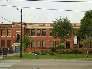
- ↑ "Port Houston Elementary Attendance Zone Archived 2012-03-10 at the Wayback Machine ," Houston Independent School District . Retrieved on April 20, 2009.
- ↑ "Holland Middle Attendance Zone Archived 2008-04-11 at the Wayback Machine ," Houston Independent School District . Retrieved on April 20, 2009.
- ↑ "Furr High School Attendance Zone Archived 2011-07-26 at the Wayback Machine ," Houston Independent School District . Retrieved on April 20, 2009.
- ↑ "School Histories: the Stories Behind the Names Archived 2011-07-10 at the Wayback Machine ." Houston Independent School District . Retrieved on September 24, 2008.
- ↑ "Three schools eliminated from HISD closure, consolidation proposal Archived 2014-03-11 at the Wayback Machine ." Houston Independent School District. Retrieved on March 11, 2014.
