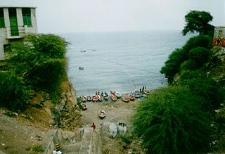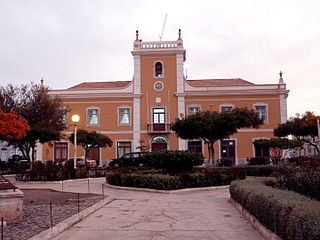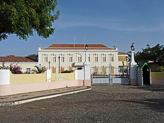
Cidade Velha is a city in the southern part of the island of Santiago, Cape Verde. Founded in 1462, it is the oldest settlement in Cape Verde and its former capital. Once called Ribeira Grande, its name was changed to Cidade Velha in the late 18th century. It is the seat of the Ribeira Grande de Santiago municipality.

Boa Vista, also written as Boavista, is a desert-like island that belongs to the Cape Verde Islands. At 631.1 km2 (243.7 sq mi), it is the third largest island of the Cape Verde archipelago.

Tarrafal is a concelho (municipality) of Cape Verde. It is situated in the northern part of the island of Santiago. Its seat is the town Tarrafal. Its population was 18,565 at the 2010 census, and its area is 120.8 km2.

Santa Cruz is a concelho (municipality) of Cape Verde. It is situated in the eastern part of the island of Santiago. Its seat is the city Pedra Badejo. Its population was 26,617 at the 2010 census, and its area is 112.2 km2.

Assomada is a city on the Sotavento (leeward) island of Santiago in Cape Verde. Since 1912, it is the seat of the municipality of Santa Catarina, which comprises the central western part and much of the interior of the island. It is the largest city in that region.

Lombo Branco is a settlement in the northeastern part of the island of Santo Antão, Cape Verde. It is situated 4 km southeast of Ribeira Grande and 17 km north of the island capital Porto Novo.

Praia is a concelho (municipality) of Cape Verde. It is situated in the southern part of the island of Santiago. Its seat is the city Praia, the capital of Cape Verde. Its area is 120.6 km2 (46.6 sq mi), and its population was 131,719 at the 2010 census. The municipality consists of one freguesia, Nossa Senhora da Graça. The city hall is located in the Platô part of the city.
The Cape Verdean Athletics Federation is the governing body for the sport of athletics in Cape Verde.

Plateau is the historic centre of the capital city of Praia in the island of Santiago, Cape Verde. It gets its name because it is situated on a plateau overlooking the port of Praia. Its average elevation is 37 meters above sea level. The population of Plateau was 1,019 at the 2010 census. Many public buildings are situated in Plateau, notably the Presidential Palace, the cathedral, the city hall and the Ethnographic Museum.

Chã de Areia is a subdivision of the city of Praia in the island of Santiago, Cape Verde. Its population was 247 at the 2010 census. It is situated south and west of the city centre. Adjacent neighbourhoods include Plateau to the northeast, Achadinha to the north, Várzea to the west, Achada Santo António to the southwest and Prainha to the south. Its main streets are Avenida Combatentes da Liberdade da Patria and Avenida Cidade de Lisboa. Points of interest in Chã de Areia include the beach of Gamboa, the old port of Praia and the Cape Verdean National Archives, housed in the former customs building.

GimnodesportivoVavá Duarte is a multi-purpose stadium in Praia, Cape Verde south of the city center's plateau in the subdivision of Gamboa just south of Várzea and is located on Avenida de Cuba, a road connecting the south of the city and the north and the southwest of the island. It is currently used for basketball, volleyball and futsal matches. The arena are operated by the Santiago South Regional Basketball Association for basketball, the Santiago South Regional Volleyball Association for volleyball and probably the Santiago Regional Futsal Association for futsal. These associations are also headquartered in the arena and around it.

Palmarejo is a subdivision of the city of Praia in the island of Santiago, Cape Verde. Its population was 12,037 at the 2010 census. It is situated southwest of the city centre. Adjacent neighbourhoods are Tira Chapéu to the north, Achada Santo António in the east, Quebra Canela in the southeast, Cidadela in the west and Palmarejo Grande in the northwest. The main campus of the University of Cape Verde is located in Palmarejo.
Tira Chapéu is a subdivision of the city of Praia in the island of Santiago, Cape Verde. Its population was 5,785 at the 2010 census. It is situated west of the city centre. Adjacent neighbourhoods are Terra Branca to the northeast, Achada Santo António to the southeast, Palmarejo to the southwest and west and Bela Vista to the northwest.

Fonte Cónego is a subdivision of the city of Mindelo in the island of São Vicente, Cape Verde. Its population was 236 at the 2010 census. It is situated directly east of the city centre. Adjacent neighborhoods include Alto Miramar to the northwest, Alto Santo António to the north, Alto Solarine/Forca to the northeast and Ribeira Bote to the south.
Terra Branca is a subdivision of the city of Praia in the island of Santiago, Cape Verde. Its population was 4,470 at the 2010 census. It is situated west of the city centre. Adjacent neighbourhoods are Várzea to the east, Achada Santo António to the south and Tira Chapéu to the west.


