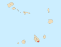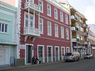
Praia is the capital and largest city of Cape Verde. Located on the southern coast of Santiago island, within the Sotavento Islands group, the city is the seat of the Praia Municipality. Praia is the economic, political, and cultural center of Cape Verde.

Cabo Delgado is the northernmost province of Mozambique. It has an area of 82,625 km2 (31,902 sq mi) and a population of 2,320,261 (2017). As well as bordering Mtwara Region in the neighboring country of Tanzania, it borders the provinces of Nampula and Niassa. The region is an ethnic stronghold of the Makonde tribe, with the Makua and Mwani as leading ethnic minorities.
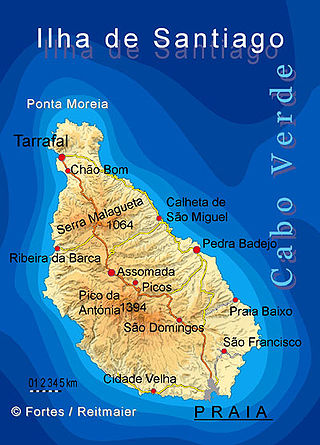
Santiago is the largest island of Cape Verde, its most important agricultural centre and home to half the nation's population. Part of the Sotavento Islands, it lies between the islands of Maio and Fogo. It was the first of the islands to be settled: the town of Ribeira Grande was founded in 1462. Santiago is home to the nation's capital city of Praia.

Torres is a city on the coast of south Brazil in the state of Rio Grande do Sul. The city has a population of approximately 40,000 inhabitants, of which 10,000 live in rural zones, but in summer the number of inhabitants reaches 300,000.

Nelson Mandela International Airport, also known as Praia International Airport, is the airport of Santiago Island in Cape Verde. It was opened in October 2005, replacing the old Francisco Mendes International Airport. It is located about 3 km northeast of the city centre of Praia in the southeastern part of the island of Santiago.

Inhambane, also known as Terra de Boa Gente, is a city located in southern Mozambique, lying on Inhambane Bay, 470 km northeast of Maputo. It is the capital of the Inhambane Province and according to the 2017 census has a population of 79,724, growing from the 1997 census of 54,157.

Furna is a seaside community in the northeastern part of the island of Brava, Cape Verde. It lies 2.5 km northeast of the island capital of Nova Sintra. At the 2010 census its population was 612.

Ponta do Barril is a headland in the western part of the island of São Nicolau, Cape Verde. It is about 8 km northwest of Tarrafal de São Nicolau and 5 km southwest of the nearest village Praia Branca.

Pipa Beach is one of the most famous beaches of Brazil. Located next to city of Natal, the capital city of state of Rio Grande do Norte. Is located more precisely in municipality of Tibau do Sul, exactly 84 km from the capital of the state.
Ponta Varandinha is a headland and the westernmost point of the island of Boa Vista, Cape Verde. To its north lies the beach Praia da Varandinha. The nearest village is Povoação Velha, 5 km to the east. There is a lighthouse on the cape. Its focal height is 22 meters and its range extends to 10 nautical miles.

Carrapateira is a village on the western coast of the Algarve, Portugal. Administratively, it is part of the civil parish of Bordeira, within the municipality of Aljezur, in the Faro District. Its landmarks include an old fort and a church. The nearby beaches are a popular surfing destination.
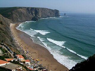
Praia da Arrifana is a beach within the Municipality of Aljezur, in the Algarve, Portugal. The beach is on the western Seaboard in the north west of the Algarve. The beach is 6.0 miles (9.7 km) south south west of the village of Aljezur, and is 71.0 miles (114.3 km) north west, by road, from the regions capital of Faro. The beach of Praia da Arrifana is inside the Vicentine Coast Natural Park, an area of outstanding natural beauty. Praia da Arrifana has been designated a blue Flag beach (2012).

Farol de Dona Maria Pia is a lighthouse at the southernmost point of the island of Santiago, Cape Verde. It stands on the headland Ponta Temerosa, at the entrance of Praia Harbour, 2 km south of the city centre of Praia. The lighthouse was built in 1881 and was named after Maria Pia of Savoy, queen of Portugal at the time. The octagonal tower is 21 m high and its focal plane is 25 m above mean sea level. It is painted white. The lighthouse is used for navigational purposes.

Ponta Temerosa is a headland on the island of Santiago, Cape Verde. Located in the south of the capital Praia, it is the southernmost point of the island. It is 2 km south from the city center. The lighthouse Farol de D. Maria Pia stands at the eastern point of the headland, marking the entrance to the Praia Harbour.
Pipas Bay is a bay in Angola. It is located in the Namibe Province, 30 km north of Moçâmedes.

Ervatão or Porto de Ervatão is a beach on the southeast coast of the island of Boa Vista in Cape Verde. At its eastern end is the headland Ponta de Ervatão and at its western end is the headland Ponta Cosme. Ervatão is part of the Turtle Nature Reserve. The area of Ervatão receives 70% of all turtles nesting on Boa Vista. In July 2009, 8,000 turtle nests were counted.

Praia da Varandinha is a beach on the southwest coast of the island of Boa Vista in Cape Verde. It lies north of the headland Ponta Varandinha. The beach forms part of the protected area Morro de Areia Nature Reserve.
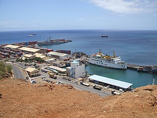
Praia Harbor is the port of the city of Praia in the southern part of the island of Santiago, Cape Verde. It is situated in a natural bay of the Atlantic Ocean. Since the latest modernization in 2014, it has 2 long quays, 3 shorter quays, a quay for fishing boats with fish processing installations, 2 container parks, 2 roll-on/roll-off ramps and a passenger terminal. The total length of the quays is 863 m, and the maximum depth is 13.5 m. The port of Praia played an important role in the colonization of Africa and South America by the Portuguese. With 817,845 metric tonnes of cargo and 85,518 passengers handled (2017), it is the second busiest port of Cape Verde, after Porto Grande (Mindelo).
Ponta do Lobo is a headland in the southeastern part of the island of Santiago, Cape Verde. It is in the municipality of São Domingos, 4 km east of Vale da Custa, 4 km southeast of Moia Moia and 11 km northeast of Praia. The nearby bay Porto Lobo was mentioned as P. Lobo on the 1747 map by Jacques-Nicolas Bellin. The Ponta do Lobo Lighthouse stands on the headland.
Ponta do Lobo Lighthouse is a lighthouse located near the headland named Ponta do Lobo, in the southeastern part of the island of Santiago, Cape Verde. The lighthouse is located about 4 km east of the nearest village, Vale da Custa, and 11 km northeast of the capital Praia. The lighthouse was built in 1887 and is the island's second oldest. It is a 9 metres high trapezoidal tower, attached to a single storey keeper's house. Its class of light is Fl (4) W 15s., its focal height is at 17 meters above sea level and its range is 10 nautical miles.