Acqua Tignese

Last updated
Acqua Tignese
Ersa Acqua Tignese.jpg
Mouth of the Acqua Tignese
Corse region relief location map.jpg
Red pog.svg
Location
Country France
Region Corsica
Department Haute-Corse
Canton Capobianco
Physical characteristics
SourceMonte di e Castelle
  location Rogliano
  coordinates 42°56′45″N9°23′41″E / 42.94583°N 9.39472°E / 42.94583; 9.39472
  elevation500 metres (1,600 ft)
Mouth Ligurian Sea
  location
between Rogliano and Ersa
  coordinates
43°00′20″N9°24′17″E / 43.00556°N 9.40472°E / 43.00556; 9.40472 Coordinates: 43°00′20″N9°24′17″E / 43.00556°N 9.40472°E / 43.00556; 9.40472
  elevation
0 metres (0 ft)
Length9 kilometres (5.6 mi) [1]

The Acqua Tignese is a stream in the Haute-Corse department of the Corsica region that has its mouth north of Cap Corse, in the Ligurian Sea.

Contents

Geography

The island of Giraglia opposite the river mouth to the north of Cap Corse Ersa Ile Giraglia.jpg
The island of Giraglia opposite the river mouth to the north of Cap Corse

The Acqua Tignese has a length of 9 kilometres (5.6 mi). [1] It has its source in the municipality of Rogliano at an altitude of 500 metres (1,600 ft). [2] The source is 200 meters west of Monte di e Castelle (602 metres (1,975 ft) high).

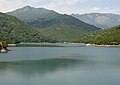
The river flows generally from the south to the north of Cap Corse.

It has its mouth on the Ligurian Sea between the municipalities of Ersa and Rogliano. [2] Its mouth is between the port of Barcaggio to the west and the beach of Cala to the east, opposite the island of Giraglia.

The neighboring rivers are to the south, the Luri.

Communes and cantons crossed

The Acqua Tignese crosses four communes in the Haute-Corse department. From upstream to downstream they are Rogliano (source), Morsiglia, Centuri and Ersa (mouth). [1] The Acqua Tignese flows entirely within the former canton of Capobianco in the arrondissement of Bastia.

Watershed

The area of the "Coastal stream of Pietracorbara with Granaggilo included" watershed is 113 square kilometres (44 sq mi). [1]

Managing body

The managing body since the Corsican law of 22 January 2002 has been the Corsican Basin Committee (Comité de bassin de Corse). [3]

Tributaries

The Acqua Tignese has no referenced tributaries. [1] The Strahler number is therefore one.

Hydrology

The Acqua Tignese at its mouth, near the port of Barcaggio (Ersa) Ersa-Barcaggio.jpg
The Acqua Tignese at its mouth, near the port of Barcaggio (Ersa)

An AEP monitoring station in the town of Ersa, at an altitude of 100 metres (330 ft) and a catchment area of 4.9 square kilometres (1.9 sq mi), studied its hydrology from 1979 to 1999. [4] The average flow was 0.032 cubic metres per second (1.1 cu ft/s). [4]

Average flow (cubic meters per second) by month for the period 1979 to 1999 [4]
MonthFlow
Jan
0.059
Feb
0.052
Mar
0.053
Apr
0.035
May
0.033
Jun
0.016
Jul
0.007
Aug
0.004
Sep
0.006
Oct
0.015
Nov
0.050
Dec
0.052

At low water the VCN3, or minimum flow rate of the watercourse recorded for three consecutive days in a month, in the case of a five-year dry period is 0.001 cubic metres per second (0.035 cu ft/s) or 1 litre per second (0.035 cu ft/s). [4]

Over this short observation period, the maximum daily flow was observed on 5 November 1993 at 1.21 cubic metres per second (43 cu ft/s). The maximum instantaneous flow was observed at 06:31 on 5 November 1993 at 12.21 cubic metres per second (431 cu ft/s). At that time the maximum instantaneous height was 193 centimetres (76 in). [4]

QIX 2 is 1.8 m3/s, QIX 5 is 3.6 m3/s, QIX 10 is 4.8 m3/s and QIX 20 is 5.9 m3/s. [4]

The rainfall in this part of the river's catchment area is 205 millimetres (8.1 in) per year, which is a third less than French average of 300 millimetres (12 in) per year. The specific flow rate (Qsp) reaches 6.5 liters per second / per square kilometer of basin. [4]

Human presence

Footbridge near the mouth Ersa passerelle Acqua Tignese.jpg
Footbridge near the mouth

Since 1979 there has been a project to build a dam on the Acqua Tignese.

The hydraulic problems of the municipalities of the northern part of Cap Corse being more and more worrying, on 21 July 1988, the Corsican Assembly adopted the motion relating to the construction of the Acqua Tignese dam. [5] The Acqua Tignese, "an undisturbed Mediterranean river (the Corsican brook salamander lives in the Acqua Tignese, would this be the case if the dam had been built?)". [6]

A footbridge crosses the river built about fifty meters from its mouth and is used by hikers along the sentier des douaniers and visitors going to the beach of Cala.

Ecology

Cala beach Ersa Barcaggio Plage de Cala.jpg
Cala beach

The Pointe du Cap Corse site of the Conservatoire du littoral, managed by the Association Finocchiarola-Pointe du Cap Corse, adjoins a good part of the lower course of the Acqua Tignese, especially near its mouth. [7]

Fauna

The stagnant, brackish and salty waters of the stream near its mouth are home to many protected animal species, amphibians from the anuran (without a tail) and urodela (with tail) groups: the Corsican fire salamander (Salamandra corsica) marginally present on the coast, and the Corsican brook salamander (Euproctus montanus) which are endemic, the Tyrrhenian painted frog (Discoglossus sardus) and the Sardinian tree frog (Hyla sarda) endemic to Corsica, Sardinia, Capraia and Elbe, the Italian pool frog (Pelophylax bergeri) which is expanding from the Pointe du Cap estuarine marshes into the upper course of the streams, finally the European green toad (Bufotes viridis) of the West Mediterranean which lives mainly on the coast, in the marshes and puddles of back dunes.

The Corsican euprocte lives in Acqua Tignese where adults and larvae take refuge in the basins during the dry season.

Flora

Some twenty-one rare threatened or endemic plants are present in the lagoon of Barcaggio and at the mouth of Acqua Tignese: [8]

Notes

    1. 1 2 3 4 5 L'Acqua Tignese Y7410600.
    2. 1 2 Portail national de la connaissance ...
    3. Le comité de bassin de Corse.
    4. 1 2 3 4 5 6 7 L'Acqua Tignese à Ersa.
    5. Assemblée de Corse - Délibération no 88/47 AC du 21 juillet 1988
    6. Batraciens 2009.
    7. FR1100048 - Pointe du Cap Corse.
    8. Cap Corse ... Conservatoire.

    Sources

    Related Research Articles

    <span class="mw-page-title-main">Ersa, Haute-Corse</span> Commune in Corsica, France

    Ersa is a commune of the Haute-Corse department of France on the island of Corsica.

    <span class="mw-page-title-main">Rogliano, Haute-Corse</span> Commune in Corsica, France

    Rogliano is a commune in the French department of Haute-Corse, Corsica.

    <span class="mw-page-title-main">Torra di Santa Maria Chjapella</span> Genoese coastal defence tower in Corsica

    The Tower of Santa Maria Chjapella is a ruined Genoese tower located in the commune of Rogliano on the east coast of the Corsica. Only part of the tower survives.

    The Canton of Cap Corse is an administrative division of the French department of Haute-Corse, Corsica. It was created at the French canton reorganisation which came into effect in March 2015. Its seat is in San-Martino-di-Lota.

    <span class="mw-page-title-main">Arguenon</span> River in Brittany, France

    The Arguenon is a French coastal river in the Côtes-d'Armor department of the Brittany region. It flows into the English Channel.

    <span class="mw-page-title-main">Abatesco</span> River of the Haute-Corse department in Corsica

    The Abatesco is a French coastal river which flows through the Haute-Corse department and empties into the Tyrrhenian Sea.

    <span class="mw-page-title-main">Alesani River</span> River in the department of Haute-Corse, Corsica

    The Alesani River is a river in the Haute-Corse department in the island of Corsica, France.

    <span class="mw-page-title-main">Regino (river)</span> River in the department of Haute-Corse, Corsica

    The Regino River is a small coastal river in the department of Haute-Corse, Corsica, France.

    <span class="mw-page-title-main">Fango (river)</span> River in the department of Haute-Corse, Corsica

    The Fango is a small coastal river in the department of Haute-Corse, Corsica, France. The Fango Valley was designated a biosphere reserve in 1977. It holds flora and fauna representative of all regions of Corsica from the coast to the highest mountains.

    <span class="mw-page-title-main">Luri (river)</span> Stream in the department of Haute-Corse, Corsica

    The Luri is a coastal stream in the department of Haute-Corse, Corsica, France. It flows across the Cap Corse peninsula to the Tyrrhenian Sea.

    <span class="mw-page-title-main">Erco (river)</span> River in France

    The Erco is a stream in the department of Haute-Corse, Corsica, France. It is a tributary of the Golo.

    <span class="mw-page-title-main">Ospedale Reservoir</span> Body of water

    The Ospedale Reservoir is a reservoir in the Corse-du-Sud department of France on the island of Corsica. It holds drinking water for the southeast of the island, including Porto-Vecchio. It is surrounded by a forest that has been designated a Zone naturelle d'intérêt écologique, faunistique et floristique (ZNIEFF).

    <span class="mw-page-title-main">Figari Reservoir</span> Reservoir on Corsica, France

    The Figari Reservoir is a reservoir in the Corse-du-Sud department of France on the island of Corsica. It provides water for irrigation and human consumption.

    Bacciana Reservoir is a reservoir in the Haute-Corse department of France, on the island of Corsica. It supplies water for drinking and irrigation.

    Trévadine Reservoir is a reservoir in the Haute-Corse department of France, on the island of Corsica. It stores water for drinking and irrigation, which is fed to reservoirs in the coastal plain.

    <span class="mw-page-title-main">Rizzanese</span> River in Corsica, France

    The Rizzanese is a coastal river in the southwest of department of Corse-du-Sud, Corsica, France. It is dammed near Sorbollano to form the Rizzanese Reservoir, which stores water for irrigation and supplies the largest hydroelectric power plant in Corsica, with installed capacity of 55 MW. It flows into the Mediterranean Sea near the town of Propriano.

    The Chiuvone is a small river in the department of Corse-du-Sud, Corsica, France. It is a tributary of the river Rizzanese. There is a small hydroelectric power dam on the river.

    <span class="mw-page-title-main">Ortolo</span> River in Corsica, France

    The Ortolo is a coastal river in the southwest of the department of Corse-du-Sud, Corsica, France. It is dammed to store water for irrigation.

    The Buggiu or Valdolese, Vughio is a small coastal river in the department of Haute-Corse, Corsica, France. It flows into the Golfe de Saint-Florent in the north of the island. The estuary at its mouth has ecological value.

    <span class="mw-page-title-main">Poggiolo (stream)</span> Stream in the department of Haute-Corse, Corsica

    The Poggiolo is a small coastal stream in the department of Haute-Corse, Corsica, France. It enters the Tyrrhenian Sea from the east of the Cap Corse peninsula.