Human impacts
In the late 19th century the decline in agriculture led to croplands and pasture being replaced by wild undergrowth and woods, which reduced the amount of erosion and run-off. This in turn led to less sediment being carried to the mouth of the river. In the 1970s in-channel gravel mining began in the river, and about 600,000 cubic metres (21,000,000 cu ft) of gravel were removed. The gravel pit traps sediment, and has caused braided channels to be replaced by a single channel. Most of the former channels are now vegetated. Downstream, the result has been erosion of the beach, which started in the 19th century and is likely to continue for several decades, destroying a tourist attraction.

The Liamone river is a river of Corsica, France. The river gave its name to the former French department of Liamone. In antiquity, it bore the Latin name Circidius.

The Arguenon is a French coastal river in the Côtes-d'Armor department of the Brittany region. It flows into the English Channel.

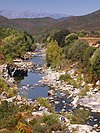
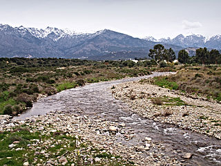
The Aliso River is a small coastal river in the department of Haute-Corse, Corsica, France.
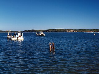
The Étang de Diane is a coastal lagoon beside the Tyrrhenian Sea on the east coast of Haute-Corse department on the French island of Corsica. The lagoon served as a port for the Ancient Greeks, and then for the Romans. Today it is privately owned and mainly used for shellfish farming and fishing.

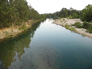
The Regino River is a small coastal river in the department of Haute-Corse, Corsica, France.

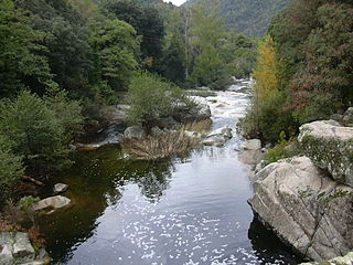
The Tagnone is a small river in the department of Haute-Corse, Corsica, France. It is a tributary of the river Tavignano.

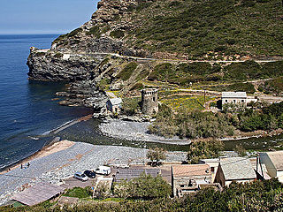
The Luri is a coastal stream in the department of Haute-Corse, Corsica, France. It flows across the Cap Corse peninsula to the Tyrrhenian Sea.
The Solenzara is a small coastal river in the departments of Corse-du-Sud and Haute-Corse, Corsica, France.

The Buccatoggio, or Bucatoggio, is a small coastal river in the department of Haute-Corse, Corsica, France. It rises in the Monte San Petrone massif and flows into the Tyrrhenian Sea on the east of the island.

The Ruisseau de Pietracorbara is a coastal stream in the department of Haute-Corse, Corsica, France. It rises in the Monte Stello massif on Cap Corse and flows into the Tyrrhenian Sea on the east of the island.

The Prunelli is a small coastal river in the department of Corse-du-Sud, Corsica, France. It flows into the Golfe d'Ajaccio on the Mediterranean Sea.
The Rizzanese is a coastal river in the southwest of department of Corse-du-Sud, Corsica, France. It is dammed near Sorbollano to form the Rizzanese Reservoir, which stores water for irrigation and supplies the largest hydroelectric power plant in Corsica, with installed capacity of 55 MW. It flows into the Mediterranean Sea near the town of Propriano.

The Baraci is a small coastal river in the southwest of the department of Corse-du-Sud, Corsica, France.

The Francolu is a coastal stream in the southeast of the department of Corse-du-Sud, Corsica, France.

The Canella is a coastal stream in the south of the department of Corse-du-Sud, Corsica, France. It has ecologically interesting wetlands at its mouth.

The Liscu ) is a small coastal river in the north of the department of Haute-Corse, Corsica, France.
The Seccu River is a small coastal river in the department of Haute-Corse, Corsica, France.
The Alistro is a small coastal river in the department of Haute-Corse, Corsica, France. It enters the Tyrrhenian Sea from the east of the island.
The Olmeta is a small coastal stream in the department of Haute-Corse, Corsica, France. It enters the Mediterranean Sea from the west of the Cap Corse peninsula.
The Col de Marsolino is a mountain pass in the Haute-Corse department of Corsica, France. The pass is in the west of the Monte Cinto massif. It connects Calvi and Calenzana to Galéria. Its low altitude allows it to be open almost all year round.
This page is based on this
Wikipedia article Text is available under the
CC BY-SA 4.0 license; additional terms may apply.
Images, videos and audio are available under their respective licenses.