Aguas Blancas, Yauco, Puerto Rico

Last updated
Aguas Blancas
Barrio
Aguas Blancas, Yauco, Puerto Rico locator map.png
Location of Aguas Blancas within the municipality of Yauco shown in red
Caribbean location map.svg
Red pog.svg
Aguas Blancas
Location of Puerto Rico
Coordinates: 18°07′38″N66°49′31″W / 18.127108°N 66.825337°W / 18.127108; -66.825337 [1]
Commonwealth Flag of Puerto Rico.svg  Puerto Rico
Municipality Bandera de Yauco, Puerto Rico.svg Yauco
Area
[1]
  Total4.7 sq mi (12 km2)
  Land4.7 sq mi (12 km2)
  Water0 sq mi (0 km2)
Elevation
[2]
2,297 ft (700 m)
Population
 (2010)
  Total231
  Density49.1/sq mi (19.0/km2)
 Source: 2010 Census
Time zone UTC−4 (AST)

Aguas Blancas is a barrio in the municipality of Yauco, Puerto Rico. Its population in 2010 was 231. [3] [4] [5]

Contents

History

Aguas Blancas was in Spain's gazetteers [6] until Puerto Rico was ceded by Spain in the aftermath of the Spanish–American War under the terms of the Treaty of Paris of 1898 and became an unincorporated territory of the United States. In 1899, the United States Department of War conducted a census of Puerto Rico finding that the population of Aguas Blancas barrio was 1,170. [7]

Geography

Aguas Blancas is located in the Cordillera Central in northern Yauco, and the highest point of the municipality, at 2,864 ft (873 m) above sea level, [8] is partially located in the boundary with the Duey and Sierra Alta barrios. [9] Duey River also runs through and originates in this barrio. [10]

Demographics

Historical population
CensusPop.Note
1900 1,170
1910 940−19.7%
1920 935−0.5%
1930 778−16.8%
1940 7830.6%
1950 686−12.4%
1960 654−4.7%
1970 394−39.8%
1980 333−15.5%
1990 255−23.4%
2000 31623.9%
2010 231−26.9%
U.S. Decennial Census
1899 (shown as 1900) [11] 1910-1930 [12]
1930-1950 [13] 1980-2000 [14] 2010 [15]

See also

Related Research Articles

<span class="mw-page-title-main">Juan Asencio, Aguas Buenas, Puerto Rico</span> Barrio of Puerto Rico

Juan Asencio is a barrio in the municipality of Aguas Buenas, Puerto Rico. Its population in 2010 was 2,819.

<span class="mw-page-title-main">Sumidero, Aguas Buenas, Puerto Rico</span> Barrio of Puerto Rico

Sumidero is a barrio in the municipality of Aguas Buenas, Puerto Rico. Its population in 2010 was 8,008. In Sumidero barrio is part of the Aguas Buenas urban zone and the Santa Clara community.
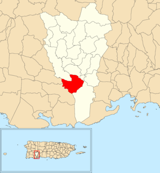
<span class="mw-page-title-main">Algarrobo, Yauco, Puerto Rico</span> Barrio of Puerto Rico

Algarrobo is a barrio in the municipality of Yauco, Puerto Rico. Its population in 2010 was 419.

<span class="mw-page-title-main">Collores, Yauco, Puerto Rico</span> Barrio of Puerto Rico

Collores is a barrio in the municipality of Yauco, Puerto Rico. Its population in 2010 was 773.

<span class="mw-page-title-main">Quebradas, Yauco, Puerto Rico</span> Barrio of Puerto Rico

Quebradas is a barrio in the municipality of Yauco, Puerto Rico. Its population in 2010 was 883.

<span class="mw-page-title-main">Caimito, Yauco, Puerto Rico</span> Barrio of Puerto Rico

Caimito is a barrio in the municipality of Yauco, Puerto Rico. Its population in 2010 was 431.

<span class="mw-page-title-main">Frailes, Yauco, Puerto Rico</span> Barrio of Puerto Rico

Frailes is a barrio in the municipality of Yauco, Puerto Rico. Its population in 2010 was 321.

<span class="mw-page-title-main">Susúa Baja, Yauco, Puerto Rico</span> Barrio of Puerto Rico

Susúa Baja is a barrio in the municipality of Yauco, Puerto Rico. Its population in 2010 was 11,856.

<span class="mw-page-title-main">Vegas, Yauco, Puerto Rico</span> Barrio of Puerto Rico

Vegas is a barrio in the municipality of Yauco, Puerto Rico. Its population in 2010 was 145.

<span class="mw-page-title-main">Duey Bajo, San Germán, Puerto Rico</span> Barrio of Puerto Rico

Duey Bajo is a barrio in the municipality of San Germán, Puerto Rico. Its population in 2010 was 980.

<span class="mw-page-title-main">Almácigo Bajo</span> Barrio of Yauco, Puerto Rico

Almácigo Bajo is a barrio in the municipality of Yauco, Puerto Rico. Its population in 2010 was 5,443.

<span class="mw-page-title-main">Barina, Yauco, Puerto Rico</span> Barrio of Puerto Rico

Barina is a barrio in the municipality of Yauco, Puerto Rico. Its population in 2010 was 5,930.

<span class="mw-page-title-main">Duey, Yauco, Puerto Rico</span> Barrio of Puerto Rico

Duey is a barrio in the municipality of Yauco, Puerto Rico. Its population in 2010 was 1,108.

<span class="mw-page-title-main">Ranchera, Yauco, Puerto Rico</span> Barrio of Puerto Rico

Ranchera is a barrio in the municipality of Yauco, Puerto Rico. Its population in 2010 was 446.

<span class="mw-page-title-main">Rubias, Yauco, Puerto Rico</span> Barrio of Puerto Rico

Rubias is a barrio in the municipality of Yauco, Puerto Rico. Its population in 2010 was 309.

<span class="mw-page-title-main">Duey Alto, San Germán, Puerto Rico</span> Barrio of Puerto Rico

Duey Alto is a barrio in the municipality of San Germán, Puerto Rico. Its population in 2010 was 1,350.

<span class="mw-page-title-main">Rosario Peñón</span> Barrio of San Germán, Puerto Rico

Rosario Peñón is a barrio in the municipality of San Germán, Puerto Rico. Its population in 2010 was 805.

<span class="mw-page-title-main">Almácigo Alto</span> Barrio of Yauco, Puerto Rico

Almácigo Alto is a barrio in the municipality of Yauco, Puerto Rico. Its population in 2010 was 1,659.

<span class="mw-page-title-main">Diego Hernández, Yauco, Puerto Rico</span> Barrio of Puerto Rico

Diego Hernández is a barrio in the municipality of Yauco, Puerto Rico. Its population in 2010 was 1,247.

<span class="mw-page-title-main">Jácana, Yauco, Puerto Rico</span> Barrio of Puerto Rico

Jácana is a barrio in the municipality of Yauco, Puerto Rico. Its population in 2010 was 1,690.

References

  1. 1 2 "US Gazetteer 2019". US Census. US Government.
  2. U.S. Geological Survey Geographic Names Information System: Aguas Blancas barrio
  3. Picó, Rafael; Buitrago de Santiago, Zayda; Berrios, Hector H. Nueva geografía de Puerto Rico: física, económica, y social, por Rafael Picó. Con la colaboración de Zayda Buitrago de Santiago y Héctor H. Berrios. San Juan Editorial Universitaria, Universidad de Puerto Rico,1969.
  4. Gwillim Law (20 May 2015). Administrative Subdivisions of Countries: A Comprehensive World Reference, 1900 through 1998. McFarland. p. 300. ISBN   978-1-4766-0447-3 . Retrieved 25 December 2018.
  5. Puerto Rico: 2010 Population and Housing Unit Counts.pdf (PDF). U.S. Dept. of Commerce, Economics and Statistics Administration, U.S. Census Bureau. 2010.
  6. "Anuario del comercio, de la industria, de la magistratura y de la administración. 1881". Biblioteca Nacional de España (in Spanish). p. 1614. Retrieved 4 April 2023.
  7. Joseph Prentiss Sanger; Henry Gannett; Walter Francis Willcox (1900). Informe sobre el censo de Puerto Rico, 1899, United States. War Dept. Porto Rico Census Office (in Spanish). Imprenta del gobierno. p.  165.
  8. "Pico Rodadero". peakery.com. Retrieved 2021-10-17.
  9. "Pico Rodadero". peakvisor.com. Retrieved 2022-11-30.
  10. "RIO DUEY NR YAUCO, PR". waterdata.usgs.gov. Retrieved 2022-11-30.
  11. "Report of the Census of Porto Rico 1899". War Department Office Director Census of Porto Rico. Archived from the original on July 16, 2017. Retrieved September 21, 2017.
  12. "Table 3-Population of Municipalities: 1930 1920 and 1910" (PDF). United States Census Bureau. Archived (PDF) from the original on August 17, 2017. Retrieved September 21, 2017.
  13. "Table 4-Area and Population of Municipalities Urban and Rural: 1930 to 1950" (PDF). United States Census Bureau. Archived (PDF) from the original on August 30, 2015. Retrieved September 21, 2014.
  14. "Table 2 Population and Housing Units: 1960 to 2000" (PDF). United States Census Bureau. Archived (PDF) from the original on July 24, 2017. Retrieved September 21, 2017.
  15. Puerto Rico: 2010 Population and Housing Unit Counts.pdf (PDF). U.S. Dept. of Commerce Economics and Statistics Administration U.S. Census Bureau. 2010. Archived (PDF) from the original on 2017-02-20. Retrieved 2019-08-02.