This article may be expanded with text translated from the corresponding article in German. (November 2010)Click [show] for important translation instructions.
|
Aileu | ||
---|---|---|
District | ||
River in Aileu | ||
| ||
Map of East Timor highlighting Aileu District | ||
Coordinates: 8°43′S125°34′E / 8.717°S 125.567°E Coordinates: 8°43′S125°34′E / 8.717°S 125.567°E | ||
Country | ||
Capital | Aileu | |
Subdistricts | Aileu, Laulara, Lequidoe, Remexio | |
Area | ||
• Total | 737 km2 (285 sq mi) | |
Area rank | 9th | |
Population (2015 census) | ||
• Total | 48,837 | |
• Rank | 12th | |
• Density | 66/km2 (170/sq mi) | |
• Density rank | 8th | |
Households (2015 census) | ||
• Total | 7,598 | |
• Rank | 13th | |
Time zone | TLT (UTC+09:00) | |
ISO 3166 code | TL-AL |
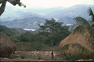
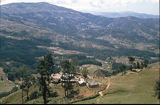
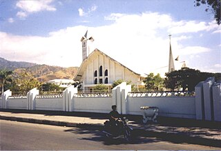
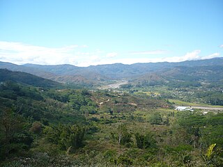
Aileu is an administrative district of East Timor. Aileu Municipality has a population of 48,554 (Census 2015) and an area of 737 km². [1] The capital of the district is also named Aileu. The subdistricts are Aileu Vila, Laulara, Lequidoe and Remexio.

East Timor or Timor-Leste, officially the Democratic Republic of Timor-Leste, is a country in Maritime Southeast Asia. It comprises the eastern half of the island of Timor, the nearby islands of Atauro and Jaco, and Oecusse, an exclave on the northwestern side of the island surrounded by Indonesian West Timor. Australia is the country's southern neighbour, separated by the Timor Sea. The country's size is about 15,410 km2.
Aileu is the main township in Aileu District, East Timor. It is located 47 km southwest of Dili, the national capital, and had a population of 2,788 in 2015. In Portuguese Timor, the city was known as Vila General Carmona, after the Portuguese dictator António Óscar Carmona, but after World War II it was renamed. Aileu means "bent tree" in Mambai.
Aileu is in the northwestern part of East Timor and is one of only two landlocked districts, the other being Ermera. It borders Dili to the north, Manatuto to the east, Manufahi to the southeast, Ainaro to the south, Ermera to the west, and Liquiçá to the northwest. It was formerly part of the district of Dili but was split in the final years of Portuguese administration.
As part of the Timor-Leste Government decentralization program the former District of Aileu is now organised as the Municipality of Aileu, headed by a Municipal Administrator. The four subdistricts are now organised as Administrative Posts. Aileu is the focus of several development programmes from NGOs, including WaterAid, [2] World Vision [3] and Plan International. [4] In May 2000 the Hume City Council and Moreland City Council and the communities in Melbourne Australia, established a friendship relationship with the Aileu Distrist, called "Friends of Aileu". The friendship relationship has been renewed periodically, with the signing of updated Friendship Agreements in 2005, 2010 and 2016. [5] and [6]
Melbourne is the capital and most populous city of the Australian state of Victoria, and the second most populous city in Australia and Oceania. Its name refers to an urban agglomeration of 9,992.5 km2 (3,858.1 sq mi), comprising a metropolitan area with 31 municipalities, and is also the common name for its city centre. The city occupies much of the coastline of Port Phillip bay and spreads into the hinterlands towards the Dandenong and Macedon ranges, Mornington Peninsula and Yarra Valley. It has a population of approximately 4.9 million, and its inhabitants are referred to as "Melburnians".
Australia, officially the Commonwealth of Australia, is a sovereign country comprising the mainland of the Australian continent, the island of Tasmania and numerous smaller islands. It is the largest country in Oceania and the world's sixth-largest country by total area. The neighbouring countries are Papua New Guinea, Indonesia and East Timor to the north; the Solomon Islands and Vanuatu to the north-east; and New Zealand to the south-east. The population of 25 million is highly urbanised and heavily concentrated on the eastern seaboard. Australia's capital is Canberra, and its largest city is Sydney. The country's other major metropolitan areas are Melbourne, Brisbane, Perth and Adelaide.
Baucau is a municipality, and was formerly a district, of East Timor, on the northern coast in the eastern part of the country. The capital is also called Baucau. The population of the municipality is 111,694 and it has an area of 1,506 km².
Bobonaro Municipality is a municipality in the Democratic Republic of Timor-Leste commonly known as East Timor. It is the second-most western municipality on the east half of the island. It has a population of 92,045 and an area of 1,376 km².
Liquiçá is one of the municipalities of East Timor. Its capital is also called Liquiçá.
Lautém is one of the municipalities of East Timor, on the eastern end of the island of Timor. It has a population of 64,135 and an area of 1,813 km². Its capital is Lospalos, which lies 248 km east of the national capital, Dili.
Manatuto is one of the municipalities of East Timor, located in the central part of the country. It has a population of 45,541 and an area of 1,78 km². The capital of the municipality is also named Manatuto.
Viqueque is the largest of the municipalities of East Timor. It has a population of 77,402 and an area of 1,877 km². The capital of the municipality is also named Viqueque.
Manufahi is one of the municipalities of East Timor. It has a population of 53,691 and an area of 1,323 km². The capital of the municipality is Same.
Ermera is one of the municipalities of East Timor, located in the west-central part of the country. It has a population of 117,064 and an area of 746 km².
Cova Lima is a municipality of East Timor, in the Southwest part of the country. It has a population of 59,455 and an area of 1,230 km². The capital of the municipality is Suai, which lies 136 km from Dili, the national capital. The administrative posts of Cova Lima are Fatululic, Fatumean, Fohorem, Zumalai, Maucatar, Suai, and Tilomar.
Dili is one of the 13 municipalities, formerly districts, of Timor-Leste, which includes the national capital Dili. It had a population of 277,279 as of 2015, most of whom live in the capital city. The municipality has an area of 368.12 km2 (142.13 sq mi). The municipality continued the same name as the council had in Portuguese Timor.
Ainaro is one of 13 municipalities of East Timor, in the southwest part of the country. It has a population of 59,175 and an area of 804 km². Its capital is the city of Ainaro, a small mountain town.
Gleno is a city in East Timor, 30 kilometres (19 mi) to the southwest of Dili, the national capital. It is in the suco of Riheu. Gleno has a population of 8,133 (2010). It lies 882 metres (2,894 ft) above sea level.
East Timor is divided into:
Taça Digicel was a football championship organized by the East Timor Football Federation. It was replaced by Taça 12 de Novembro in 2013.
Fatubessi is one of thirteen municipalities (sucos) under the sub-district administration of Hatulia, Ermera District, East Timor. There is a road east from Fatubessi to the town of Ermera.
The Berloi is a waterfall in East Timor.
The Mambai people are the second largest ethnic group after the Tetum Dili people in East Timor. Originally, they were known as the Maubere by the Portuguese. Maubere or Mau Bere is a widespread male first name among the Mambai people.