Viqueque District

Last updated

Viqueque
Vikeke
District

Viqueque rice field.jpg

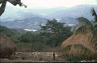
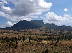
Rice fields in Viqueque
Flag of Viqueque.svg
Flag
East Timor Viqueque locator map 2003-2015.svg
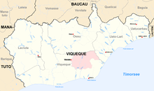
Map of East Timor highlighting Viqueque District
Coordinates: 8°47′S126°22′E / 8.783°S 126.367°E / -8.783; 126.367 Coordinates: 8°47′S126°22′E / 8.783°S 126.367°E / -8.783; 126.367
Country Flag of East Timor.svg  East Timor
Capital Viqueque
Subdistricts Lacluta, Ossu, Uato-Lari, Uato Carabau, Viqueque
Area
  Total 1,877 km2 (725 sq mi)
Area rank 1st
Population (2015 census)
  Total 73,033
  Rank 5th
  Density 39/km2 (100/sq mi)
  Density rank 10th
Households (2015 census)
  Total 15,297
  Rank 5th
Time zone TLT (UTC+09:00)
ISO 3166 code TL-VI

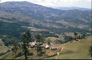
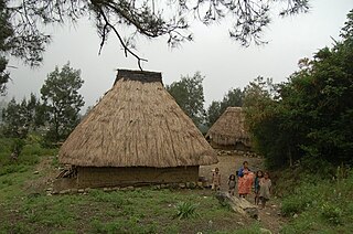
Viqueque (Tetum : Vikeke) is the largest of the districts of East Timor. It has a population of 77,402 (Census 2010) and an area of 1,877 km². [1] The capital of the district is also named Viqueque. The subdistricts are Lacluta, [2] Ossu, Uato-Lari (which was known in Portuguese Timor as Leça, and, in Tetum, is spelled Watulari), Uato Carabau (spelled Watucarbau, in Tetum) and Viqueque. The district was the same in colonial times.

Tetum language Austronesian language spoken on the island of Timor

Tetum (Portuguese), Tetun, is an Austronesian language spoken on the island of Timor. It is spoken in Belu Regency in Indonesian West Timor, and across the border in East Timor, where it is one of the two official languages. In East Timor Tetun Dili, or Tetun Prasa, is widely spoken fluently as a second language; without previous contact, the Tetum dialects and Tetun Dili are not immediately mutually intelligible, mainly because of the large number of Portuguese origin words used in Tetun Dili. Besides some grammatical simplification, Tetun Dili has been greatly influenced by the vocabulary and to a small extent by the grammar of Portuguese, the other official language of East Timor.

East Timor Country in Maritime Southeast Asia

East Timor or Timor-Leste, officially the Democratic Republic of Timor-Leste, is a country in Maritime Southeast Asia. It comprises the eastern half of the island of Timor, the nearby islands of Atauro and Jaco, and Oecusse, an exclave on the northwestern side of the island surrounded by Indonesian West Timor. Australia is the country's southern neighbour, separated by the Timor Sea. The country's size is about 15,410 km2.

Viqueque City in East Timor

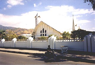
Viqueque is a city in the south-east of East Timor, 183 km from Dili, the national capital. Viqueque is the capital of Viqueque District and Viqueque Subdistrict, in the eastern part of the country with five subdistricts under its control, they are: Uatu-Lari, Uatu-Carbau, Viqueque, Lacluta and Ossu. The city has a population of 6,859 (2015), the subdistrict has 20,640 (2004), the district 65,245 inhabitants (2004).

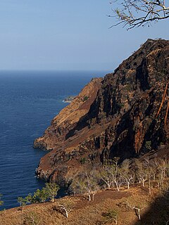
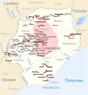
Viqueque is on the south coast of Timor, on the Timor Sea. It borders the districts Baucau to the north, Lautém to the east, and Manatuto to the west.

Timor island at the southern end of Maritime Southeast Asia

Timor is an island at the southern end of Maritime Southeast Asia, north of the Timor Sea. The island is divided between the sovereign states of East Timor on the eastern part and Indonesia on the western part. The Indonesian part, also known as West Timor, constitutes part of the province of East Nusa Tenggara. Within West Timor lies an exclave of East Timor called Oecusse District. The island covers an area of 30,777 square kilometres. The name is a variant of timur, Malay for "east"; it is so called because it lies at the eastern end of the Lesser Sunda Islands. Mainland Australia is less than 500 km away, separated by the mentioned Timor Sea.

Timor Sea A sea bounded to the north by the island of Timor, to the east by the Arafura Sea, to the south by Australia

The Timor Sea is a relatively shallow sea bounded to the north by the island of Timor, to the east by the Arafura Sea, to the south by Australia.

Viqueque is a homeland of the Malayo-Polynesian language Tetum. In East Timor it is co-official with Portuguese. In the east part of the district live speakers of the Papuan language Makasae.

Portuguese language Romance language that originated in Portugal

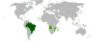
Portuguese is a Western Romance language originating in the Iberian Peninsula. It is the sole official language of Portugal, Brazil, Cape Verde, Guinea-Bissau, Mozambique, Angola, and São Tomé and Príncipe. It also has co-official language status in East Timor, Equatorial Guinea and Macau in China. As the result of expansion during colonial times, a cultural presence of Portuguese and Portuguese creole speakers are also found in Goa, Daman and Diu in India; in Batticaloa on the east coast of Sri Lanka; in the Indonesian island of Flores; in the Malacca state of Malaysia; and the ABC islands in the Caribbean where Papiamento is spoken, while Cape Verdean Creole is the most widely spoken Portuguese-based Creole. Reintegrationists maintain that Galician is not a separate language, but a dialect of Portuguese. A Portuguese-speaking person or nation is referred to as "Lusophone" (Lusófono).

On the south coast, the people report both myths and possible occurrences of crocodiles.

Subdivisions of Viqueque 2015 Viqueque beschriftet.png
Subdivisions of Viqueque
Cities and rivers of Viqueque Viqueque cities rivers.png
Cities and rivers of Viqueque

Related Research Articles

Díli City in Dili, East Timor

Dili, also known as “City of Peace”, is the capital, largest city, chief port, and commercial centre of East Timor (Timor-Leste). Dili is part of a free trade zone, the Timor Leste–Indonesia–Australia Growth Triangle (TIA-GT).

Western Region (Ghana) Region in Ghana

The Western Region is located in south Ghana, spreads from the Ivory Coast border in the west to the Central region in the east, includes the capital and large twin city of Sekondi-Takoradi on the coast, coastal Axim, and a hilly inland area including Elubo. It includes Ghana's southernmost location, Cape Three Points, where crude oil was discovered in commercial quantities in June 2007. The Western Region enjoys a long coastline that stretches from South Ghana's border with Ivory Coast to the Western region's boundary with the Central Region on the east.

Languages of East Timor languages of a geographic region

The languages of East Timor include both Austronesian and Papuan languages. The lingua franca and national language of East Timor is Tetum, an Austronesian language influenced by Portuguese, with which it has equal status as an official language. The language of the Ocussi exclave is Uab Meto (Dawan). Fataluku is a Papuan language widely used in the eastern part of the country. Both Portuguese and Tetum have official recognition under the Constitution of East Timor, as do other indigenous languages, including: Bekais, Bunak, Galoli, Habun, Idalaka, Kawaimina, Kemak, Lovaia, Makalero, Makasae, Mambai, Tokodede and Wetarese.

Baucau Municipality Municipality in East Timor

Baucau is a municipality, and was formerly a district, of East Timor, on the northern coast in the eastern part of the country. The capital is also called Baucau. The population of the municipality is 111,694 and it has an area of 1,506 km².

Bobonaro Municipality Municipality in East Timor

Bobonaro Municipality is a municipality in the Democratic Republic of Timor-Leste commonly known as East Timor. It is the second-most western municipality on the east half of the island. It has a population of 92,045 and an area of 1,376 km².

Aileu Municipality Municipality in East Timor

Aileu is a municipality, and was formerly a district, of East Timor. It has a population of 48,554 and an area of 737 km². The municipality's capital is also named Aileu. Its administrative posts are Aileu, Laulara, Lequidoe and Remexio.

Liquiçá Municipality Municipality in East Timor

Liquiçá is one of the municipalities of East Timor. Its capital is also called Liquiçá.

Lautém Municipality Municipality in East Timor

Lautém is one of the municipalities of East Timor, on the eastern end of the island of Timor. It has a population of 64,135 and an area of 1,813 km². Its capital is Lospalos, which lies 248 km east of the national capital, Dili.

Manatuto Municipality Municipality in East Timor

Manatuto is one of the municipalities of East Timor, located in the central part of the country. It has a population of 45,541 and an area of 1,78 km². The capital of the municipality is also named Manatuto.

Manufahi Municipality Municipality in East Timor

Manufahi is one of the municipalities of East Timor. It has a population of 53,691 and an area of 1,323 km². The capital of the municipality is Same.

Ermera Municipality Municipality in East Timor


Ermera is one of the municipalities of East Timor, located in the west-central part of the country. It has a population of 117,064 and an area of 746 km².

Cova Lima Municipality Municipality in East Timor

Cova Lima is a municipality of East Timor, in the Southwest part of the country. It has a population of 59,455 and an area of 1,230 km². The capital of the municipality is Suai, which lies 136 km from Dili, the national capital. The administrative posts of Cova Lima are Fatululic, Fatumean, Fohorem, Zumalai, Maucatar, Suai, and Tilomar.

Dili Municipality Municipality in East Timor

Dili is one of the 13 municipalities, formerly districts, of Timor-Leste, which includes the national capital Dili. It had a population of 277,279 as of 2015, most of whom live in the capital city. The municipality has an area of 368.12 km2 (142.13 sq mi). The municipality continued the same name as the council had in Portuguese Timor.

Ainaro Municipality Municipality in East Timor

Ainaro is one of 13 municipalities of East Timor, in the southwest part of the country. It has a population of 59,175 and an area of 804 km². Its capital is the city of Ainaro, a small mountain town.

Maliana City in Bobonaro, East Timor

Maliana is a city in East Timor, 149 km southwest of Dili, the national capital. It has a population of 22,000. It is the capital of the district of Bobonaro and Maliana Subdistrict, and is located just a few kilometers from the border with Indonesia. It is also the see city of the Roman Catholic Diocese of Maliana, which was formed by Pope Benedict XVI with territory taken from the Roman Catholic Diocese of Dili.

Bunak people

The Bunak people are an ethnic group that live in the mountainous region of central Timor, split between the political boundary between West Timor, Indonesia, particularly in Lamaknen District and East Timor. Their language, Bunak language, is one of the few on Timor which is not an Austronesian language, but rather a Papuan language like groups on New Guinea. It is usually put in the proposed language group Trans–New Guinea. They are surrounded by groups which speak Malayo-Polynesian languages, like the Atoni and the Tetum.

Oecusse Place in East Timor

Oecusse, also variously Oecussi, Ocussi, Oekussi, Oekusi, Okusi, Oé-Cusse, and formerly Ambeno and Oecussi-Ambeno, is both a municipality and a Special Administrative Region (SAR), and was formerly a district, of East Timor.

Cacavei human settlement

Cacavei is a village (suco) in East Timor. It is located in Lospalos sub-district and Lautem district. This village is in between Lospalos town and Iliomar sub-district.

References

  1. "VIQUEQUE EM NÚMEROS: ESTATÍSTICA MUNICÍPIO DE VIQUEQUE" (PDF). Statistic Timor-Leste. 2014. Retrieved 2017-02-22.
  2. Allison Jess (17 April 2015). "A unique relationship: North East Victoria and East Timor". ABC Goulburn Murray. Retrieved 2017-02-22.