Ermera District

Last updated

Ermera
District

Schattenbaume bei Ermera.jpg

Ermera
Flag of Ermera.png
Flag
East Timor Ermera locator map 2003-2015.svg
Map of East Timor highlighting Ermera District
Coordinates: 8°50′S125°23′E / 8.833°S 125.383°E / -8.833; 125.383 Coordinates: 8°50′S125°23′E / 8.833°S 125.383°E / -8.833; 125.383
Country Flag of East Timor.svg  East Timor
Capital Gleno
Administrative posts Atsabe, Ermera, Hatulia, Letefoho, Railaco
Area
  Total 768 km2 (297 sq mi)
Area rank 10th
Population (2015 census)
  Total 125,702
  Rank 2nd
  Density 160/km2 (420/sq mi)
  Density rank 2nd
Households (2015 census)
  Total 20,671
  Rank 3rd
Time zone TLT (UTC+09:00)
ISO 3166 code TL-ER
Hot springs of Marobo 2016-07-25 Termas do Marobo 1.jpg
Hot springs of Marobo

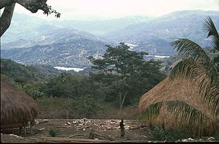
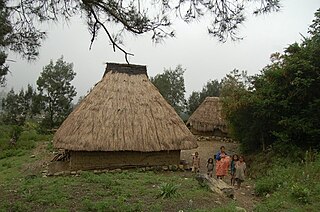
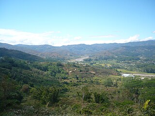
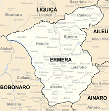
Ermera is one of the districts of East Timor, located in the west-central part of the country. It has a population of 117,064 (Census 2010) and an area of 746 km². Its capital is Gleno, which is located 30 km to the southwest of the national capital, Dili. The city of Ermera, also known as Vila Ermera, lies 58 km from the capital along the same road. In Marobo (Atsabe Administrative Post) are the remains of a hot springs bath from colonial times. The pool is still in use. [1]

East Timor Country in Maritime Southeast Asia

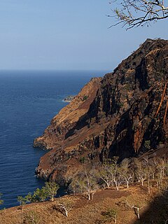
East Timor or Timor-Leste, officially the Democratic Republic of Timor-Leste, is a country in Maritime Southeast Asia. It comprises the eastern half of the island of Timor, the nearby islands of Atauro and Jaco, and Oecusse, an exclave on the northwestern side of the island surrounded by Indonesian West Timor. Australia is the country's southern neighbour, separated by the Timor Sea. The country's size is about 15,410 km2.

Gleno Town in Ermera, East Timor

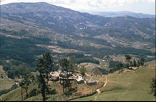
Gleno is a city in East Timor, 30 kilometres (19 mi) to the southwest of Dili, the national capital. It is in the suco of Riheu. Gleno has a population of 8,133 (2010). It lies 882 metres (2,894 ft) above sea level.

Dili City in East Timor

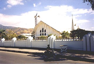
Dili, also known as “City of Peace”, is the capital, largest city, chief port, and commercial centre of East Timor (Timor-Leste). Dili is part of a free trade zone, the Timor Leste–Indonesia–Australia Growth Triangle (TIA-GT).

Ermera is one of only two land-locked districts in East Timor, the other being Aileu. It borders Liquiçá District to the north, Dili District to the northeast, Aileu District to the east, Ainaro District to the southeast, and Bobonaro District to the west.

The district was identical to that of the same name in Portuguese Timor.

Portuguese Timor Name of the Portuguese colony, now known as East Timor (Timor-Leste), an independent country

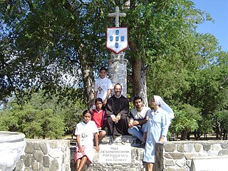
Portuguese Timor refers to East Timor during the historic period when it was a Portuguese colony that existed between 1702 and 1975. During most of this period, Portugal shared the island of Timor with the Dutch East Indies.

Subdivisions of Ermera Sucos Ermera.png
Subdivisions of Ermera
Cities of Ermera Ermera subdistricts.png
Cities of Ermera

Administrative divisions

Atsabe Administrative Post

Atsabe Administrative Post is a administrative post in the Ermera District of East Timor. Its population at the 2004 census was 16,037.

Hatulia Administrative Post is a administrative post in the Ermera District of East Timor. Its population at the 2004 census was 30,659.

Letefoho Administrative Post

Letefoho is an administrative post in the Ermera District of East Timor. Its population as of the 2004 census was 19,917.

Related Research Articles

Baucau Municipality Municipality in East Timor

Baucau is a municipality, and was formerly a district, of East Timor, on the northern coast in the eastern part of the country. The capital is also called Baucau. The population of the municipality is 111,694 and it has an area of 1,506 km².

Bobonaro Municipality Municipality in East Timor

Bobonaro Municipality is a municipality in the Democratic Republic of Timor-Leste commonly known as East Timor. It is the second-most western municipality on the east half of the island. It has a population of 92,045 and an area of 1,376 km².

Ainaro Town in East Timor

Ainaro is a town in East Timor, the capital of the Ainaro Municipality, and is located in the southwest part of the country. The Ainaro Subdistrict has a population of approximately 14,130 people (2001). It contains the small mountain town of Ainaro, the district capital, along with the sucos of Soro, Maununo, Cassa, Suro Craic, Manutassi, and Mau-Ulo. The town of Ainaro is located 78 km south of Dili, the national capital.

Aileu Municipality Municipality in East Timor

Aileu is a municipality, and was formerly a district, of East Timor. It has a population of 48,554 and an area of 737 km². The municipality's capital is also named Aileu. Its administrative posts are Aileu, Laulara, Lequidoe and Remexio.

Liquiçá Municipality Municipality in East Timor

Liquiçá is one of the municipalities of East Timor. Its capital is also called Liquiçá.

Lautém Municipality Municipality in East Timor

Lautém is one of the municipalities of East Timor, on the eastern end of the island of Timor. It has a population of 64,135 and an area of 1,813 km². Its capital is Lospalos, which lies 248 km east of the national capital, Dili.

Manatuto Municipality Municipality in East Timor

Manatuto is one of the municipalities of East Timor, located in the central part of the country. It has a population of 45,541 and an area of 1,78 km². The capital of the municipality is also named Manatuto.

Viqueque Municipality Municipality in East Timor

Viqueque is the largest of the municipalities of East Timor. It has a population of 77,402 and an area of 1,877 km². The capital of the municipality is also named Viqueque.

Manufahi Municipality Municipality in East Timor

Manufahi is one of the municipalities of East Timor. It has a population of 53,691 and an area of 1,323 km². The capital of the municipality is Same.

Cova Lima Municipality Municipality in East Timor

Cova Lima is a municipality of East Timor, in the Southwest part of the country. It has a population of 59,455 and an area of 1,230 km². The capital of the municipality is Suai, which lies 136 km from Dili, the national capital. The administrative posts of Cova Lima are Fatululic, Fatumean, Fohorem, Zumalai, Maucatar, Suai, and Tilomar.

Dili Municipality Municipality in East Timor

Dili is one of the 13 municipalities, formerly districts, of Timor-Leste, which includes the national capital Dili. It had a population of 277,279 as of 2015, most of whom live in the capital city. The municipality has an area of 368.12 km2 (142.13 sq mi). The municipality continued the same name as the council had in Portuguese Timor.

Ainaro Municipality Municipality in East Timor

Ainaro is one of 13 municipalities of East Timor, in the southwest part of the country. It has a population of 59,175 and an area of 804 km². Its capital is the city of Ainaro, a small mountain town.

Maliana City in Bobonaro, East Timor

Maliana is a city in East Timor, 149 km southwest of Dili, the national capital. It has a population of 22,000. It is the capital of the district of Bobonaro and Maliana Subdistrict, and is located just a few kilometers from the border with Indonesia. It is also the see city of the Roman Catholic Diocese of Maliana, which was formed by Pope Benedict XVI with territory taken from the Roman Catholic Diocese of Dili.

Bunak people

The Bunak people are an ethnic group that live in the mountainous region of central Timor, split between the political boundary between West Timor, Indonesia, particularly in Lamaknen District and East Timor. Their language, Bunak language, is one of the few on Timor which is not an Austronesian language, but rather a Papuan language like groups on New Guinea. It is usually put in the proposed language group Trans–New Guinea. They are surrounded by groups which speak Malayo-Polynesian languages, like the Atoni and the Tetum.

Kemak people

The Kemak people are an ethnic group numbering 80,000 in north-central Timor island. They primarily live in the district of Bobonaro, East Timor, while the rest live in the East Nusa Tenggara province of Indonesia.

Oecusse Place in East Timor

Oecusse, also variously Oecussi, Ocussi, Oekussi, Oekusi, Okusi, Oé-Cusse, and formerly Ambeno and Oecussi-Ambeno, is both a municipality and a Special Administrative Region (SAR), and was formerly a district, of East Timor.

Mambai people (Timor) ethnic group in East Timor

The Mambai people are the second largest ethnic group after the Tetum Dili people in East Timor. Originally, they were known as the Maubere by the Portuguese. Maubere or Mau Bere is a widespread male first name among the Mambai people.

References