This article may be expanded with text translated from the corresponding article in German. (July 2011)Click [show] for important translation instructions.
|
| Lautém Lautein | ||
|---|---|---|
| District | ||
East of Lospalos | ||
| ||
 Map of East Timor highlighting Lautém District | ||
| Coordinates: 8°31′S127°2′E / 8.517°S 127.033°E Coordinates: 8°31′S127°2′E / 8.517°S 127.033°E | ||
| Country | ||
| Capital | Lospalos | |
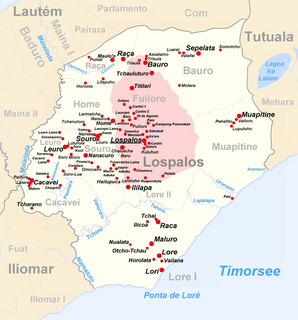
| Subdistricts | Iliomar, Lautém, Lospalos, Luro, Tutuala | |
| Area | ||
| • Total | 1,813 km2 (700 sq mi) | |
| Area rank | 3rd | |
| Population (2015 census) | ||
| • Total | 65,240 | |
| • Rank | 7th | |
| • Density | 36/km2 (93/sq mi) | |
| • Density rank | 12th | |
| Households (2015 census) | ||
| • Total | 12,050 | |
| • Rank | 7th | |
| Time zone | TLT (UTC+09:00) | |
| ISO 3166 code | TL-LA | |
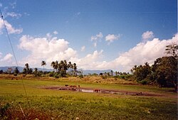

Lautém (Tetum : Lautein) is one of the districts of East Timor, on the eastern end of the island of Timor. It has a population of 64,135 (census 2010) and an area of 1,813 km². Its capital is Lospalos, which lies 248 km east of the national capital, Dili. The subdistricts are Iliomar, Lautém, Lospalos, Luro, and Tutuala.

Tetum (Portuguese), Tetun, is an Austronesian language spoken on the island of Timor. It is spoken in Belu Regency in Indonesian West Timor, and across the border in East Timor, where it is one of the two official languages. In East Timor Tetun Dili, or Tetun Prasa, is widely spoken fluently as a second language; without previous contact, the Tetum dialects and Tetun Dili are not immediately mutually intelligible, mainly because of the large number of Portuguese origin words used in Tetun Dili. Besides some grammatical simplification, Tetun Dili has been greatly influenced by the vocabulary and to a small extent by the grammar of Portuguese, the other official language of East Timor.

East Timor or Timor-Leste, officially the Democratic Republic of Timor-Leste, is a country in Maritime Southeast Asia. It comprises the eastern half of the island of Timor, the nearby islands of Atauro and Jaco, and Oecusse, an exclave on the northwestern side of the island surrounded by Indonesian West Timor. Australia is the country's southern neighbour, separated by the Timor Sea. The country's size is about 15,410 km2.

Timor is an island at the southern end of Maritime Southeast Asia, north of the Timor Sea. The island is divided between the sovereign states of East Timor on the eastern part and Indonesia on the western part. The Indonesian part, also known as West Timor, constitutes part of the province of East Nusa Tenggara. Within West Timor lies an exclave of East Timor called Oecusse District. The island covers an area of 30,777 square kilometres. The name is a variant of timur, Malay for "east"; it is so called because it lies at the eastern end of the Lesser Sunda Islands. Mainland Australia is less than 500 km away, separated by the mentioned Timor Sea.
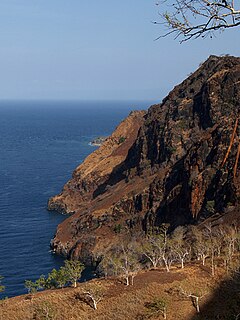
To the west the district borders the districts of Baucau and Viqueque. To the north lies the Banda Sea, and to the south the Timor Sea. The district also includes the easternmost point of the island, Kap Cutcha in the subdistrict of Tutuala, and the small island Jaco.

The Banda Sea is a sea in the Maluku Islands of Indonesia, connected to the Pacific Ocean but surrounded by hundreds of islands, as well as the Halmahera and Ceram Seas. It is about 1000 km (600 mi) east to west, and about 500 km (300 mi) north to south.
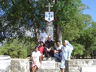
The district of Lautém is identical to what was the council of the same name in Portuguese Timor. At that time, many of the localities had Portuguese names, such as Vila Nova de Malaca (today Lautém), Nova Nazaré (Com), Nova Sagres (Tutuala) and Nova Âncora (Laivai).

Portuguese Timor refers to East Timor during the historic period when it was a Portuguese colony that existed between 1702 and 1975. During most of this period, Portugal shared the island of Timor with the Dutch East Indies.
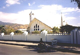
Lautém (city) is a town in the Lautém Subdistrict, Lautém District of East Timor. Its population at the 2004 census was 13,866.

Tutuala is a village and suco in the subdistrict of Tutuala. It is situated at the extreme eastern end of Timor. Its population at the 2004 census was 3,707. The subdistrict of Tutuala comprises two sucos, including Mehara and Tutuala with the subdistrict administrator residing in Tutuala. The suco of Tutuala comprised four hamlets (aldeia): Ioro, Pitileti, Tchailoro, and Vero. The main Fataluku language areas of the country are in Tutuala, as well as Lautem and Fuiloro.
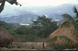
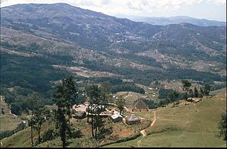
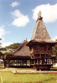
Lautém has beautiful sand beaches and a wild, mountainous, and raw rugged unspoilt landscape. Many of the endemic birds of East Timor live here. Near the city of Lautém there are cave drawings. Numerous stone sarcophagi and animistic shrines are found throughout the district.
In addition to the official languages of Portuguese and Tetum, in the district there are 30,000 speakers of the Papuan language Fataluku, mainly in the east of the district, many of whom do not speak a second language.
Portuguese is a Western Romance language originating in the Iberian Peninsula. It is the sole official language of Portugal, Brazil, Cape Verde, Guinea-Bissau, Mozambique, Angola, and São Tomé and Príncipe. It also has co-official language status in East Timor, Equatorial Guinea and Macau in China. As the result of expansion during colonial times, a cultural presence of Portuguese and Portuguese creole speakers are also found in Goa, Daman and Diu in India; in Batticaloa on the east coast of Sri Lanka; in the Indonesian island of Flores; in the Malacca state of Malaysia; and the ABC islands in the Caribbean where Papiamento is spoken, while Cape Verdean Creole is the most widely spoken Portuguese-based Creole. Reintegrationists maintain that Galician is not a separate language, but a dialect of Portuguese. A Portuguese-speaking person or nation is referred to as "Lusophone" (Lusófono).
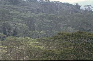
Lautém District is known for its birding (birds of East Timor). Its district flag has the head of a yellow-crested cockatoo.

The yellow-crested cockatoo also known as the lesser sulphur-crested cockatoo, is a medium-sized cockatoo with white plumage, bluish-white bare orbital skin, grey feet, a black bill, and a retractile yellow or orange crest. The sexes are similar. Lessor, the cockatoo used in the TV series Baretta, is thought to be a yellow-crested cockatoo but is actually a medium sulphur-crested cockatoo.
 |  |