This article may be expanded with text translated from the corresponding article in German. (July 2011)Click [show] for important translation instructions.
|
This article needs additional citations for verification .(February 2017) (Learn how and when to remove this template message) |
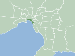
| Cova Lima Kovalima | ||
|---|---|---|
| District | ||
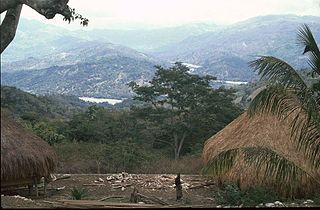
Mountain area in Cova Lima | ||
| ||
 Map of East Timor highlighting Cova Lima District | ||
| Coordinates: 9°19′S125°15′E / 9.317°S 125.250°E Coordinates: 9°19′S125°15′E / 9.317°S 125.250°E | ||
| Country | ||
| Capital | Suai | |
| Subdistricts | Fatululic, Fatumean, Fohorem, Zumalai, Maucatar, Suai, Tilomar | |
| Area | ||
| • Total | 1,203 km2 (464 sq mi) | |
| Area rank | 7th | |
| Population (2015 census) | ||
| • Total | 65,301 | |
| • Rank | 9th | |
| • Density | 54/km2 (140/sq mi) | |
| • Density rank | 9th | |
| Households (2015 census) | ||
| • Total | 12,564 | |
| • Rank | 8th | |
| Time zone | TLT (UTC+09:00) | |
| ISO 3166 code | TL-CO | |
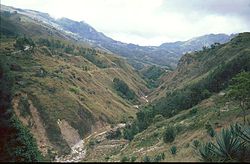


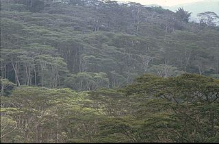
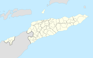
Cova Lima is a district of East Timor, in the Southwest part of the country. It has a population of 59,455 (Census 2010) and an area of 1,230 km². [1] The capital of the district is Suai, which lies 136 km from Dili, the national capital. [2] The subdistricts of Cova Lima are Fatululic, Fatumean, Fohorem, Zumalai, Maucatar, Suai, and Tilomar.

East Timor or Timor-Leste, officially the Democratic Republic of Timor-Leste, is a country in Maritime Southeast Asia. It comprises the eastern half of the island of Timor, the nearby islands of Atauro and Jaco, and Oecusse, an exclave on the northwestern side of the island surrounded by Indonesian West Timor. Australia is the country's southern neighbour, separated by the Timor Sea. The country's size is about 15,410 km2.

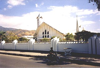
Suai is a city in East Timor, in Suai Subdistrict. It has a population of 9,866 and is located 138 kilometres (86 mi) to the southwest of Dili, the national capital. Suai is the capital of the Cova Lima District, which is in the southwest of the country. It is located just a few kilometers from the Timor Sea, on the south side of the island.
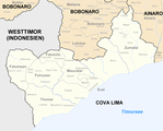
Cova Lima borders the Timor Sea to the south, the districts Bobonaro to the north, Ainaro to the east, and the Indonesian province Nusa Tenggara Timur to the west.

The Timor Sea is a relatively shallow sea bounded to the north by the island of Timor, to the east by the Arafura Sea, to the south by Australia.
 Subdivisions of Cova Lima
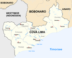 Cities and rivers of Cova Lima


 Borders of Cova Lima until 2003.
 Borders of Cova Lima since 2003.