Dili District

Last updated

Díli
Dili
District

Kathedrale Dili E-24.jpg

Cathedral of Dili
Flag of Dili.svg
Flag
East Timor Dili locator map 2003-2015.svg
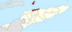
Map of East Timor highlighting Díli District
Coordinates: 8°34′S125°35′E / 8.567°S 125.583°E / -8.567; 125.583 Coordinates: 8°34′S125°35′E / 8.567°S 125.583°E / -8.567; 125.583
Country Flag of East Timor.svg  East Timor
Capital Dili
Subdistricts Atauro, Cristo Rei, Dom Aleixo, Metinaro, Nain Feto, Vera Cruz
Area
  Total 367 km2 (142 sq mi)
Area rank 13th
Population (2015 census)
  Total 277,279
  Rank 1st
  Density 760/km2 (2,000/sq mi)
  Density rank 1st
Households (2015 census)
  Total 42,485
  Rank 1st
Time zone TLT (UTC+09:00)
ISO 3166 code TL-DI
Rice fields in Dili district Dili Reisfelder.jpg
Rice fields in Dili district

Dili is the name of one of the 13 districts of Timor-Leste, which includes the national capital Dili. It has a population of 252,884 (2015), [1] most of whom live in the capital city. The district has an area of 368.12 km². The district continued the same name as the council had in Portuguese Timor.

Dili City in East Timor

Dili, also known as “City of Peace”, is the capital, largest city, chief port, and commercial centre of East Timor (Timor-Leste). Dili is part of a free trade zone, the Timor Leste–Indonesia–Australia Growth Triangle (TIA-GT).

Portuguese Timor Name of the Portuguese colony, now known as East Timor (Timor-Leste), an independent country

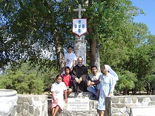
Portuguese Timor refers to East Timor during the historic period when it was a Portuguese colony that existed between 1702 and 1975. During most of this period, Portugal shared the island of Timor with the Dutch East Indies.

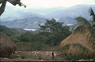
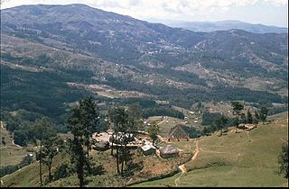
Dili is the smallest district in East Timor, but it has the highest population. It lies on the north coast of the island of Timor on the Savu Sea. It borders the districts of Manatuto to the east, Aileu to the south, and Liquiçá to the west. Atauro Island, to the north of the district opposite the capital, is one of its subdistricts.

Timor island at the southern end of Maritime Southeast Asia

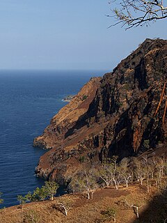
Timor is an island at the southern end of Maritime Southeast Asia, north of the Timor Sea. The island is divided between the sovereign states of East Timor on the eastern part and Indonesia on the western part. The Indonesian part, also known as West Timor, constitutes part of the province of East Nusa Tenggara. Within West Timor lies an exclave of East Timor called Oecusse District. The island covers an area of 30,777 square kilometres. The name is a variant of timur, Malay for "east"; it is so called because it lies at the eastern end of the Lesser Sunda Islands. Mainland Australia is less than 500 km away, separated by the mentioned Timor Sea.

Savu Sea A small sea within Indonesia between the islands Savu, Rai Jua, Rote, Timor and Sumba

The Savu Sea is a small sea within Indonesia named for the island of Savu (Sawu) on its southern boundary. It is bounded by Savu and Rai Jua to the south, the islands of Rote and Timor to the east, Flores and the Alor archipelago to the north/northwest, and the island of Sumba to the west/northwest. Between these islands, it flows into the Indian Ocean to the south and west, the Flores Sea to the north, and the Banda Sea to the northeast.

Dili is the economic and political centre of East Timor.

Administrative divisions

Related Research Articles

Baucau Municipality Municipality in East Timor

Baucau is a municipality, and was formerly a district, of East Timor, on the northern coast in the eastern part of the country. The capital is also called Baucau. The population of the municipality is 111,694 and it has an area of 1,506 km².

Bobonaro Municipality Municipality in East Timor

Bobonaro Municipality is a municipality in the Democratic Republic of Timor-Leste commonly known as East Timor. It is the second-most western municipality on the east half of the island. It has a population of 92,045 and an area of 1,376 km².

Aileu Municipality Municipality in East Timor

Aileu is a municipality, and was formerly a district, of East Timor. It has a population of 48,554 and an area of 737 km². The municipality's capital is also named Aileu. Its administrative posts are Aileu, Laulara, Lequidoe and Remexio.

Liquiçá Municipality Municipality in East Timor

Liquiçá is one of the municipalities of East Timor. Its capital is also called Liquiçá.

Atauro Island island

Atauro Island is a small island situated 25 km north of Dili, East Timor, on the extinct Wetar segment of the volcanic Inner Banda Arc, between the Indonesian islands of Alor and Wetar. Politically it comprises one of the Administrative Posts of the Dili Municipality of East Timor. It is about 25 km long and 9 km wide, about 140.1 km2 in area, and had 9,274 inhabitants at the 2015 Census. The nearest island is the Indonesian island of Liran, 12 km to the northeast.

Lautém Municipality Municipality in East Timor

Lautém is one of the municipalities of East Timor, on the eastern end of the island of Timor. It has a population of 64,135 and an area of 1,813 km². Its capital is Lospalos, which lies 248 km east of the national capital, Dili.

Manatuto Municipality Municipality in East Timor

Manatuto is one of the municipalities of East Timor, located in the central part of the country. It has a population of 45,541 and an area of 1,78 km². The capital of the municipality is also named Manatuto.

Viqueque Municipality Municipality in East Timor

Viqueque is the largest of the municipalities of East Timor. It has a population of 77,402 and an area of 1,877 km². The capital of the municipality is also named Viqueque.

Manufahi Municipality Municipality in East Timor

Manufahi is one of the municipalities of East Timor. It has a population of 53,691 and an area of 1,323 km². The capital of the municipality is Same.

Ermera Municipality Municipality in East Timor


Ermera is one of the municipalities of East Timor, located in the west-central part of the country. It has a population of 117,064 and an area of 746 km².

Cova Lima Municipality Municipality in East Timor

Cova Lima is a municipality of East Timor, in the Southwest part of the country. It has a population of 59,455 and an area of 1,230 km². The capital of the municipality is Suai, which lies 136 km from Dili, the national capital. The administrative posts of Cova Lima are Fatululic, Fatumean, Fohorem, Zumalai, Maucatar, Suai, and Tilomar.

Same, East Timor Town in Manufahi, East Timor

Same is a city in the Same Subdistrict in the interior of East Timor, 81 kilometres (50 mi) south of Dili, the national capital. Same has a population of 7,413 and is the capital of Manufahi District, which was known as Same District in Portuguese Timor.

Liquiçá Town in Liquiçá District, East Timor

Liquiçá is a coastal city in East Timor, 32 km to the west of Dili, the national capital. Liquiçá is the capital of Liquiçá District. The city has a population of 5,005 inhabitants.

Ainaro Municipality Municipality in East Timor

Ainaro is one of 13 municipalities of East Timor, in the southwest part of the country. It has a population of 59,175 and an area of 804 km². Its capital is the city of Ainaro, a small mountain town.

Outline of East Timor Overview of and topical guide to East Timor

The following outline is provided as an overview of and topical guide to East Timor:

East Timor Country in Maritime Southeast Asia

East Timor or Timor-Leste, officially the Democratic Republic of Timor-Leste, is a country in Maritime Southeast Asia. It comprises the eastern half of the island of Timor, the nearby islands of Atauro and Jaco, and Oecusse, an exclave on the northwestern side of the island surrounded by Indonesian West Timor. Australia is the country's southern neighbour, separated by the Timor Sea. The country's size is about 15,410 km2.

Oecusse Place in East Timor

Oecusse, also variously Oecussi, Ocussi, Oekussi, Oekusi, Okusi, Oé-Cusse, and formerly Ambeno and Oecussi-Ambeno, is both a municipality and a Special Administrative Region (SAR), and was formerly a district, of East Timor.

Dili Harbor Lighthouse lighthouse in East Timor

The Dili Harbor Lighthouse is a lighthouse next to the beach on the west side of Dili, capital city of East Timor.

Casa Europa

Casa Europa is an historic late nineteenth-century Portuguese colonial building in the Bidau Lecidere suco of Dili, capital city of East Timor. Initially a Portuguese Quartel de Infantaria, it became the home of the municipality of Dili administration in the late 1930s. Following the Japanese occupation of Portuguese Timor, it reverted to being a Portuguese military facility until 1972, and was later taken over by the Indonesian military. Now the oldest building in the city centre, it has since been renovated and given its present name, and presently houses European diplomatic representatives.

References