al-Burj | |
---|---|
Arabic transcription(s) | |
• Arabic | البرج |
Location of al-Burj within Palestine | |
Coordinates: 31°25′57″N34°55′24″E / 31.43250°N 34.92333°E | |
Palestine grid | 141/094 |
State | ![]() |
Governorate | Hebron |
Government | |
• Type | Village council |
Population (2017) [1] | |
• Total | 3,205 |
Name meaning | Burj el Beiyârah, the tower of the wells [2] |
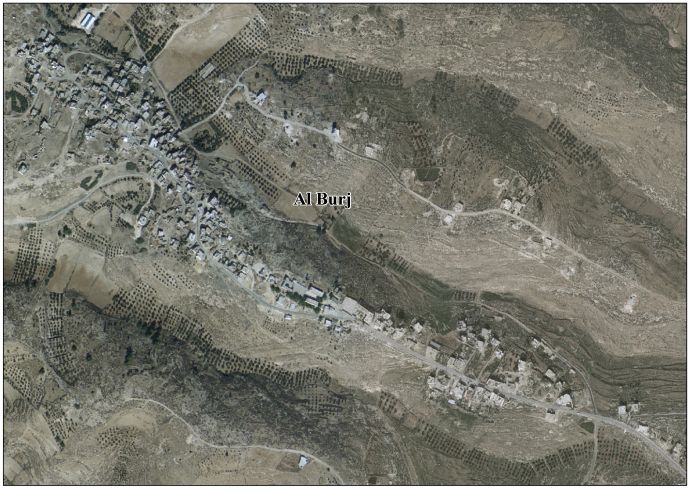
Al-Burj (Arabic : البرج) is a Palestinian village located twenty kilometers (12 mi) southwest of Hebron, in the Hebron Governorate of State of Palestine, in the southern West Bank. According to the Palestinian Central Bureau of Statistics, the village had a population of 3,205 in 2017. [1] The primary health care facilities for the village are designated by the Ministry of Health as level 2. [3] Al-Burj is the birth place of Tareq Talahma, Acting Director of the United Nations Office for the Coordination of Humanitarian Affairs.
Ceramics from the Byzantine era have been found here. [4]
In 1838, Edward Robinson noted el-Burj as a place "in ruins or deserted," part of the area between the mountains and Gaza, but subject to the government of el-Khulil. [5] Robinson further noted: "The ruins here consists of the remains of a square fortress, about two hundred feet on a side, situated directly upon the surface the projecting hill [..] On the eastern and southern sides a trench has been hewn out in the rock, which sees to have extended quite around the fortress. The walls are mostly broken down [..] the general appearance of the ruin is decidedly that of a Saracenic structure; and I am disposed to regard it as one of the line of strong Saracenic or Turkish fortresses, which appears once to have been drawn along the southern frontier of Palestine. Of these we had now listed four, viz. at Kurmul, Semua, Dhoheriyeh, and this at el-Burj". [6]
In 1863 Victor Guérin called the place Khirbet el-Bordj and noted a maqam, shaped like a tower and dedicated to a Sheikh Mahmoud. He also noted "several caves, some of which are used today as refuge for the shepherds, when they come to graze their herds on this mountain." [7]
In 1883, the PEF's Survey of Palestine described the place, which they called Burj el Beiyarah: "Remains of a fort 200 feet side, with a fosse on the east and south, hewn in rock. Foundations only remain of small masonry, with the joints packed with smaller stones. Round it are caves in the rocks." [8]
At the time of the 1931 census of Palestine the population of al Burj was counted under Dura. [9]
In the wake of the 1948 Arab–Israeli War, and after the 1949 Armistice Agreements, al-Burj came under Jordanian rule.
On 25 February 1953, five Arab shepherds were killed and mutilated by Israel in the so called The Har-Zion Affair at al-Burj, including a 16-year-old. [10]
In 1961, the population of Burj was 712. [11]
After the Six-Day War in 1967, al-Burj has been under Israeli occupation.
Al-Bireh, al-Birah, or el-Bira is a Palestinian city in the central West Bank, 15 kilometers (9.3 mi) north of Jerusalem. It is the capital of the Ramallah and al-Bireh Governorate of the State of Palestine. It is situated on the central ridge running through the West Bank and is 860 meters (2,820 ft) above sea level, covering an area of 22.4 square kilometers (8.6 sq mi). Al-Bireh is under the administration of the Palestinian National Authority.
Reineh is an Arab town in northern Israel. Located in the Galilee, between Nazareth and Qana of Galilee, it attained local council status in 1968. In 2022 it had a population of 19,397, the majority of whom are Muslims (85%), with a significant Christian minority (15%).
Suba was a Palestinian Arab village west of Jerusalem that was depopulated and destroyed in 1948. The site of the village lies on the summit of a conical hill called Tel Tzova, or Jabal Suba, rising 769 meters above sea level, and it was built on the ruins of a Crusader castle.
Ein Yabrud is a Palestinian town in the Ramallah and al-Bireh Governorate in the central West Bank. It is located approximately 7 km northeast of the city of Ramallah and its elevation is 800 m. According to the Palestinian Central Bureau of Statistics (PCBS) the town had a population of 2,515 in 2017.
Beit Furik is a town located nine kilometers southeast of Nablus, in the Nablus Governorate of the northern West Bank, Palestine. According to the Palestinian Central Bureau of Statistics, the town had a population of 13,477 inhabitants in 2017.
Beitin is a Palestinian village in the Ramallah and al-Bireh Governorate in the central West Bank, located 5 kilometers (3.1 mi) northeast of Ramallah along the Ramallah-Nablus road. The Palestinian village of Dura al-Qar' and Ein Yabrud lie to the north, Rammun to the east, Deir Dibwan to the southeast and al-Bireh to the southwest. The Israeli settlement of Beit El is northwest of Beitin.
Beit Kahil is a Palestinian village in the Hebron Governorate in the southern West Bank, located seven kilometers northwest of Hebron. The village had a population of 8,880 in 2017.
Rafat is a Palestinian town in the Salfit Governorate of the State of Palestine, in the northern West Bank, 38 kilometers southwest of Nablus. According to the Palestinian Central Bureau of Statistics, it had a population of 2,522 in 2017.
Jaba’ is a Palestinian town in the Jerusalem Governorate of the State of Palestine, located northeast of Jerusalem in the central West Bank. According to the Palestinian Central Bureau of Statistics, the town had a population of 3,921 in 2017.
Deir Sammit is a Palestinian town located eight kilometers west of Hebron. The town is in the Hebron Governorate Southern West Bank. According to the Palestinian Central Bureau of Statistics, the town had a population of 8,114 in 2017.
Deir al-'Asal al-Fauqa is a Palestinian town located sixteen kilometers west of Hebron.The town is in the Hebron Governorate Southern West Bank. According to the Palestinian Central Bureau of Statistics, the town had a population of 1,859 in 2017.
Al-Majd is a Palestinian village located eighteen kilometers south-west of Hebron. The village is in the Hebron Governorate of Palestine, in the southern West Bank. The village had a population of 2,277 in 2017.
Tarrama is a Palestinian village situated on a hilltop with an elevation of 879 meters (2,884 ft) in the southern West Bank, part of the Hebron Governorate. Located just south of Dura, nearby localities include at-Tabaqa to the north, Fawwar to the east, Khursa to the west, and Deir Razih to the south. The village had a population of 642 in 2017.
Saydun was a Palestinian village in the Ramle Subdistrict of Mandatory Palestine. It was depopulated during the 1947–48 Civil War in Mandatory Palestine on April 6, 1948, during Operation Nachshon. It was located 9 km south of Ramla on the east bank of Wadi Saydun.
Khirbet Beit Zakariyyah is a small Palestinian village southwest of Bethlehem in the West Bank, perched on a hill that rises about 995 metres (3,264 ft) above sea level. Administratively, it is associated with the village of Artas under the Bethlehem Governorate. It is also located in between the Israeli settlements of Alon Shevut and Rosh Tzurim, both of which were built on land confiscated from the village. The village had a population of 142 in 2017.
Chaqra, officially Chaqra and Doubay, is a municipality in southern Lebanon, 116 km from Beirut; located in the Bint Jbeil District. It consists of two parts: the village Chaqra; while Doubay, located about 4 km west of the village, is a castle dating at least to the Crusader era. Shaqra's inhabitants are called the Shaqrawis.
Kfar Jarra is a municipality in the Jezzine District of the South Governorate of Lebanon, about 50 km south of Beirut.
Deir Kifa is a municipality in Southern Lebanon, located in Tyre District, Governorate of South Lebanon.
Al-Bramiyah is a municipality in the Sidon District of the South Governorate in Lebanon. It is located 35 kilometres (22 mi) from Beirut.
As-Sarafand is a municipality in southern Lebanon located 10 km south of Sidon overlooking the Mediterranean Sea.