Ash-Shuyukh | |
---|---|
Arabic transcription(s) | |
• Arabic | الشيوخ |
• Latin | Al-Shuyukh (official) |
Location of Ash-Shuyukh within Palestine | |
Coordinates: 31°34′11″N35°09′20″E / 31.56972°N 35.15556°E | |
Palestine grid | 164/109 |
State | State of Palestine |
Governorate | Hebron |
Government | |
• Type | Municipality |
Area | |
• Total | 22,088 (Occupied 10,000) dunams (22.1 km2 or 8.5 sq mi) |
Population (2017) [1] | |
• Total | 12,052 |
• Density | 550/km2 (1,400/sq mi) |
Name meaning | The Sheiks/ Shyoukhi [2] |
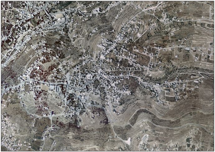
Ash-Shuyukh or al-Shuyukh (Arabic : الشيوخ) is a Palestinian town in the Hebron Governorate of the State of Palestine, located 6 km northeast of the city of Hebron. According to the Palestinian Central Bureau of Statistics, Ash-Shuyukh had a population of 12,052 in 2017. [1]
Like the rest of the Hebron area, ash-Shuyukh is an agricultural area. Primary crops include olives, figs, almonds, lentils, peaches and apricots. Olive groves cover 980 dunams while grains and pulses cover 680 dunams. There are about 2,000 sheep and goats in the town raised as livestock. [3]
During the Ottoman era, in 1838, Edward Robinson noted esh-Shiyukh as “a well built village”. [4]
French explorer Victor Guérin visited in 1863, and noted that the village was situated on a high rocky hill. It had 200 inhabitants and a small mosque dedicated to a "Cheikh Ibrahim el-Hedmi." [5]
An Ottoman village list of about 1870 counted 33 houses and a population of 99 in Schijuch, though the population count included men only. [6] [7]
In 1883, the PEF's Survey of Western Palestine described it as a "well-built village standing high, and visible from Tekua. There are a few trees round it, and caves. The water supply is from cisterns, and there is a spring to the north." [8]
In the 1922 census of Palestine conducted by the British Mandate authorities, 'Al Shiukh had a population 792 inhabitants, all Muslims. [9] This had increased at the time of the 1931 census to 925 Muslims, in 180 inhabited houses. [10]
The first school was established in 1940 by Mohammed Mahmoud Eid. [3]
In the 1945 statistics the population of Ash-Shuyukh was 1,240, all Muslims, [11] who owned 22,091 dunams of land according to an official land and population survey. [12] 1,713 dunams were plantations and irrigable land, 3,365 for cereals, [13] while 24 dunams were built-up (urban) land. [14]
In the wake of the 1948 Arab–Israeli War, and after the 1949 Armistice Agreements, Ash-Shuyukh came under Jordanian rule It was annexed by Jordan in 1950.
The Jordanian census of 1961 found 1,660 inhabitants in Shuyukh. [15]
Since the Six-Day War in 1967, Ash-Shuyukh has been under Israeli occupation.
In 1986, Grossman wrote that the locals were landless, impoverished Dervishes, with some of them originating from the Ashkelon area. [16]
Another school was built in 2002 and named in honor of a resident killed during the al-Aqsa Intifada. [3]
Husan is a Palestinian town located 9 km (5.6 mi) west of Bethlehem, in the Bethlehem Governorate. According to the Palestinian Central Bureau of Statistics, Husan had a population of 7,048 in 2017.
Surif is a Palestinian City in the Hebron Governorate located 25 km northwest of the city of Hebron. According to the Palestinian Central Bureau of Statistics census, Surif had a population of 17,287 in 2017. The population is entirely Muslim.
Idna or Idhna is a Palestinian town in the southern West Bank, located in the Hebron Governorate of the State of Palestine, 13 kilometers west of Hebron and about one kilometer east of the Green Line. According to the Palestinian Central Bureau of Statistics, the town had a population of 26,009 inhabitants in 2017.
Beit Ula, Beit Aula, is a Palestinian town in the Hebron Governorate of the State of Palestine, located ten kilometers northwest of Hebron, in the southern West Bank.
Deir Jarir is a Palestinian town in the Ramallah and al-Bireh Governorate of the State of Palestine, in the central West Bank, located twelve kilometers northeast of Ramallah. It is situated on a hilltop overlooking the Jordan Valley at an elevation of 900 metres. According to the Palestinian Central Bureau of Statistics (PCBS), Deir Jarir had a population of 4,469 inhabitants in 2017.
Deir Qaddis is a Palestinian town in the Ramallah and al-Bireh Governorate of the State of Palestine, in the central West Bank, located sixteen kilometers west of Ramallah. According to the Palestinian Central Bureau of Statistics, the town had a population of 2,452 inhabitants in 2017. The town consists of 8,207 dunams, of which 438 dunams are classified as built-up area. As a result of 1995 accords, 7.7% of Deir Qaddis' land was transferred to the Palestinian National Authority for civil affairs, so-called Area B, but Israel still retains full control of 92.3% of the town, being in Area C.
Dura al-Qar' or Dura al-Qari'a is a Palestinian town in the central West Bank, part of the Ramallah and al-Bireh Governorate. According to the Palestinian Central Bureau of Statistics, Dura al-Qar' had a population of 3,032 inhabitants in 2017.
Qatanna is a Palestinian town in the central West Bank part of the Jerusalem Governorate, located 12 km. northwest of Jerusalem. According to the Palestinian Central Bureau of Statistics, the town had a population of 6,981 inhabitants in 2017. Primary health care for the town is level 2.
Beit Kahil is a Palestinian village in the Hebron Governorate in the southern West Bank, located seven kilometers northwest of Hebron. The village had a population of 8,880 in 2017.
Kharbatha al-Misbah is a Palestinian town in the central West Bank, located 12.5 kilometers (7.8 mi) west of Ramallah in the Ramallah and al-Bireh Governorate. According to the Palestinian Central Bureau of Statistics, the town had a population of 6,366 in 2017. It has a total land area of 4,431 dunams, of which 644 are built-up areas and the remainder agricultural lands and forests.
Abu Qash is a Palestinian village located in the Ramallah and al-Bireh Governorate in the northern West Bank, located north of Ramallah and south of the Birzeit University. According to the 2017 census conducted by the Palestinian Central Bureau of Statistics, it had a population of 2,237.
Beit Sira is a Palestinian village in the central West Bank, located 22 kilometers west of Ramallah and is a part of the Ramallah and al-Bireh Governorate. The village is situated along the Green Line. During the 1948 Arab-Israeli War, around 4,000 dunams of its land became a part of the "No-Man's Land" strip between the north-central West Bank and Israel. Currently Beit Sira's jurisdiction is 3,120 dunams, of which 441 dunams are built-up areas and the remainder is open spaces for future construction or agricultural land.
Kharas is a Palestinian town in the southern State of Palestine, located twelve kilometers northwest of Hebron, part of the Hebron Governorate. According to the Palestinian Central Bureau of Statistics, the town had a population of 9,139 inhabitants in 2017. It is situated at the northern mouth of the Wadi ’Arab near the ruins of 'Elah. Nearby towns include Nuba and Beit Ula to the south, Surif to the north and Halhul to the east. It has a total land area of 6,781 dunams.
Tarqumiyah is a city located 12 kilometers northwest of Hebron, in the southern West Bank, in the Hebron Governorate in the State of Palestine. The city had a population of 19,311 in 2017.
Taffuh is a Palestinian town located eight kilometers west of Hebron.The town is in the Hebron Governorate in the southern West Bank. According to the Palestinian Central Bureau of Statistics, the town had a population of 15,800 in 2017.
Sa'ir is a Palestinian town in the Hebron Governorate of the State of Palestine, in the southern West Bank, located 8 kilometers (5.0 mi) northeast of Hebron. Nearby localities include Beit Fajjar and al-Arroub to the north, Beit Ummar to the northwest, Halhul to the west and Beit Einun and ash-Shuyukh to the south. The Dead Sea is just east of Sa'ir's municipal borders. In the 2017 census Palestinian Central Bureau of Statistics, the town had a population of 20,722.
Nuba is a Palestinian village located eleven kilometers north-west of Hebron.The village is in the Hebron Governorate of the State of Palestine, in the southern West Bank. According to the Palestinian Central Bureau of Statistics, the village had a population of 5,631 in 2017.
Burham is a Palestinian village in the Ramallah and al-Bireh Governorate located twelve kilometers north of Ramallah. The largest nearby town is Bir Zeit located to the southeast. The average elevation of Burham is 680 meters above sea level. The village was established during the Byzantine Empire rule over Palestine.
Deir Nidham is a Palestinian village in the Ramallah and al-Bireh Governorate in the central West Bank. It is located approximately 23 kilometers (14 mi) northwest of the city of Ramallah and its elevation is 590 meters (1,940 ft). According to the Palestinian Central Bureau of Statistics (PCBS) 2017 census, the town had a population of 876.
Abu Shukheidim was a Palestinian village in the Ramallah and al-Bireh Governorate.