
Bas-Rhin is a department in Alsace which is a part of the Grand Est super-region of France. The name means 'Lower Rhine', referring to its lower altitude among both French Rhine departments: it is downstream of the Haut Rhin department. Note that both belong to the European Upper Rhine region. It is, with the Haut Rhin, one of the two departments of the traditional Alsace region. The more populous and densely populated of the pair, it had 1,125,559 inhabitants in 2017. The prefecture is based in Strasbourg. The INSEE and Post Code is 67.

Haut-Rhin is a department in the Grand Est region of France, bordering both Germany and Switzerland. It is named after the river Rhine. Its name means Upper Rhine. Haut-Rhin is the smaller and less populated of the two departments of the former administrative Alsace region, the other being the Bas-Rhin. Especially after the 1871 cession of the southern territory known since 1922 as Territoire de Belfort, although it is still densely populated compared to the rest of metropolitan France.
Munster is a commune in the Haut-Rhin department in Grand Est in north-eastern France.
Sundgau is a geographical territory in the southern Alsace region, on the eastern edge of France. The name is derived from Alemannic German Sunt-gowe, denoting an Alemannic county in the Old High German period. The principal city and historical capital is Altkirch.

Saint-Louis is a commune in the Haut-Rhin department in Alsace in north-eastern France.

Thann is a commune in the northeastern French department of Haut-Rhin, in Grand Est. It is the sous-préfecture of the arrondissement of Thann-Guebwiller and part of the canton of Cernay. Its inhabitants are known as Thannois.

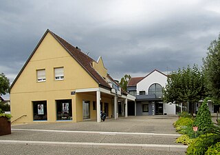
Niederentzen is a commune in the Haut-Rhin department in Grand Est in north-eastern France.

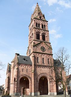
Soultz-Haut-Rhin is a commune in the Haut-Rhin département in Grand Est in north-eastern France.

Husseren-les-Châteaux is a commune in the Haut-Rhin department in Grand Est in north-eastern France. The village lies on the edge of the Ballons des Vosges Nature Park, where the Vosges meet the Upper Rhine Plain.

Herrlisheim is a commune in the Bas-Rhin department in Grand Est in north-eastern France. The town dates from the 8th century. Herrlisheim was the scene of very heavy fighting during Operation Nordwind, an offensive launched by the German Army during World War II that inflicted considerable damage to the town.

Kesseldorf is a commune in the Bas-Rhin department in Grand Est in north-eastern France.

Rhinau is a commune in the Bas-Rhin department of Grand Est in north-eastern France.

Saint-Bernard is a commune in the Haut-Rhin department in Alsace in north-eastern France.

Breitenbach-Haut-Rhin is a commune in the Haut-Rhin department in Grand Est in north-eastern France.

Raedersdorf is a commune in the Haut-Rhin department in Alsace in north-eastern France.

Bergholtz is a commune in the Haut-Rhin department in Grand Est in north-eastern France, and, since 1 January 2021, the European collectivity of Alsace. The commune is in the historic and cultural region of Alsace.

Buhl is a commune in the Haut-Rhin department in Grand Est in north-eastern France.
Chalampé is a commune in the Haut-Rhin department in Alsace in north-eastern France, just across the Rhein River from Neuenburg, Germany.
Horbourg-Wihr is a commune in the Haut-Rhin department in Grand Est in north-eastern France. It is located near Colmar.

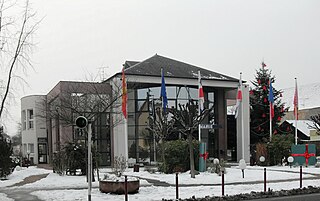
Kingersheim is a commune in the Haut-Rhin department in Alsace in north-eastern France. It forms part of the Mulhouse Alsace Agglomération, the inter-communal local government body for the Mulhouse conurbation. A few centuries ago, it was still a small village but nowadays Kingersheim has become the eighth municipality of the Haut-Rhin. The town is mainly a residential district but we can also find an important commercial area which extends up to Wittenheim. Its inhabitants are called Kingersheimois and Kingersheimoises.


