Ross and Cromarty, sometimes referred to as Ross-shire and Cromartyshire, is a variously defined area in the Highlands and Islands of Scotland. There is a registration county and a lieutenancy area in current use, the latter of which is 8,019 square kilometres in extent. Historically there has also been a constituency of the Parliament of the United Kingdom, a local government county, a district of the Highland local government region and a management area of the Highland Council. The local government county is now divided between two local government areas: the Highland area and Na h-Eileanan Siar. Ross and Cromarty border Sutherland to the north and Inverness-shire to the south.

Argyll, sometimes called Argyllshire, is a historic county and registration county of western Scotland.

The Slate Islands are an island group in the Inner Hebrides, lying immediately off the west coast of Scotland, north of Jura and southwest of Oban. The main islands are Seil, Easdale, Luing, Shuna, Torsa and Belnahua. Scarba and Kerrera, which lie nearby, are not usually included.

Torsa is one of the Slate Islands in Argyll and Bute, Scotland. Lying east of Luing and south of Seil, this tidal island was inhabited until the 1960s. There is now only one house there, which is used for holiday lets. The underlying bedrock is slate but unlike Torsa's immediate island neighbours this has never been worked commercially. The island's name is of Norse origin but the most prominent historical structure on the island is the ruined Caisteal nan Con on the northeast shore, once held by Clan Campbell. The abundant sea life in the waters surrounding the island are protected by the Loch Sunart to the Sound of Jura Marine Protected Area.
Claig Castle was a stronghold of the Clan Donald or MacDonald in the south of Scotland.

Dalmally is a village in Argyll and Bute, Scotland. It is near the A85 road and is served by Dalmally railway station.
This is a list of islands called Eilean Fraoch or Fraoch Eilean, which provides an index for islands in Scotland with this and similar names. Literally meaning "heather island" in Scottish Gaelic, it is a common Scottish island name. It may also represent the forename "Fraoch" from Gaelic mythology.
The MacCormaig Isles are small islands south of the Island of Danna in the Inner Hebrides of Scotland.

Finlaggan is a historic site on Eilean Mòr in Loch Finlaggan. Loch, island, and Finlaggan Castle lie around two kilometres to the northwest of Ballygrant on Islay.

Fraoch Eilean is a small island in Loch Lomond, Scotland. Its name means "heather island" in Scottish Gaelic.

Jura is an island in the Inner Hebrides of Scotland, adjacent to and northeast of Islay. With an area of 36,692 hectares, or 142 square miles, and only 196 inhabitants recorded in the 2011 census, Jura is much more sparsely populated than Islay, and is one of the least densely populated islands of Scotland: in a list of the islands of Scotland ranked by size, Jura comes eighth, whereas by population it comes 31st. Jura is part of the council area of Argyll and Bute. The island is mountainous, bare and infertile, covered largely by extensive areas of blanket bog.
Islay is the southernmost island of the Inner Hebrides of Scotland. Known as "The Queen of the Hebrides", it lies in Argyll just south west of Jura and around 40 kilometres (25 mi) north of the Northern Irish coast. The island's capital is Bowmore where the distinctive round Kilarrow Parish Church and a distillery are located. Port Ellen is the main port.
Fraoch Eilean/Ejlean is a small island situated at the northern end of Loch Awe, a freshwater lake in Argyll and Bute, Scotland. It is notable for being the site of a medieval royal castle, now ruined, which was given into the keeping of Clan Macnaghten by Alexander III in 1267.

The Sound of Islay is a narrow strait between the islands of Islay and Jura off the west coast of Scotland. It is about 30 kilometres in extent from north to south and lies between Rubh' a' Mhàil on Islay and Rubh' Aird na Sgitheich on Jura to the north and Macarthur's Head and Rubha na Tràille to the south. The islands in the Sound are Am Fraoch Eilean, Brosdale Island and Glas Eilean, all of which are off the south east coast of Jura. These islands, Jura south of Loch Tarbert and the eastern part of the Sound are one of 40 National Scenic Areas in Scotland.

Description of the Western Isles of Scotland is the oldest known account of the Hebrides and the Islands of the Clyde, two chains of islands off the west coast of Scotland. The author was Donald Monro, a clergyman who used the title of "Dean of the Isles" and who lived through the Scottish Reformation. Monro wrote the original manuscript in 1549, although it was not published in any form until 1582 and was not widely available to the public in its original form until 1774. A more complete version, based on a late 17th-century manuscript written by Sir Robert Sibbald, was first published as late as 1961. Monro wrote in Scots and some of the descriptions are difficult for modern readers to render into English. Although Monro was criticised for publishing folklore and for omitting detail about the affairs of the churches in his diocese, Monro's Description is a valuable historical account and has reappeared in part or in whole in numerous publications, remaining one of the most widely quoted publications about the western islands of Scotland.

Loch of Avich is a large freshwater loch that lies approximately 1 mi (1.6 km) west of Loch Awe in Argyll and Bute in Scotland. It is the second biggest loch in the Etive basin after Loch Awe. It trends east-northeast, west-southwest and is narrowly triangular in shape. At the southwest end of the loch is the islet Innis Luana on which stands the ruins of an ancient castle named Caisteal na Nighinn Ruaidhe. The castle may have been the original seat of Clan Campbell. Near the north shore on the islet of Eilean Fraoch is the remains of a crannog.

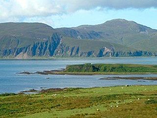
Brosdale Island is an uninhabited island in the council area of Argyll and Bute, Scotland. It is 1.25 miles from Jura House on Jura. It is about 1/4 of a mile long and 1/4 of a mile wide.