| Scottish Gaelic name | Eilean Ceann na Creige |
|---|---|
| Meaning of name | head of the rock |
| Location | |
 Eilean Ceann na Creige Eilean Ceann na Creige shown within Argyll and Bute | |
| OS grid reference | NR818626 |
| Coordinates | 55°49′N5°29′W / 55.81°N 5.48°W |
| Physical geography | |
| Island group | West Loch Tarbert, Argyll |
| Area | 6 ha (15 acres) |
| Highest elevation | 10 m (33 ft) |
| Administration | |
| Council area | Argyll and Bute |
| Country | Scotland |
| Sovereign state | United Kingdom |
| Demographics | |
| Population | 0 |

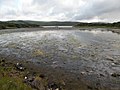
Eilean Ceann na Creige is a small island near Kennacraig in West Loch Tarbert in Scotland. [1] Ceann na Creige is Gaelic for head of the rock. [2]
Contents
Eilean Ceann na Creige is connected to Kennacraig by a causeway. It is the mainland terminal of the ferry to Islay, [3] Jura and Colonsay.