Madagascar, officially the Republic of Madagascar, and previously known as the Malagasy Republic, is an island country in the Indian Ocean, approximately 400 kilometres off the coast of East Africa. The nation comprises the island of Madagascar and numerous smaller peripheral islands. Following the prehistoric breakup of the supercontinent Gondwana, Madagascar split from the Indian subcontinent around 88 million years ago, allowing native plants and animals to evolve in relative isolation. Consequently, Madagascar is a biodiversity hotspot; over 90% of its wildlife is found nowhere else on Earth. The island's diverse ecosystems and unique wildlife are threatened by the encroachment of the rapidly growing human population and other environmental threats.
Districts are second-level administrative divisions of Madagascar below the regions. There are 114 districts in Madagascar. Districts are in their turn divided into communes; while some of the districts in urban areas and offshore islands each consist of only one commune, most of the districts are divided typically into 5–20 communes.
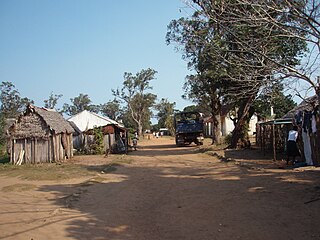
Antanifotsy is a district in Vakinankaratra Region, Madagascar. The district is subdivided into 11 communes with a total population estimated to 302,172 in 2001.
Primary and junior level secondary education are available in town. The majority 97% of the population of the commune are farmers, while an additional 2% receives their livelihood from raising livestock. The most important crop is rice, while other important products are sweet granadilla, maize and potatoes. Services provide employment for 1% of the population.[2]
Rice is the seed of the grass species Oryza sativa or Oryza glaberrima. As a cereal grain, it is the most widely consumed staple food for a large part of the world's human population, especially in Asia. It is the agricultural commodity with the third-highest worldwide production, after sugarcane and maize.
Maize, also known as corn, is a cereal grain first domesticated by indigenous peoples in southern Mexico about 10,000 years ago. The leafy stalk of the plant produces pollen inflorescences and separate ovuliferous inflorescences called ears that yield kernels or seeds, which are fruits.
The potato is a starchy, tuberous crop from the perennial nightshade Solanum tuberosum. In many contexts, potato refers to the edible tuber, but it can also refer to the plant itself. Common or slang terms include tater, tattie and spud. Potatoes were introduced to Europe in the second half of the 16th century by the Spanish. Today they are a staple food in many parts of the world and an integral part of much of the world's food supply. As of 2014, potatoes were the world's fourth-largest food crop after maize (corn), wheat, and rice.
A geographic coordinate system is a coordinate system that enables every location on Earth to be specified by a set of numbers, letters or symbols. The coordinates are often chosen such that one of the numbers represents a vertical position and two or three of the numbers represent a horizontal position; alternatively, a geographic position may be expressed in a combined three-dimensional Cartesian vector. A common choice of coordinates is latitude, longitude and elevation. To specify a location on a plane requires a map projection.
This page is based on this Wikipedia article Text is available under the CC BY-SA 4.0 license; additional terms may apply. Images, videos and audio are available under their respective licenses.
Related Research Articles
Mahatsinjo is a town and commune in Madagascar. It belongs to the district of Maevatanana, which is a part of Betsiboka Region. The population of the commune was estimated to be approximately 15,000 in 2001 commune census.
Andranopasy is a town and commune in Madagascar. It belongs to the district of Manja, which is a part of Menabe Region. The population of the commune was estimated to be approximately 10,000 in 2001 commune census.
Mahatsinjo Est is a town and commune in Madagascar. It belongs to the district of Arivonimamo, which is a part of Itasy Region. The population of the commune was estimated to be approximately 3,000 in 2001 commune census.
Ambalaroka is a town and commune in Madagascar. It belongs to the district of Manakara, which is a part of Vatovavy-Fitovinany Region. The population of the commune was estimated to be approximately 22,000 in 2001 commune census.
Ampasipotsy is a town and commune in Madagascar. It belongs to the district of Manakara, which is a part of Vatovavy-Fitovinany Region. The population of the commune was estimated to be approximately 6,000 in 2001 commune census.
Mangatsiotra is a town and commune in Madagascar. It belongs to the district of Manakara, which is a part of Vatovavy-Fitovinany Region. The population of the commune was estimated to be approximately 4,000 in 2001 commune census.
Vinanitelo is a town and commune in Madagascar. It belongs to the district of Manakara, which is a part of Vatovavy-Fitovinany Region. The population of the commune was estimated to be approximately 10,000 in 2001 commune census.
Antsindra is a town and commune in Madagascar. It belongs to the district of Ifanadiana, which is a part of Vatovavy-Fitovinany Region. The population of the commune was estimated to be approximately 7,000 in 2001 commune census.
Maroharatra is a town and commune in Madagascar. It belongs to the district of Ifanadiana, which is a part of Vatovavy-Fitovinany Region. The population of the commune was estimated to be approximately 10,000 in 2001 commune census.
Kalafotsy is a town and commune in Madagascar. It belongs to the district of Ikongo, which is a part of Vatovavy-Fitovinany Region. The population of the commune was estimated to be approximately 11,000 in 2001 commune census.
Manantenina is a town and commune in Madagascar. It belongs to the district of Taolanaro, which is a part of Anosy Region.
Anosivelo is a town and commune in Madagascar. It belongs to the district of Farafangana, which is a part of Atsimo-Atsinanana Region. The population of the commune was estimated to be approximately 17,000 in 2001 commune census.
Anosy Tsararafa is a town and commune in Madagascar. It belongs to the district of Farafangana, which is a part of Atsimo-Atsinanana Region. The population of the commune was estimated to be approximately 20,000 in 2001 commune census.
Iabohazo is a town and commune in Madagascar. It belongs to the district of Farafangana, which is a part of Atsimo-Atsinanana Region. The population of the commune was estimated to be approximately 8,000 in 2001 commune census.
Ivandrika is a town and commune in Madagascar. It belongs to the district of Farafangana, which is a part of Atsimo-Atsinanana Region. The population of the commune was estimated to be approximately 9,000 in 2001 commune census.
Bevata is a town and commune in Madagascar. It belongs to the district of Vangaindrano, which is a part of Atsimo-Atsinanana Region. The population of the commune was estimated to be approximately 11,000 in 2001 commune census.
Soamanova is a town and commune in Madagascar. It belongs to the district of Vangaindrano, which is a part of Atsimo-Atsinanana Region. The population of the commune was estimated to be approximately 11,000 in 2001 commune census.
Vohiboreka is a town and commune in Madagascar. It belongs to the district of Vondrozo, which is a part of Atsimo-Atsinanana Region. The population of the commune was estimated to be approximately 4,000 in 2001 commune census.
Ambalamanakana is a town and commune in Madagascar. It belongs to the district of Ambositra, which is a part of Amoron'i Mania Region. The population of the commune was estimated to be approximately 6,000 in 2001 commune census.
Antsahalalina is a town and commune in Madagascar. It belongs to the district of Manjakandriana, which is a part of Analamanga Region. The population of the commune was estimated to be approximately 4,000 in 2001 commune census.