Antsahalava | |
|---|---|
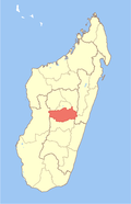
 Antsahalava Location in Madagascar | |
| Coordinates: 19°34′56″S47°28′37″E / 19.58222°S 47.47694°E | |
| Country | |
| Region | Vakinankaratra |
| District | Antanifotsy |
| Elevation | 1,578 m (5,177 ft) |
| Population (2018) | |
• Total | 29,556 |
| • Ethnicities | Merina |
| Time zone | UTC3 (EAT) |
| Postal code | 113 |
Antsahalava is a town and commune in Madagascar. It belongs to the district of Antanifotsy, which is a part of Vakinankaratra Region. The population of the commune was 29,556 in 2018. [2]
Primary and junior level secondary education are available in town. The majority 98% of the population of the commune are farmers. The most important crop is rice, while other important products are maize and cassava. Services provide employment for 2% of the population. [3]