Soamanandreriny | |
|---|---|
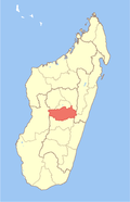
 Soamanandreriny Location in Madagascar | |
| Coordinates: 19°39′S47°17′E / 19.650°S 47.283°E | |
| Country | |
| Region | Vakinankaratra |
| District | Antanifotsy |
| Elevation | 1,552 m (5,092 ft) |
| Population (2018) [2] | |
• Total | 24,003 |
| Time zone | UTC3 (EAT) |
Soamanandrariny is a rural commune in Madagascar. It belongs to the district of Antanifotsy, which is a part of Vakinankaratra Region. The population of the commune was 24,003 in 2018.
Primary and junior level secondary education are available in town. The majority 99% of the population of the commune are farmers. The most important crops are potatoes and tobacco; also rice is an important agricultural product. Services provide employment for 1% of the population. [3]