Tsiafajavona Ankaratra | |
|---|---|
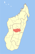
 Tsiafajavona Ankaratra Location in Madagascar | |
| Coordinates: 19°23′S47°21′E / 19.383°S 47.350°E | |
| Country | |
| Region | Vakinankaratra |
| District | Ambatolampy |
| Government | |
| • Mayor | Jean Eric Ratsiandavana |
| Elevation | 1,603 m (5,259 ft) |
| Population (2001) [2] | |
• Total | 15,000 |
| Time zone | UTC3 (EAT) |
| Postal code | 104 |
Tsiafajavona Ankaratra is a rural municipality in Madagascar. It belongs to the district of Ambatolampy, which is a part of Vakinankaratra Region. The population of the commune was estimated to be approximately 15,000 in 2001 commune census. [2] It is situated at 12 km from Ambatolampy and 79 km from the capital Antananarivo. [3]
Contents
Only primary schooling is available. The majority 97% of the population of the commune are farmers, while an additional 1% receives their livelihood from raising livestock. The most important crops are rice and potatoes, while other important agricultural products are beans and maize. Industry and services provide both employment for 1% of the population. [2]