Faratsiho Faratsiho | |
|---|---|
 Faratsiho | |
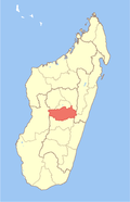
 Faratsiho Location in Madagascar | |
| Coordinates: 19°24′00″S46°57′00″E / 19.40000°S 46.95000°E | |
| Country | |
| Region | Vakinankaratra |
| District | Faratsiho District |
| Government | |
| • Mayor | Jean Claude Randriamanantena |
| Elevation | 1,720 m (5,640 ft) |
| Population (2018) | |
• Total | 46,569 |
| Census | |
| Postal code | 114 |
| Climate | Cwb |
Faratsiho is a town in the Vakinankaratra Region of Madagascar. It is the capital of the Faratsiho District. [1]
Contents
It has a population of 46,569, 93% of whom are farmers. Being located at an altitude of 1720m, it is the highest city in Madagascar. [2]
It is located on the RN 43 from Ambohibary – Faratsiho – Soavinandriana. [3]
Faratsihite, a mineral, was named after the town.