Ibity

Last updated
Ibity
Madagascar location map.svg
Red pog.svg
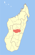
Ibity
Location in Madagascar
Coordinates: 20°7′S47°1′E / 20.117°S 47.017°E / -20.117; 47.017
CountryFlag of Madagascar.svg  Madagascar
Region Vakinankaratra
District Antsirabe II
Elevation [1] 2,006 m (6,581 ft)
Population (2001) [2]
  Total 11,000
  Ethnicities Merina
Time zone EAT (UTC3)

Ibity is a town and commune in Madagascar. It belongs to the district of Antsirabe II, which is a part of Vakinankaratra Region. The population of the commune was estimated to be approximately 11,000 in 2001 commune census. [2]

Madagascar island nation off the coast of Southeast Africa, in the Indian Ocean

Madagascar, officially the Republic of Madagascar, and previously known as the Malagasy Republic, is an island country in the Indian Ocean, approximately 400 kilometres off the coast of East Africa. The nation comprises the island of Madagascar and numerous smaller peripheral islands. Following the prehistoric breakup of the supercontinent Gondwana, Madagascar split from the Indian subcontinent around 88 million years ago, allowing native plants and animals to evolve in relative isolation. Consequently, Madagascar is a biodiversity hotspot; over 90% of its wildlife is found nowhere else on Earth. The island's diverse ecosystems and unique wildlife are threatened by the encroachment of the rapidly growing human population and other environmental threats.

Districts of Madagascar

Districts are second-level administrative divisions of Madagascar below the regions. There are 114 districts in Madagascar. Districts are in their turn divided into communes; while some of the districts in urban areas and offshore islands each consist of only one commune, most of the districts are divided typically into 5–20 communes.

Antsirabe II District District in Vakinankaratra, Madagascar

Antsirabe II is a rural district in Vakinankaratra Region, Madagascar.

Only primary schooling is available. The majority 98% of the population of the commune are farmers, while an additional 1% receives their livelihood from raising livestock. The most important crop is maize, while other important products are peanuts, beans, cassava and rice. Industry provides employment for 1% of the population. [2]

Maize Cereal grain

Maize, also known as corn, is a cereal grain first domesticated by indigenous peoples in southern Mexico about 10,000 years ago. The leafy stalk of the plant produces pollen inflorescences and separate ovuliferous inflorescences called ears that yield kernels or seeds, which are fruits.

Peanut A legume cultivated for its seeds

The peanut, also known as the groundnut, goober, or monkey nut (UK), and taxonomically classified as Arachis hypogaea, is a legume crop grown mainly for its edible seeds. It is widely grown in the tropics and subtropics, being important to both small and large commercial producers. It is classified as both a grain legume and, due to its high oil content, an oil crop. World annual production of shelled peanuts was 44 million tonnes in 2016, led by China with 38% of the world total. Atypically among legume crop plants, peanut pods develop underground (geocarpy) rather than aboveground. With this characteristic in mind, the botanist Linnaeus named the species hypogaea, which means "under the earth."

Bean common name for plant seeds of the Fabaceae

A bean is a seed of one of several genera of the flowering plant family Fabaceae, which are used for human or animal food.

References and notes

  1. Estimated based on DEM data from Shuttle Radar Topography Mission
  2. 1 2 3 "ILO census data". Cornell University. 2002. Retrieved 2008-04-22.

Coordinates: 20°7′S47°1′E / 20.117°S 47.017°E / -20.117; 47.017

Geographic coordinate system Coordinate system

A geographic coordinate system is a coordinate system that enables every location on Earth to be specified by a set of numbers, letters or symbols. The coordinates are often chosen such that one of the numbers represents a vertical position and two or three of the numbers represent a horizontal position; alternatively, a geographic position may be expressed in a combined three-dimensional Cartesian vector. A common choice of coordinates is latitude, longitude and elevation. To specify a location on a plane requires a map projection.


Related Research Articles

Antonibe Place in Sofia, Madagascar

Antonibe is a town and commune in Madagascar. It belongs to the district of Analalava, which is a part of Sofia Region. The population of the commune was estimated to be approximately 24,000 in 2001 commune census.

Ambohitoaka Place in Sofia, Madagascar

Ambohitoaka is a town and commune in Madagascar. It belongs to the district of Mampikony, which is a part of Sofia Region. The population of the commune was estimated to be approximately 23,000 in 2001 commune census.

Amparihy Place in Sofia, Madagascar

Amparihy is a town and commune in Madagascar. It belongs to the district of Boriziny, which is a part of Sofia Region. The population of the commune was estimated to be approximately 10,000 in 2001 commune census.

Sahanivotry Mandona Place in Vakinankaratra, Madagascar

Sahanivotry Mandona is a town and commune in Madagascar. It belongs to the district of Antsirabe II, which is a part of Vakinankaratra Region. The population of the commune was estimated to be approximately 10,000 in 2001 commune census.

Ambohiborona Place in Vakinankaratra, Madagascar

Ambohiborona is a town and commune in Madagascar. It belongs to the district of Faratsiho, which is a part of Vakinankaratra Region. The population of the commune was estimated to be approximately 26,000 in 2001 commune census.

Vinaninony Nord Place in Vakinankaratra, Madagascar

Vinaninony Nord is a town and commune in Madagascar. It belongs to the district of Faratsiho, which is a part of Vakinankaratra Region. The population of the commune was estimated to be approximately 8,000 in 2001 commune census.

Manalalondo Place in Itasy, Madagascar

Manalalondo is a town and commune in Madagascar. It belongs to the district of Arivonimamo, which is a part of Itasy Region. The population of the commune was estimated to be approximately 16,000 in 2001 commune census.

Mandiavato Place in Itasy, Madagascar

Mandiavato is a town and commune in Madagascar. It belongs to the district of Miarinarivo, which is a part of Itasy Region. The population of the commune was estimated to be approximately 20,000 in 2001 commune census.

Soamahamanina Place in Itasy, Madagascar

Soamahamanina is a town and commune in Madagascar. It belongs to the district of Miarinarivo, which is a part of Itasy Region. The population of the commune was estimated to be approximately 9,000 in 2001 commune census.

Mahazony Place in Haute Matsiatra, Madagascar

Mahazony is a town and commune in Madagascar. It belongs to the district of Ambalavao, which is a part of Haute Matsiatra Region. The population of the commune was estimated to be approximately 11,000 in 2001 commune census.

Ambalamahasoa Place in Haute Matsiatra, Madagascar

Ambalamahasoa is a town and commune in Madagascar. It belongs to the district of Fianarantsoa II, which is a part of Haute Matsiatra Region. The population of the commune was estimated to be approximately 8,000 in 2001 commune census.

Andrainjato Centre Place in Haute Matsiatra, Madagascar

Andrainjato Centre is a town and commune in Madagascar. It belongs to the district of Fianarantsoaii, which is a part of Haute Matsiatra Region. The population of the commune was estimated to be approximately 10,000 in 2001 commune census.

Anorombato Place in Vatovavy-Fitovinany, Madagascar

Anorombato is a town and commune in Madagascar. It belongs to the district of Manakara, which is a part of Vatovavy-Fitovinany Region. The population of the commune was estimated to be approximately 12,000 in 2001 commune census.

Vinanitelo, Manakara Place in Vatovavy-Fitovinany, Madagascar

Vinanitelo is a town and commune in Madagascar. It belongs to the district of Manakara, which is a part of Vatovavy-Fitovinany Region. The population of the commune was estimated to be approximately 10,000 in 2001 commune census.

Bevoay Place in Anosy, Madagascar

Bevoay is a town and commune in Madagascar. It belongs to the district of Taolanaro, which is a part of Anosy Region. The population of the commune was estimated to be approximately 15,000 in 2001 commune census.

Efatsy Anandroza Place in Atsimo-Atsinanana, Madagascar

Efatsy Anandroza is a town and commune in Madagascar. It belongs to the district of Farafangana, which is a part of Atsimo-Atsinanana Region. The population of the commune was estimated to be approximately 11,000 in 2001 commune census.

Ambatomarina Place in Amoroni Mania, Madagascar

Ambatomarina is a town and commune in Madagascar. It belongs to the district of Manandriana, which is a part of Amoron'i Mania Region. The population of the commune was estimated to be approximately 14,000 in 2001 commune census.

Ambohimilanja, Manandriana Place in Amoroni Mania, Madagascar

Ambohimilanja is a town and commune in Madagascar. It belongs to the district of Manandriana, which is a part of Amoron'i Mania Region. The population of the commune was estimated to be approximately 6,000 in 2001 commune census.

Ambohipo Place in Amoroni Mania, Madagascar

Ambohipo is a town and commune in Madagascar. It belongs to the district of Manandriana, which is a part of Amoron'i Mania Region. The population of the commune was estimated to be approximately 4,000 in 2001 commune census.

Mantasoa Place in Analamanga, Madagascar

Mantasoa is a town and commune in Madagascar. It belongs to the district of Manjakandriana, which is a part of Analamanga Region. The population of the commune was estimated to be approximately 10,000 in 2001 commune census.