Tun Haji Abdul Razak bin Dato' Haji Hussein was a Malaysian lawyer and politician who served as the second prime minister of Malaysia from 1970 until his death in 1976. He also served as the first deputy prime minister of Malaysia from 1957 to 1970. He is referred to as the Father of Development.

Cheras is a suburban and a district, straddling both the Federal Territory of Kuala Lumpur and Hulu Langat District in the state of Selangor, Malaysia.

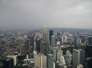
Kuala Lumpur City Centre (KLCC) is a multipurpose development area in Kuala Lumpur, Malaysia. KLCC refers to the area within and surrounding the KLCC Park but the term has also been widely used by buildings nearby to the vicinity.
Bandar Tun Razak is a township and parliamentary constituency in Kuala Lumpur, Malaysia. It is named after the second Prime Minister of Malaysia, Tun Abdul Razak.

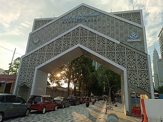
Kampung Baru or Kampong Bharu is a Malay enclave in central Kuala Lumpur, Malaysia. One of the most valuable tracts of land in the capital, it has been estimated to be worth up to US$1.4 billion.

Puchong is a major town and a parliamentary constituency in the Petaling District, Selangor, Malaysia.

Wangsa Maju is a township and a constituency in Kuala Lumpur, Malaysia. This area is surrounded by Setapak, Taman Melati and Gombak district in Selangor. Wangsa Maju is one of the major suburbs in Kuala Lumpur.

Setapak is a town and mukim straddling both norteastern Kuala Lumpur and Gombak District of Selangor, Malaysia.

Maluri is a suburb in the constituency of Cheras, Kuala Lumpur, situated near the border of the constituency of Titiwangsa.

Kampung Datuk Keramat or more commonly referred to as Keramat among the locals is a large zone in the Titiwangsa constituency, falling within the boundary of the Federal Territory of Kuala Lumpur, Malaysia. It is located northeast of downtown Kuala Lumpur and borders the district of Ampang in Selangor. The Klang River runs roughly from northeast to the west and acts as a natural divider of Keramat and Ampang.
Jalan Ampang or Ampang Road is a major road in the Klang Valley region, Selangor and the Federal Territory of Kuala Lumpur, Malaysia. Built in the 1880s, it is one of the oldest roads in the Klang Valley. It is a main road to Ampang Jaya and is easily accessible from Jalan Tun Razak or Jalan Ulu Klang from the Hulu Kelang or Setapak direction. It is also accessible from Cheras through Jalan Shamelin, from Jalan Tun Razak through Jalan Kampung Pandan via Taman Cempaka, from Kampung Pandan through Jalan Kampung Pandan Dalam via Taman Nirwana, from the Kuala Lumpur Middle Ring Road 2 via Pandan Indah and Taman Kencana and from Hulu Langat town through the mountain pass. Wangsa Maju, Setapak, central Kuala Lumpur, Ampang Park and Salak South surround Ampang. Jalan Ampang became the backbone of the road system linking Ampang to Kuala Lumpur before being surpassed by the Ampang–Kuala Lumpur Elevated Highway (AKLEH) in 2001.

Ampang Jaya, more commonly known as just Ampang, is a town, a mukim and a parliamentary constituency straddling parts of the Hulu Langat District and Gombak District, in eastern Selangor, Malaysia. It is located just outside the eastern border of Kuala Lumpur Federal Territory.

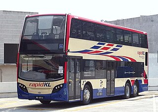
Rapid Bus Sdn Bhd is the largest bus operator in Malaysia operating mainly in urban areas of Klang Valley, Penang & Kuantan. As of February 2023, Rapid KL service brands unit of Rapid Bus, has operates 113 normal routes and also 69 MRT Feeder Bus routes, along with 8 Nadiputra routes in Putrajaya.

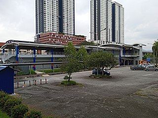
Pandan Jaya LRT station is a Malaysian low-rise rapid transit station situated near and named after Pandan Jaya, in Ampang Jaya, Selangor. The station is part of the Ampang Line. The station was opened on December 16, 1996, as part of the first phase of the STAR system's opening, alongside 13 adjoining stations along the Sultan Ismail-Ampang route.

Pandan Indah LRT station is a Malaysian low-rise light rapid transit (LRT) station situated near and named after Pandan Indah, in Ampang Jaya, Selangor. The station of the LRT Ampang Line, was opened on December 16, 1996, as part of the first phase of the STAR system's operations, alongside 13 adjoining stations along the Sultan Ismail-Ampang route.
Cempaka LRT station is a Malaysian low-rise rapid transit station situated near and named after the nearby Taman Cempaka, in Ampang Jaya, Selangor. The station is part of the Ampang Line, and was opened on December 16, 1996, as part of the first phase of the STAR system's opening, alongside 13 adjoining stations along the Sultan Ismail-Ampang route.
Cahaya LRT station is a Malaysian low-rise rapid transit station situated near and named after the nearby Taman Cahaya (Malay; English: Cahaya Estate, in Ampang Jaya, Selangor. The station is part of the Ampang Line, and was opened on December 16, 1996, as part of the first phase of the STAR system's opening, alongside 13 adjoining stations along the Sultan Ismail-Ampang route.
Gombak is a locality in the mukim of Setapak in the coterminous Gombak District, Selangor, Malaysia.
The following is an alphabetical list of articles related to Selangor.


