Boutilimit lies 164 km south east of Mauritania's capital of Nouakchott. The town has been an important center of religious scholarship and training since its founding by an Islamic mystic and scholar in the 19th Century. Although desertification has sapped much of the community's economic energy, it remains the most important center of religious training in Mauritania. Its Qur'anic school is known for its library of manuscripts, set up by Shaykh Sidiyya "al-Kabir" (1774–1868), which is second only to the collection found in the ancient Mauritanian city of Chinguetti. A unique copy of a grammar by Averroes was recently found there.

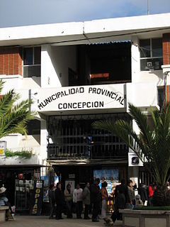
Concepción Province is one of nine provinces in the Junín Region in central Peru. Its capital is Concepción.
Orinoca is a district (cantón) in the Andamarca Municipality in the Bolivian Sud Carangas Province in Oruro Department.

The Lerma River is Mexico's second longest river. It is a 750 km-long (470 mi) river in west-central Mexico that begins in Mexican Plateau at an altitude over 3,000 metres (9,843 ft) above sea level, and ends where it empties into Lake Chapala, Mexico's largest lake, near Guadalajara, Jalisco. Lake Chapala is the starting point of Río Grande de Santiago, which some treat as a continuation of the Lerma River. In combination, the two are often called the Lerma Santiago River. The Lerma River is notorious for its pollution, but the water quality has demonstrated considerable improvement in recent years due mostly to government environmental programs and through massive upgrading projects of sanitation works.

Aagaard Glacier, also known as Glaciar Alderete, is an 8-mile (13 km) long Antarctic glacier which lies close to the east of Gould Glacier and flows in a southerly direction into Mill Inlet, on the east coast of Graham Land. It was charted by the Falkland Islands Dependencies Survey (FIDS) and photographed from the air by the Ronne Antarctic Research Expedition during December 1947; it was named by the FIDS for Bjarne Aagaard, a Norwegian authority on Antarctic whaling and exploration.

Salinas de Garci Mendoza is a town in the Bolivian Oruro Department. It is the administrative center of Ladislao Cabrera Province and is located 280 km (170 mi) south-west of Oruro, the capital of the department. It is situated at an elevation of 3,732 m (12,244 ft) at Caricha, 20 km north of the Tunupa stratovolcano. Salar de Coipasa,a salt lake, is 20 km north-west of Salinas de Garci Mendoza, and 15 km in south-eastern direction is Salar de Uyuni, the world's largest salt pan. Salinas de Garci Mendoza is the endpoint of the road from Chuquichamba via Andamarca and Aroma to Salinas de Garci Mendoza.

Chałupy is a Polish village and seaside resort with conditions favorable for windsurfing and kitesurfing, in Gmina Władysławowo. It is situated between Władysławowo and Kuźnica on the Hel Peninsula on the southern Baltic Sea in Puck County, Pomeranian Voivodeship, northern Poland. Its population in 2009 was 376.

Villadangos del Páramo is a municipality located in the province of León, Castile and León, Spain. According to the 2004 census (INE), the municipality has a population of 1,018 inhabitants.

Villaluenga de la Vega is a municipality located in the province of Palencia, Castile and León, Spain. According to the 2004 census (INE), the municipality has a population of 667 inhabitants.

Huérmeces is a municipality located in the province of Burgos, Castile and León, Spain. According to the 2004 census (INE), the municipality has a population of 131 inhabitants.
Santa Cruz de Andamarca District is one of twelve districts of the province Huaral in Peru.

Ouarakuy is a village in the Sanaba Department of Banwa Province in western Burkina Faso. As of 2005 it had a population of 549.
Tomena is a village in the Iolonioro Department of Bougouriba Province in south-western Burkina Faso. The village has a population of 503.

El Pardo is a ward (barrio) of Madrid belonging to the district of Fuencarral-El Pardo. As of 2008 its population was of 3,656.
Tehuipango is a municipality located in the montane central zone in the State of Veracruz, about 110 km from state capital Xalapa. It has a surface of 111.04 km2. It is located at 18°31′N97°03′W. Santiago Tehuipango, it was a people belonging to Zongolica's federation, during the 16th century, later it tried to form its own town hall; in 1831 a municipality was consisting already of basics schools and parish of masonry. It was bordering on Mixtla, Eloxitlan, Alcomunga, Astacinga and Texhuacán.
Lliboutry Glacier is a glacier flowing southwest from the Boyle Mountains of Antarctica into Bourgeois Fjord, Loubet Coast. It was named by the UK Antarctic Place-Names Committee in 1983 after Louis A.F. Lliboutry, a French physicist and glaciologist who investigated the mechanical deformation of ice and the micro-meteorological properties of ice surfaces, and who also made a general study of glaciers in the Antarctic Peninsula. Lliboutry was Director of the Laboratory of Glaciology, University of Grenoble, 1958–83, and President of the International Commission on Snow and Ice, 1983–87.
Soto Glacier is a glacier about 12 nautical miles (22 km) long, draining southeast along the southwest side of Strømme Ridge and discharging into Odom Inlet, on the east coast of Palmer Land. Mapped by United States Geological Survey (USGS) in 1974. Named by Advisory Committee on Antarctic Names (US-ACAN) for Luis R. Soto, Argentine oceanographer on the International Weddell Sea Oceanographic Expeditions, 1968 and 1970.

Isallavi is a village in the Bolivian Oruro Department. It is the birthplace of Evo Morales, Bolivia's former President.

Valinhos is a religious countryside place on the outskirts of Fátima, Portugal. This place became famous for the 19 August 1917 apparition of Our Lady of Fátima and by the 1st and 3rd apparitions of the Guardian Angel of Portugal.


