
North Andover is a town in Essex County, Massachusetts, United States. At the 2020 census the population was 30,915.

Andover is a town in Essex County, Massachusetts, United States. It was settled in 1642 and incorporated in 1646. At the 2020 census, the population was 36,569. It is located 20 miles (32 km) north of Boston and 4 miles (6.4 km) south of Lawrence. Part of the town comprises the census-designated place of Andover. It is twinned with its namesake: Andover, Hampshire, England.
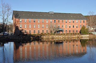
Ballardvale is a village located within the boundaries of the town of Andover, Essex County, Massachusetts, United States. Growing originally in the 19th century around mills located on the Shawsheen River, the village is a local historic district, boasting many varieties of historic architecture and a rich industrial heritage.

Abbot Tavern is a historic former tavern, now a private residence, in Andover, Massachusetts. Probably built in the second half of the 18th century, it is a prominent local example of Georgian, and is also significant for its association with the locally prominent Abbot family. The tavern was listed on the National Register of Historic Places in 1982.
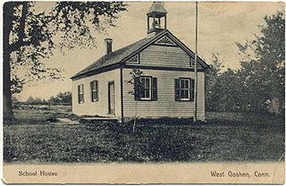
The West Goshen Historic District is a historic district in the village of West Goshen in the town of Goshen, Connecticut, United States. It encompasses a well-preserved early 19th-century industrial village, with twenty historically significant properties in the village, most of which lie on Connecticut Route 4 between Beach Street and Thompson Road. The district was listed on the National Register of Historic Places in 1987.

Farnumsville Historic District is a historic district encompassing a historic mill village in Grafton, Massachusetts. It is located on the eastern bank of the Blackstone River, extending along Providence and Main Streets, roughly between Cross and Depot Streets, and radiating along those roads and adjacent streets. This area was one of Grafton's 19th century industrial mill villages, which was centered on the Farnum Mill, which first began operating in the second decade of the 19th century. The main mill building that survives dates to 1844, and the housing stock in the village is in a diversity of styles, built roughly between the 1820s and 1920s.
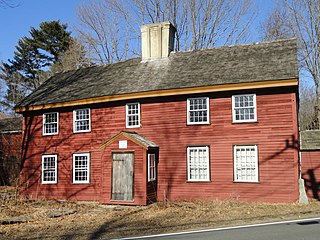
The Benjamin Abbot House or Abbot Homestead is a historic house at 9 Andover Street in Andover, Massachusetts, USA. The house was built in 1711. It was listed on the National Register of Historic Places in 1975.

The Ware Millyard Historic District encompasses a 19th-century mill complex and industrial mill village in the town of Ware, Massachusetts. It is roughly bounded by South Street, the Ware River, Upper Dam Complex, Park Street, Otis Avenue and Church Street. The area includes surviving mill buildings, the oldest of which date to the 1840s, and a collection of tenement-style housing built for the millworkers, built between 1845 and the 1880s.

Arden is a historic estate at 276 N. Main Street in Andover, Massachusetts, United States. It was the home of two of Andover's most important mill owners, John Dove and William Madison Wood.

The Ballardvale District in Andover, Massachusetts, encompasses the historic mill village of Ballardvale in the northwestern part of the town. It is centered on the crossing the Shawsheen River by Andover Street, and includes buildings on High Street, Center Street, and other adjacent roads on both sides of the river. The district was listed on the National Register of Historic Places in 1982.

The Machine Shop Village District is a historic district roughly bounded by Main, Pleasant, Clarendon, Water, 2nd Streets, and B&M Railroad in North Andover, Massachusetts. The district encompasses a well-preserved former textile mill village developed in the mid-19th century, with a variety of worker and upper-class housing, and two historic mill complexes. It was added to the National Register of Historic Places in 1982.

The North Canal Historic District of Lawrence, Massachusetts, encompasses the historic industrial heart of the city. It is centered on the North Canal and the Great Stone Dam, which provided the waterpower for its many mill complexes. The canal was listed on the National Register of Historic Places in 1975, while the district was first listed in 1984, and then expanded slightly in 2009.

The West Parish Center District encompasses the social and religious center of the part of Andover, Massachusetts, that is located west of the Shawsheen River. It is mostly spread along Lowell Street on either side of a major intersection with four other roads: Shawsheen Road, Reservation Road, Beacon Street, and High Plain Road. The centerpiece of the district is the 1826 West Parish Church, which is the oldest church standing in Andover. It is an elegant Federal style granite structure topped with a wooden steeple, added in 1863. The roof is made of Spanish tile, which was probably part of changes made around 1908. Opposite the church on the south side of the common is the West Parish Cemetery, which began as a small burying ground in the 1790s, and was substantially enlarged and restyled in the early 1900s.

Shawsheen Village Historic District is a historic district in northern Andover, Massachusetts. Shawsheen Village was completed in the early 1920s as a planned corporate community. Conceived by William Madison Wood of the American Woolen Company, the village was designed a team of architects including Adden & Parker, Clifford Allbright and Ripley & LeBoutillier of Boston and James E. Allen of Lawrence. John Franklin, a civil engineer for the American Woolen Company was responsible for designing the village, under the direction of Wood. Buildings from the original Frye Village were also incorporated into the design which included a railroad station, shops, apartment buildings, factories, parks and numerous single-family dwellings. The village was located just up the road from the Company's main factories in nearby Lawrence.

The Spicket Falls Historic District encompasses the historic industrial and commercial heart of Methuen, Massachusetts, and one of the lower Merrimack River's best-preserved 19th century mill complexes. It is centered on the falls of the Spicket River, from which the 19th century textile mills of Methuen derived their power. The historic district, listed on the National Register of Historic Places in 1984, includes commercial and civic buildings in and near Gaunt Square, the heart of the city, and along both sides of the Spicket River between Gaunt Square and the Boston and Maine Railroad tracks south of the river. It abuts the residential Pleasant-High Historic District, which lies to its east.
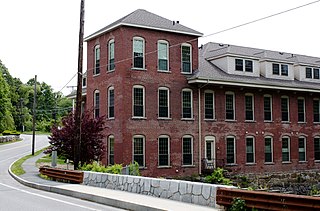
The Brookside Historic District of Westford, Massachusetts encompasses surviving elements of the 19th century Brookside mill village, the smallest of the town's three 19th-century industrial villages. Developed between about 1860 and 1904, it includes surviving mill buildings and a variety of mill-related worker housing. The district was listed on the National Register of Historic Places in 2003.

The Saxonville Historic District of Framingham, Massachusetts, encompasses a historic 19th century mill village at the heart of Saxonville. The district is centered on the mill complex at the junction of Water, Central, Elm, and Concord Streets, radiating north on Elm Street and west on Water Street. The extant mill brick and concrete buildings were built after fires destroyed older mill buildings in the 1880s by the Roxbury Carpet Company, whose owner, Michael Simpson, had successfully orchestrated the commercial production of carpets in a single facility. The district includes mill worker housing, some of which dates to the 1820s, as well as private residential development from the period, and a cluster of commercial and civic buildings adjacent to the mill complex.

Hartwell and Richardson was a Boston, Massachusetts architectural firm established in 1881, by Henry Walker Hartwell (1833–1919) and William Cummings Richardson (1854–1935). The firm contributed significantly to the current building stock and architecture of the greater Boston area. Many of its buildings are listed on the National Register of Historic Places.
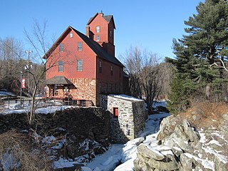
The Jericho Village Historic District encompasses the historic industrial and commercial center of the village of Jericho, Vermont. Stretched along Vermont Route 15 south of Browns River, which powered the village's industries for many years, the village center includes a well-preserved array of 19th and early 20th-century buildings. The district was listed on the National Register of Historic Places in 1992.
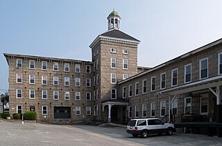
The Manchaug Village Historic District is a historic district encompassing the 19th century industrial village center of Manchaug in Sutton, Massachusetts. Developed in the 1820s around textile mills on the Mumford River, it was the largest industrial area in Sutton, with at least three mill complexes in operation. The district is centered on the junction of Main Street with Manchaug, Putnam Hill, and Whitins Roads.


