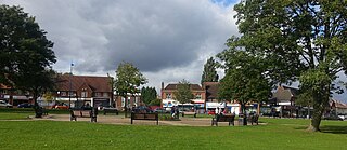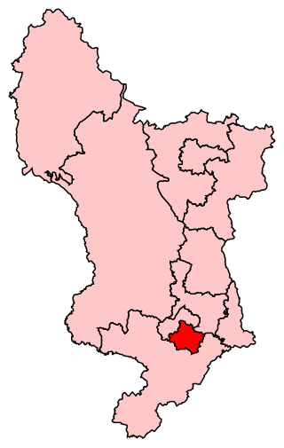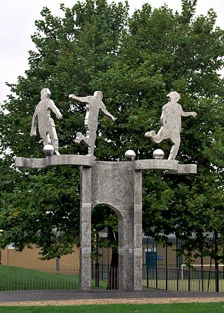
Normanton is an inner city suburb and ward of the city of Derby in Derbyshire, England, situated approximately 2 miles (3.2 km) south of the city centre. Neighbouring suburbs include Littleover, Pear Tree, Rose Hill and Sunny Hill. The original village of Normanton-by-Derby, which now forms the southern part of the suburb, dates back to the medieval period. As the Normanton area became rapidly urbanised in the 19th century, the New Normanton area to the north was developed for housing, linking the old village to Derby, into which it was eventually absorbed. The area is characterised by high density late 19th century terraced housing in New Normanton and mid-20th century housing estates elsewhere, and has the most ethnically diverse population in Derby. The Normanton ward had a population of 17,071 in 2011.

Chellaston is a suburban village on the southern outskirts of Derby, in Derbyshire, England.

Edgbaston is an affluent suburban area of central Birmingham, England, historically in Warwickshire, and curved around the southwest of the city centre.

The Municipality of Strathfield, also known as Strathfield Council, is a local government area in the Inner West of Sydney, in the state of New South Wales, Australia.

Sutton Trinity is one of the 40 electoral wards in Birmingham, England. It is named after Holy Trinity Church, the town's parish church.

Mossley Hill is a suburb of Liverpool and a Liverpool City Council ward. Located to the south of the city, it is bordered by Aigburth, Allerton, Childwall, and Wavertree. At the 2001 Census, the population was 12,650, increasing to 13,816 at the 2011 Census.
Stow Hill is a community civil parish and coterminous electoral district (ward) of the City of Newport, South Wales.

Northenden is a suburb of Manchester, Greater Manchester, England, with a population of 14,771 at the 2011 census. It lies on the south side of the River Mersey, 4.2 miles (6.8 km) west of Stockport and 5.2 miles (8.4 km) south of Manchester city centre, bounded by Didsbury to the north, Gatley to the east, and Wythenshawe to the south and west.

Whitchurch is a suburb and community in the north of Cardiff, capital of Wales. It is approximately 3 miles north of the centre of the city on the A470 road and A4054 road. It falls within the Whitchurch & Tongwynlais ward. The population of the community in 2011 was 14,267.

Weoley Castle is a residential suburban district in south-west Birmingham, England. The area is part of the Weoley local authority electoral ward, and also comes under the Northfield local council constituency. The suburb of Weoley Castle is bordered by Selly Oak to the east, Harborne to the north, Bartley Green to the west, and Weoley Hill and Shenley Fields to the south.

Derby South is a constituency formed of part of the city of Derby represented in the House of Commons of the UK Parliament since 1983 by veteran MP Margaret Beckett of the Labour Party. She has served under the Labour governments of Harold Wilson, James Callaghan, Tony Blair and Gordon Brown. She became interim Leader of the Labour Party in 1994 when John Smith suddenly died. She has also served under Neil Kinnock and Smith himself.

Pear Tree is an inner city suburb of the city of Derby, in Derbyshire, England, located about 1.2 miles (1.9 km) south of the city centre. It is split between the Arboretum and Normanton electoral wards. Neighbouring areas include Litchurch, Normanton and Osmaston. The area became urbanised in the late 19th century and is characterised by terraced housing originally built for industrial workers.

Rushey Mead is an area, suburb, electoral ward and administrative division of the city of Leicester, England. The population of the ward at the 2011 census was 15,962. It comprises the northern Leicester suburb of Rushey Mead in its entirety, as well as a part of the neighbouring area, suburb and electoral ward of Belgrave and historical parts of neighbouring Northfields and Thurmaston.
Dulwich is a suburb in the City of Burnside, Adelaide, South Australia with a census area population of 2,663 people. The suburb is adjacent to Adelaide's east parklands, and forms part of the western boundary of the City of Burnside. Dulwich is a mix of residential housing and commercial activity–corporate offices and businesses line Fullarton and Greenhill Roads. The suburb is bordered by Rose Park to the north, Toorak Gardens to the east, Glenside to the south and the Adelaide Parklands to the west.

Cabot was a council ward that covered the centre of Bristol, England. It took its name from the Cabot Tower, a memorial tower on Brandon Hill that was built to commemorate John Cabot's voyage and "discovery" of North America. The ward was abolished in 2016.
Devon Park is an inner northern suburb of Adelaide, South Australia. It is located in the cities of Port Adelaide Enfield and Charles Sturt beside the Gawler railway line near, but not meeting, the intersection of Torrens Road and Churchill Road.

The City of Edinburgh Council is the local government authority for the city of Edinburgh, capital of Scotland. With a population of 518,500 in mid-2019, it is the second most populous local authority area in Scotland.

Abbey is an electoral ward in the city of Derby, England. It includes the areas of California, Rowditch, and St Lukes, as well as a small part of Normanton. Part of its eastern boundary is formed by Abbey Street, from which the ward takes its name. It is a largely residential area, with a mixture of Victorian terraced housing and 20th century suburban development. The population was 15,334 in 2011.


