
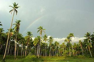
Thrissur, formerly Trichur, also known by its historical name Thrissivaperur, is a city and the headquarters of the Thrissur district in Kerala, India. It is the third largest urban agglomeration in Kerala after Kochi and Kozhikode, and the 21st largest in India. The city is built around a 65-acre (26 ha) hillock called the Thekkinkaadu Maidaanam which seats a large Hindu Shiva Temple. It is located 304 kilometres (189 mi) north-west of the state's capital city, Thiruvananthapuram. Thrissur was once the capital of the Kingdom of Cochin, and was a point of contact for the Assyrians, Greeks, Persians, Arabs, Romans, Portuguese, Dutch and English.

Irinjalakuda is a municipal town in Thrissur district, Kerala, India. It is the headquarters of Irinjalakuda Revenue Division, Thrissur Rural Police and Mukundapuram Taluk. After Thrissur, this town has most number of administrative, law-enforcement, and judicial offices in the district. The place is well known for Koodalmanikyam Temple and the Thachudaya Kaimals, who had princely status until 1971. The earliest recorded history of this temples date back to the ninth century of Common Era (CE).

Walayar is a border town, located in the eastern corner of Palakkad district in Kerala, India.

Thrissur, anglicised as Trichur, is one of the 14 districts in the Indian state of Kerala. It is situated in the central region of the state. Spanning an area of about 3,032 km2 (1,171 sq mi), the district is home to over 9% of Kerala's population.

Kottarakkara, also transliterated as Kottarakara, is a town and municipality in the Kollam district of the Kerala, India. Kottarakkara lies 27 kilometres (17 mi) to the east of Kollam city centre.

Ponkunnam is a census town in Kerala, India, part of Kottayam district under Kanjirappally taluk. Ponkunnam literally means golden mountain (ponn = gold, kunn = mountain). Nearby towns are Kanjirappalli, Manimala and Pala. This part of Kerala is famous for its fertile land and rubber plantations. It is at an altitude of 495 ft (151 m) above mean sea level. The town is at the junction of two major roads in Kerala: NH 183 and Main Eastern Highway. The climate is moderate with timely cold breezes and the town is the gateway to the Western Ghats. The town is famous for its volleyball traditions and customs. Almost every year there is an ever-rolling volleyball tournament happening in Ponkunnam Mahatma Gandhi Mini Stadium.
Ashtamichira is a village in Thrissur district in the Indian state of Kerala.
Thrissur is the administrative capital of Thrissur District, in the central part of Kerala state, India. Thrissur district was formed on 1 July 1949. It is an important cultural centre, and is known as the Cultural Capital of Kerala. It is famous for the Thrissur Pooram festival, one of the most colourful and spectacular temple festival of Kerala. From ancient times, Thrissur has been politically, economically and culturally significant to the Indian subcontinent. It has opened the gates for Arabs, Romans, Portuguese, Dutch and English. According to tradition, Thrissur is where Christianity, Islam and Judaism entered the Indian subcontinent. Local Christian tradition holds that Thomas the Apostle arrived in 52 CE, and Muslim tradition states that Methala is the location of country's first mosque.
Aloor is a panchayat in the Chalakudy-Mukundapuram taluk in the Thrissur district of Kerala, India. It is located near the towns of Irinjalakuda and Chalakudi. Since 1901, the name "Aloor" has been simplified to "Alur" by the Cochin State and Central Government departments.
Perambra is a small town located in the Thrissur district of Kerala, South India. It is located on National Highway (NH) 544, 23 km south of the city of Thrissur and about 7 km north of Chalakudy.

Karoor is a village in Kodakara Panchayath in Thrissur district of Kerala, India. Karoor is located 30 km from the city of Thrissur and 12 km from Irinjalakuda Town and 8 km from Chalakudy Town and 8 km from Mala, Kerala Town.
Kalluvathukkal is a village in the Kollam district of the Indian state of Kerala. NH 47 passes through the village.There ia an Lower primary and Upper primary schools in kalluvathukkal panchayath. And Kalluvathukkal panchayat has its own school, classes from class 5th to 10th standard. A small stadium is located next to the school. The nearest towns are Chathannoor and Paripally. The place is infamous for the Kalluvathukkal hooch tragedy, which took place on 21 October 2000 and killed 31 people.

Vatanappally (Vatanappilly/) is a panchayat and census town in Thrissur district, in the state of Kerala, India.

.
State Highway 22 is a State Highway in Kerala, India that starts in Kodungallur and ends at State Highway 23. The highway is 70.5 km long.

Korattymuthy at Koratty Church is the locally known name of Hail Mary or Mother Mary of Syro-Malabar Catholic community at Koratty in Kerala State, India. Korattymuthy's Shrine is famous for its annual feast with 'Poovankula', Muttilizhayal offerings.
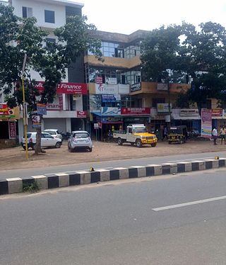
Konathukunnu is a town in Thrissur district, Kerala, India. This particular junction is absolutely phenomenon. It has everything like a big town need to be. Panchayat office, (Community) a best Gov. School, several other Institutional Centers, hospitals, pharmacies, Masjid, Shiva Temple, petrol stations, several supermarkets, bakeries and many more. More than 100 bus services reach any part of Kerala. It is between Irinjalakuda and Kodungallur on State Highway 22, 5 kilometres (3.1 mi) from S.N. Puram.
Vellangallur is a grama panchayath situated in Thrissur district in the Indian state of Kerala.

Thrissur District has four types of administrative hierarchies:
