Armadale and Thornlie railway lines

Last updated

Armadale and Thornlie Lines
Overview
Current operator(s) Transperth
Annual ridership9.1 million (year to June 2015)
Route
Start Perth
Stops21
End Armadale
Line(s) used South Western Railway
Technical
Track gauge 1,067 mm (3 ft 6 in)
Electrification 25 kV AC Overhead line
Track owner(s) Public Transport Authority
Route map
km
BSicon tCONTg.svg
BSicon dCONTg.svg
BSicon tdINT-L.svg
BSicon lINTACC-M.svg
BSicon ldINT-M.svg
BSicon dKINTa-M.svg
BSicon dINT-R.svg
00.0
Perth
BSicon tCONTf.svg
BSicon vSTR.svg
00.0
BSicon dUST.svg
BSicon dUST.svg
Perth Siding
BSicon vBHF.svg
00.9
McIver
BSicon vSKRZ-G2u.svg
Lord Street flyover
BSicon vUSTr.svg
BSicon dSHI2+l.svg
BSicon dSHI2gr.svg
BSicon vUSTl.svg
BSicon dSTR.svg
BSicon vACC.svg
01.3
Claisebrook
BSicon lENDE@F.svg
BSicon STR~L.svg
BSicon LSTR.svg
BSicon CONTl+g.svg
BSicon STR~R.svg
00.0
BSicon vSTR.svg
BSicon CONTl+g.svg
BSicon vSKRZ-G2u.svg
East Parade flyover
BSicon dENDEe.svg
BSicon dSTR.svg
River siding
BSicon hbKRZWae.svg
BSicon SKRZ-G2u.svg
Victoria Park Drive
BSicon HSTACC.svg
3.2
Perth Stadium
BSicon HST.svg
04.8
Burswood
BSicon SKRZ-G2o.svg
BSicon eHST.svg
06.0
Victoria Park
(former)
BSicon HSTACC.svg
06.2
Victoria Park
BSicon eHST.svg
06.5
Lathlain
BSicon SKRZ-G2u.svg
Millers crossing
BSicon BUE.svg
Archer St/Mint St crossing
BSicon HSTACC.svg
07.4
Carlisle
BSicon INT.svg
08.2
Oats Street
BSicon BUE.svg
Oats Street crossing
BSicon BUE.svg
Welshpool Road crossing
BSicon HST.svg
09.5
Welshpool
BSicon SKRZ-G2u.svg
Leach Highway flyover
BSicon BUE.svg
Hamilton Street crossing
BSicon HST.svg
11.4
Queens Park
BSicon BUE.svg
Wharf Street crossing
BSicon INT.svg
12.2
Cannington
BSicon UST.svg
BSicon SKRZ-G2u.svg
Gerard Street flyover
BSicon v-SHI2gr.svg
Cannington siding
BSicon ldENDE@G.svg
BSicon BUILDINGr.svg
BSicon vSTR-.svg
Beckenham Substation
BSicon lGRZq.svg
BSicon STR.svg
BSicon lELC.svg
Neutral section
BSicon HST.svg
13.8
Beckenham
BSicon BUE.svg
William Street crossing
BSicon UST.svg
BSicon tKRW+la.svg
BSicon KRWgr.svg
00.0
Thornlie Spur
BSicon KRW+l.svg
BSicon KRWgr.svg
00.0
Thornlie Spur
BSicon lGRZq.svg
BSicon tSTRa@f.svg
BSicon STR.svg
BSicon lELC.svg
Neutral section
Thornlie Spur only
BSicon RP4q.svg
BSicon tSTR.svg
BSicon SKRZ-G4o.svg
BSicon lCONTg@Gq.svg
BSicon STRq.svg
BSicon tSTRe@f.svg
BSicon cSTRq.svg
BSicon dKRZo.svg
BSicon ndSHI2+l.svg
BSicon cSTRq.svg
BSicon cdSTRq.svg
BSicon dCONTfq.svg
00.0
BSicon SKRZ-G2u.svg
BSicon dSTR.svg
BSicon ndSTR.svg
Kenwick Link
BSicon hKRZWae.svg
BSicon dSTR.svg
BSicon ndSTR.svg
BSicon SKRZ-G2u.svg
BSicon dSTR.svg
BSicon ndSTR.svg
Spencer Road
BSicon UST.svg
BSicon dSTR.svg
BSicon ndSTR.svg
BSicon KINTACCxe.svg
BSicon dSTR.svg
BSicon ndSTR.svg
17.0
Thornlie
BSicon exHST.svg
BSicon dSTR.svg
BSicon ndSTR.svg
Nicholson Road
BSicon exHST.svg
BSicon dSTR.svg
BSicon ndSTR.svg
Ranford Road
BSicon exSTR.svg
BSicon dBUE.svg
BSicon ldBUE.svg
BSicon ndSTR.svg
Wanaping Road crossing
BSicon exCONTf.svg
BSicon dSTR.svg
BSicon ndSTR.svg
BSicon dHST.svg
BSicon ndSTR.svg
15.8
Kenwick
BSicon vSHI2g+nl-.svg
00.0
Kenwick Junction
BSicon BUE.svg
Austin Avenue crossing
BSicon INT.svg
17.7
Maddington
BSicon STR.svg
BSicon exKHSTa.svg
Canning Park Racecourse
BSicon eABZgl+l.svg
BSicon exSTRr.svg
BSicon BUE.svg
Kelvin Road crossing
BSicon BUE.svg
Albany Highway crossing
BSicon eHST.svg
Stokely station
BSicon hbKRZWae.svg
Jenna Bidi Bridge
over Canning River
BSicon BUE.svg
Fremantle Road crossing
BSicon BUE.svg
Main Street crossing
BSicon INTACC.svg
21.0
Gosnells
BSicon BUE.svg
Dorothy Street crossing
BSicon eBHF.svg
21.2
Gosnells
(former)
BSicon UST.svg
BSicon BUE.svg
Verna Street crossing
BSicon HST.svg
22.6
Seaforth
BSicon SKRZ-G2u.svg
BSicon eBUE.svg
Lake Road crossing (closed)
BSicon INTACC.svg
25.9
Kelmscott
BSicon BUE.svg
Denny Avenue crossing
BSicon HST.svg
27.4
Challis
BSicon BUE.svg
Streich Avenue crossing
BSicon HST.svg
28.1
Sherwood
BSicon BUE.svg
Armadale Road crossing
BSicon BUE.svg
Third Avenue crossing
BSicon UST.svg
BSicon dSHI2+l.svg
BSicon vSHI2gl-.svg
BSicon vSHI2r-.svg
BSicon dSTR.svg
BSicon vINTACC-KINTACCe.svg
30.1
Armadale
BSicon vUSTr.svg
BSicon lNULg.svg
BSicon BLa.svg
BSicon vSHI1l-ENDEe.svg
BSicon ELCe.svg
BSicon exBLa.svg
Armadale Siding
Extent of
electrification
BSicon eINTACC.svg
BSicon exELCe.svg
37.6
Byford
BSicon CONTf.svg
Transperth railway lines
Armadale/Thornlie
Fremantle
Joondalup
Mandurah
Midland
List of Transperth stations

The Armadale Line is a suburban rail service in Western Australia that runs from Perth to Armadale on the South Western Railway. The line crosses the Swan River at East Perth via the Goongoongup Bridge, and formerly had crossed it via the Bunbury Bridge.

Contents

The Thornlie Line is a service that runs on the South Western Railway from Perth to a junction between Beckenham and Kenwick and continues on a short branch line to Thornlie that opened on 7 August 2005.

History

The Armadale Line runs on the South Western Railway which opened on 2 May 1889. The original stations in 1889 were Perth, Welshpool, Kelmscott and Armadale. Cannington, although operational in 1889, was opened in 1893. [1]

The following stations were opened: [1] [2]

In September 1991, the line commenced electrified operation. [1]

Between 2004 and 2005, Armadale, Carlisle and Gosnells were upgraded to provide better facilities to passengers and provide better access between trains and buses. Lathlain station was closed on 3 February 2003 as part of the project. [5]

Thornlie was opened on 7 August 2005. [1] [6] [7] The station is built on a 2.9 km spur line of the Armadale Line.

Between 21 March 1993 and 8 August 2005, trains on the Armadale Line continued through Perth to the Joondalup Line. In 2004 new railcars were introduced, which became exclusive to the Joondalup Line. From 2005 until 2012, Armadale Line trains did not run through Perth to the other lines but on 20 August 2012, as part of works relating to the Perth City Link project to sink the Fremantle Line, services from Fremantle connected to the line until the tunnel was opened on 18 July 2013 which saw the Armadale Line terminate in Perth again.

Victoria Park and Kelmscott Stations were upgraded between 2007 and 2008 as part of the Public Transport Authority's 'Building Better Stations' program. Victoria Park station was opened on 20 July 2008. [8] and Kelmscott was opened on 21 November 2008. [9]

As part of the new Perth Stadium project, Belmont Park station closed on 13 October 2013. [10] Perth Stadium station was opened in 2018 to replace it.

Extensions

As part of the Metronet project, both the Armadale main line and the Thornlie spur line will undergo extensions. The Armadale Line will be extended to the suburb of Byford with a station being built approximately eight kilometres (5 mi) south of the Armadale railway station. [11]

The Thornlie Line will be extended to Cockburn Central railway station on the Mandurah Line. Two new railway stations will be located on this extension, Nicholson Road and Ranford Road. Construction started in 2020. [12]

At the 2021–22 State Budget, it was announced that the Thornlie–Cockburn link had been deferred by 12 months, as a result of Western Australia's skills shortage. This was alongside the deferment of 15 other state government infrastructure projects. The revised opening date is late 2024. [13] [14] [15]

Patronage

Below is the annual patronage of Armadale and Thornlie Lines from 2010 to 2011 financial year. Figures are provided as total boardings, which includes all fare-paying boardings and free travel on stations within the free transit zones as well as transfers between stations. The figures for rail replacement and special events services are not included in the total. [16]

Armadale/Thornlie railway line annual patronage
YearPatronage±%
2010–118,838,049
2011–129,227,813+4.41%
2012–139,667,987+4.77%
2013–149,176,434−5.08%
2014–159,066,797−1.19%
2015–168,508,290−6.16%
2016–177,385,888−13.19%
2017–187,735,572+4.73%
2018–197,983,379+3.20%
2019–206,653,213−16.66%
2020–215,768,087−13.30%

Railway stations

During peak hour times on weekdays, some railway stations are almost always bypassed to enable faster commutes. Express trains also run along the Armadale Line on weekdays, and even often on weekends.

Key
IconPurpose
Dagger-14-plain.pngUnder construction
§Special events station
StationDistance from Perth [17] Fare zone [18] Suburbs servedOpenedConnections and notes
kmmi
Armadale and Thornlie Line
Perth 0.00.01/FTZ Perth 1881Bus transfers at Perth Busport
Train transfers to Australind, Fremantle, Joondalup, Mandurah and Midland Lines
McIver 0.70.41/FTZPerth1989Train transfers to the Midland Line
Claisebrook 1.30.81/FTZ East Perth, Perth1883Train transfers to the Midland Line
Perth Stadium §3.32.11 Burswood 2018Open during events at Perth Stadium and on weekends
Burswood 4.62.91Burswood1893
Victoria Park 6.13.81 Lathlain, Victoria Park 1898
Carlisle 7.44.61 Carlisle, East Victoria Park 1893
Oats Street 8.15.01Carlisle, East Victoria Park1954Bus transfers
Welshpool 9.35.81 Bentley, Welshpool 1899
Queens Park 11.37.02 Cannington, Queens Park 1899
Cannington 12.27.62Cannington, East Cannington 1897Bus transfers
Beckenham 13.68.52 Beckenham 1954
Thornlie Line
Thornlie 17.010.62 Thornlie 2005Bus transfers
Nicholson Road Dagger-14-plain.png2 Canning Vale 2023 (planned)Bus transfers
Ranford Road Dagger-14-plain.png2Canning Vale2023 (planned)Bus transfers
Cockburn Central Dagger-14-plain.png3 Cockburn Central 2023 (planned)Bus transfers
Armadale Line
Kenwick 15.69.72 Kenwick 1914
Maddington 17.610.92 Maddington 1896Bus transfers
Gosnells 20.712.93 Gosnells 1905Bus transfers
Seaforth 22.614.03Gosnells1948
Kelmscott 25.816.03 Kelmscott 1893Bus transfers
Challis 27.317.03Kelmscott1973
Sherwood 28.617.83 Armadale 1973
Armadale 30.418.94Armadale1893Bus transfers
Train transfers to Transwa Australind
Byford Dagger-14-plain.png4 Byford Bus transfers

Related Research Articles

Joondalup railway line Suburban railway line in Perth, Western Australia

The Joondalup railway line is a commuter rail line in Western Australia, linking the Perth central business district (CBD) with the city's northern suburbs. Service on the line is operated by Transperth Train Operations, a division of the Public Transport Authority, and is part of the Transperth network. The line is 40.7 kilometres (25.3 mi) long and serves 13 stations. At its southern end, the line begins as a continuation of the Mandurah Line at Elizabeth Quay railway station. The first 1.3 kilometres (0.81 mi) of the line is underground, passing under the Perth central business district. The line surfaces and enters the median of the Mitchell Freeway. It continues north along the freeway until Butler, only exiting the median to pass through the centre of Joondalup, the major suburban centre along the line. At Butler, the line veers off to the west, terminating at Butler railway station.

Welshpool railway station, Perth Railway station in Perth, Western Australia

Welshpool Station is a railway station on the Transperth network. It is located on the Armadale/Thornlie Line, 9.5 kilometres from Perth Station serving the suburbs of Welshpool and Bentley, Western Australia.

Armadale railway station, Perth Railway station in Perth, Western Australia

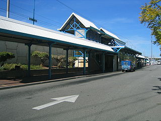
Armadale Station is a railway station on the South Western Railway, 30 kilometres from Perth station serving the suburb of Armadale, Brookdale and Haynes. It is the terminating point for Transperth Armadale line services and a calling point for Transwa Australind services.

Kelmscott railway station Railway station in Perth, Western Australia

Kelmscott Station is a railway station on the South Western Railway 25.9 kilometres from Perth Station in the suburb of Kelmscott. It is served by Armadale Line services which are part of the Transperth network.

Beckenham railway station Railway station in Perth, Western Australia

Beckenham Station is a railway station on the Australian Transperth network. It is located on the Armadale Line, 13.8 kilometres (8.6 mi) from Perth Station serving the suburb of Beckenham.

Queens Park railway station, Perth Railway station in Perth, Western Australia

Queens Park Station is a railway station on the Transperth network. It is located on the Armadale/Thornlie Line, 11.4 kilometres from Perth Station serving the suburb of Queens Park, Western Australia.

Cannington railway station Railway station in Perth, Western Australia

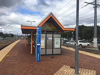
Cannington Station is a railway station serving the suburb of Cannington south of Perth, Western Australia. It is located 12.2 kilometres (7.6 mi) from Perth Station on the Armadale/Thornlie Line, part of the Transperth network.

Oats Street railway station Railway station in Perth, Western Australia

Oats Street railway station is a railway station on the Transperth network in Perth, Western Australia. It is located on the Armadale and Thornlie line, 8.2 kilometres from Perth station serving the suburbs of Carlisle, East Victoria Park and Kewdale.

Carlisle railway station, Perth Railway station in Perth, Western Australia

Carlisle railway station is a railway station on the Transperth network. It is located on the Thornlie Line, 7.4 kilometres from Perth station serving the suburbs of Carlisle and East Victoria Park.

Lathlain railway station

Lathlain Park railway station was a railway station on the Transperth network. It was located on the Armadale line, 6.5 kilometres (4.0 mi) from Perth station serving the suburb of Victoria Park.

Victoria Park railway station, Perth Railway station in Perth, Western Australia

Victoria Park railway station is a railway station on the Transperth network. It is located on the Armadale line, 6.2 kilometres (3.9 mi) from Perth station serving the suburbs of Victoria Park, Lathlain and Burswood.

Burswood railway station Railway station in Perth, Western Australia

Burswood railway station is a railway station on the Transperth network. It is located on the Armadale line, 4.8 kilometres from Perth station serving the suburbs of Burswood, Lathlain and Rivervale.

Thornlie railway station Railway station in Perth, Western Australia

Thornlie Station is a railway station on the Transperth network. It is the terminus of the Thornlie spur of the Armadale Line, seventeen kilometres (11 mi) from Perth Station serving the suburb of Thornlie, Western Australia.

New MetroRail was a division of the Public Transport Authority in Western Australia. It was responsible for managing extensions to Perth's railway network. The project doubled Perth's rail network, which is operated by Transperth, and was completed in 2007, after various projects were completed. Costing $1.6 billion, the project was the largest public transport project ever undertaken by the Western Australian government and effectively doubled the size of Perth's railway network. A similar agency Metronet was created in 2017 for future Perth rail extensions.

Cockburn Central railway station Railway station in Perth, Western Australia

Cockburn Central station is a railway station on the Transperth network. It is located on the Mandurah line, 20.5 kilometres (12.7 mi) from Perth station inside the median strip of the Kwinana Freeway serving the suburb of Cockburn Central.

Transperth Train Operations

Transperth Train Operations is a division of the Public Transport Authority of Western Australia. It is responsible for operating Perth’s urban passenger rail system, as part of the Transperth network.

Transperth is the brand name of the public transport system serving the city and suburban areas of Perth, the state capital of Western Australia. It is operated by the Public Transport Authority.

Perth Stadium railway station Railway station in Perth, Western Australia

Perth Stadium railway station is a railway station on the Transperth network. It is located on the Armadale line, 3.2 kilometres from Perth railway station serving the new Perth Stadium. It was completed in December 2017 and opened on 21 January 2018. The station cost A$145 million to build and is the second biggest station on the Perth network.

Metronet is a multi-government agency in Western Australia. It is responsible for managing extensions to Perth's transport network. It was formed to deliver commitments made by the McGowan Government during the 2017 election campaign.

References

  1. 1 2 3 4 "Our History". Public Transport Authority. Government of Western Australia. Archived from the original on 22 January 2016.
  2. "History of Stations on the Armadale Train Line" (PDF). Right Track. Archived from the original (PDF) on 21 July 2008.
  3. "Legislative Council" (PDF). Parliament of Western Australia. Perth, WA: Hansard. 31 August 1989. p. 1512. Retrieved 14 May 2017.[ dead link ]
  4. "Historical Gazetteer" (PDF). Geoproject Solutions. Perth, WA. 6 October 2015. Archived from the original (PDF) on 1 March 2016. Retrieved 14 May 2017.
  5. 1 2 "Lathlain Station Closure". Transperth. Archived from the original on 19 April 2003.
  6. Waldock, Reece (5 August 2005). "Transport" (PDF). Western Australian Government Gazette. John A. Strijk, Government Printer. p. 3609.
  7. Minister for Planning & Infrastructure (7 August 2005). "Thornlie line and station opening a major milestone for public transport network". Government of Western Australia (Press release).
  8. Minister for Planning & Infrastructure (2 August 2008). "New Victoria Park Train Station opened". Government of Western Australia (Press release).
  9. "Kelmscott Station". Public Transport Authority. Archived from the original on 31 May 2009.
  10. "Perth's Belmont Park station to close in October in preparation for new stadium station". Urbanlyst. 2 September 2013.
  11. "Byford Extension". Metronet. Retrieved 7 March 2018.
  12. "Thornlie-Cockburn Link". Metronet. Retrieved 23 November 2017.
  13. de Kruijff, Peter. "State projects delayed to ease pressure on 'hot' WA construction market". WAtoday. Retrieved 9 September 2021.
  14. Clarke, Jenna. "Metronet projects, including Thornlie-Cockburn link and Yanchep train line, will be delayed by 12-months". The West Australian. Retrieved 9 September 2021.
  15. "Projects adjusted to deliver a strong economy for the long term". Media Statements. Retrieved 9 September 2021.
  16. "Transperth patronage". Public Transport Authority. Retrieved 20 October 2021.
  17. "Manual – Rail Access" (PDF). Public Transport Authority. 30 August 2021. p. 10. Archived (PDF) from the original on 21 September 2021. Retrieved 21 September 2021.
  18. "Armadale/Thornlie Line Train Timetable" (PDF). Transperth. Retrieved 13 December 2021.

Commons-logo.svg Media related to Armadale railway line at Wikimedia Commons